|
|
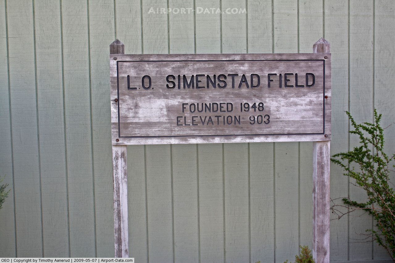
L O Simenstad Muni Airport |
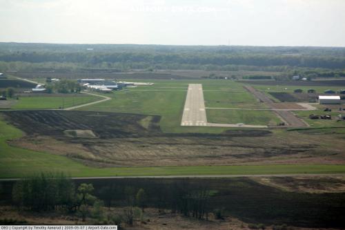 |
(Click on the photo to enlarge) |
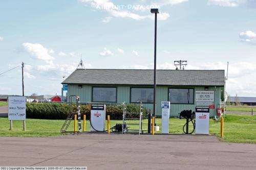 |
(Click on the photo to enlarge) |
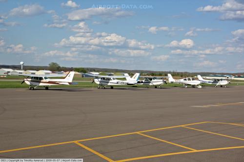 |
(Click on the photo to enlarge) |
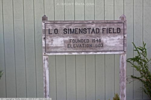 |
(Click on the photo to enlarge) |
 |
(Click on the photo to enlarge) |
Location & QuickFacts
| FAA Information Effective: | 2008-09-25 |
| Airport Identifier: | OEO |
| Airport Status: | Operational |
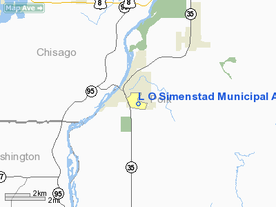
| Longitude/Latitude: | 092-41-24.1230W/45-18-34.2410N
-92.690034/45.309511 (Estimated) |
| Elevation: | 903 ft / 275.23 m (Surveyed) |
| Land: | 274 acres |
| From nearest city: | 0 nautical miles SE of Osceola, WI |
| Location: | Polk County, WI |
| Magnetic Variation: | 01E (2000) |
Owner & Manager
| Ownership: | Publicly owned |
| Owner: | Village Of Osceola |
| Address: | Po Box 217
Osceola, WI 54020 |
| Phone number: | 715-294-3498 |
| Manager: | Richard Johnson |
| Address: | 310 Chieftain Street
Osceola, WI 54020 |
| Phone number: | 715-294-4500 |
Airport Operations and Facilities
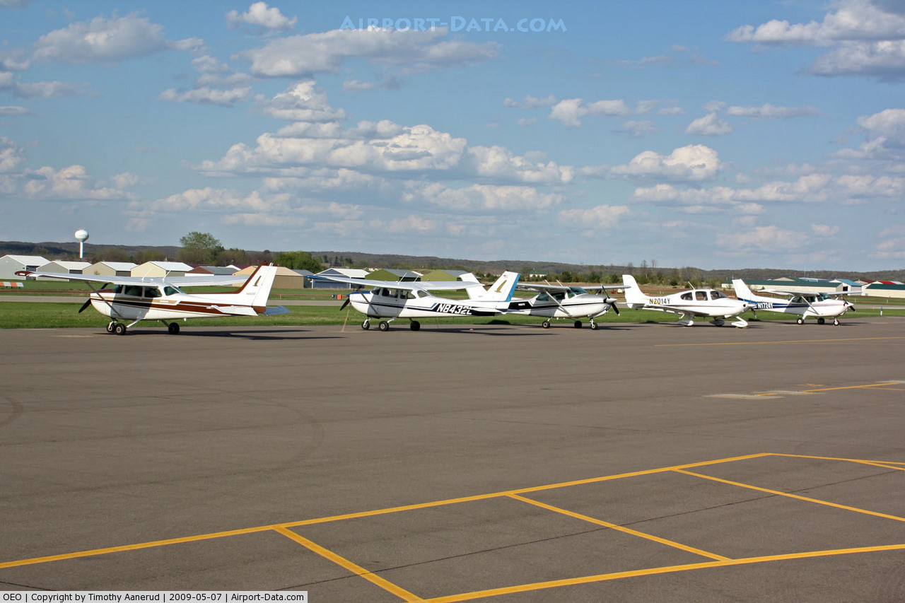
| Airport Use: | Open to public |
| Wind indicator: | Yes |
| Segmented Circle: | Yes |
| Control Tower: | No |
| Lighting Schedule: | RDO-CTL
MIRL RY 10/28 PRESET ON LOW INTST DUSK-DAWN TO INCREASE INTENSITY ACTVT PAPI RYS 10 & 28 & REIL RY 28 - CTAF. |
| Beacon Color: | Clear-Green (lighted land airport) |
| Landing fee charge: | No |
| Sectional chart: | Green Bay |
| Region: | AGL - Great Lakes |
| Traffic Pattern Alt: | 1000 ft |
| Boundary ARTCC: | ZMP - Minneapolis |
| Tie-in FSS: | GRB - Green Bay |
| FSS on Airport: | No |
| FSS Toll Free: | 1-800-WX-BRIEF |
| NOTAMs Facility: | GRB (NOTAM-d service avaliable) |
| Federal Agreements: | NGY |
Airport Communications
Airport Services
| Fuel available: | 100LLA
SELF SVC FUEL AVBL 24 HRS. |
| Airframe Repair: | MAJOR |
| Power Plant Repair: | MAJOR |
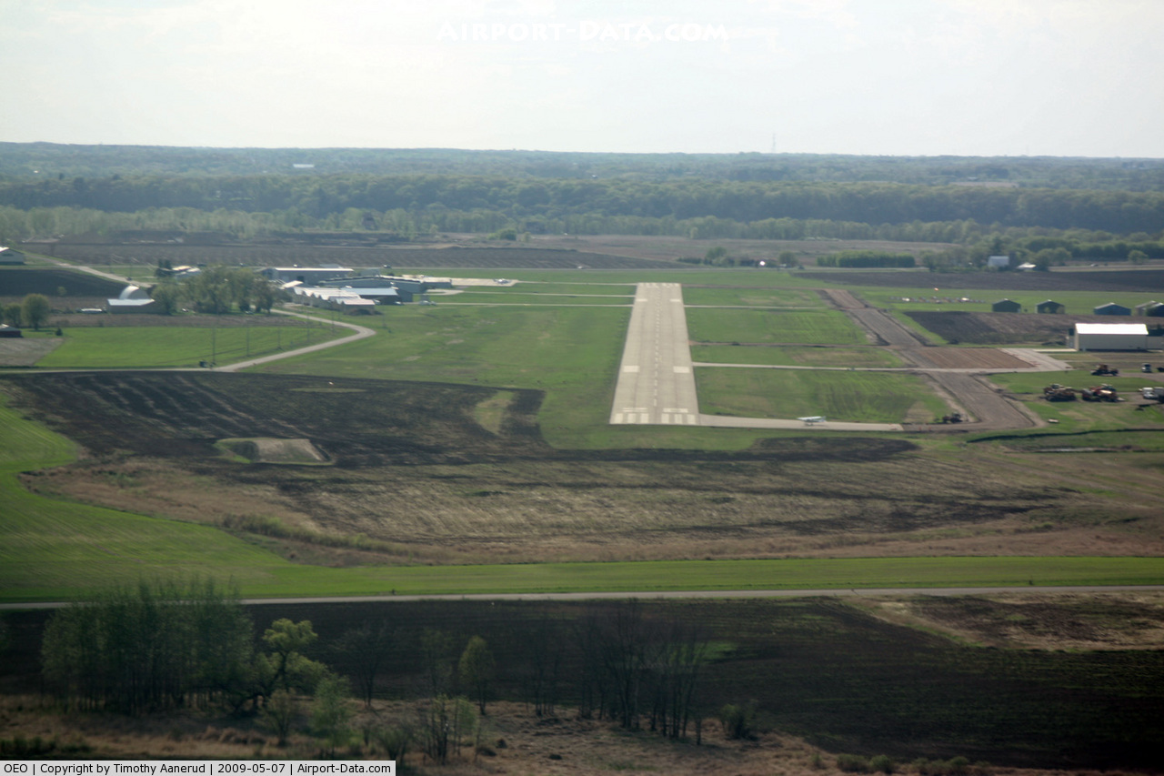
Runway Information
Runway 04/22
| Dimension: | 2270 x 150 ft / 691.9 x 45.7 m |
| Surface: | TURF, Fair Condition |
| |
Runway 04 |
Runway 22 |
| Longitude: | 092-41-52.1200W | 092-41-29.6300W |
| Latitude: | 45-18-36.6100N | 45-18-52.4370N |
| Elevation: | 883.00 ft | 877.00 ft |
| Alignment: | 45 | 127 |
| Traffic Pattern: | Left | Left |
| Markings: | None,
RY 04 /22 MKD WITH YELLOW CONES. | None, |
| Runway End Identifier: | No | No |
| Centerline Lights: | No | No |
| Touchdown Lights: | No | No |
| Obstruction: | 23 ft , 730.0 ft from runway, 30 ft right of centerline, 31:1 slope to clear | , 50:1 slope to clear |
|
Runway 10/28
| Dimension: | 5005 x 75 ft / 1525.5 x 22.9 m |
| Surface: | ASPH, Good Condition |
| Weight Limit: | Single wheel: 20000 lbs.
Dual wheel: 30000 lbs. |
| Edge Lights: | Medium |
| |
Runway 10 |
Runway 28 |
| Longitude: | 092-41-50.5300W | 092-40-42.5200W |
| Latitude: | 45-18-35.4600N | 45-18-23.6900N |
| Elevation: | 884.00 ft | 906.00 ft |
| Alignment: | 104 | 127 |
| Traffic Pattern: | Left | Left |
| Markings: | Non-precision instrument, Good Condition | Non-precision instrument, Good Condition |
| Crossing Height: | 35.00 ft | 37.00 ft |
| VASI: | 2-light PAPI on left side | 4-light PAPI on left side |
| Visual Glide Angle: | 3.00° | 3.00° |
| Runway End Identifier: | No | Yes |
| Centerline Lights: | No | No |
| Touchdown Lights: | No | No |
| Obstruction: | 20 ft road, 670.0 ft from runway, 320 ft right of centerline, 23:1 slope to clear | , 50:1 slope to clear |
|
Radio Navigation Aids
| ID |
Type |
Name |
Ch |
Freq |
Var |
Dist |
| RNH | NDB | New Richmond | | 257.00 | 02E | 11.8 nm |
| AHH | NDB | Ameron | | 278.00 | 01E | 13.6 nm |
| ROS | NDB | Rush City | | 282.00 | 02E | 25.8 nm |
| PPI | NDB | Hopey | | 400.00 | 03E | 28.3 nm |
| CBG | NDB | Cambridge | | 350.00 | 03E | 28.4 nm |
| UBE | NDB | Cumberland | | 375.00 | 01E | 32.4 nm |
| BXR | NDB | Big Doctor | | 203.00 | 02E | 33.6 nm |
| MS | NDB | Narco | | 266.00 | 02E | 33.7 nm |
| SSQ | NDB | Shell Lake | | 212.00 | 01E | 41.0 nm |
| PNM | NDB | Princeton | | 368.00 | 03E | 41.6 nm |
| JMR | NDB | Mora | | 327.00 | 03E | 42.5 nm |
| RZN | VOR/DME | Siren | 031X | 109.40 | 02E | 33.5 nm |
| MSP | VOR/DME | Minneapolis | 100X | 115.30 | 02E | 34.0 nm |
| RPD | VOR/DME | Rice Lake | 037X | 110.00 | 01E | 39.0 nm |
| FCM | VOR/DME | Flying Cloud | 055X | 111.80 | 06E | 43.6 nm |
| GEP | VORTAC | Gopher | 120X | 117.30 | 06E | 30.6 nm |
| FGT | VORTAC | Farmington | 104X | 115.70 | 06E | 45.8 nm |
| STP | VOT | St Paul | | 114.40 | | 27.1 nm |
| MSP | VOT | Minneapolis St Paul | | 111.00 | | 33.9 nm |
Remarks
- RY 04/22 CLSD TO WHEELED ACFT WHEN COVERED WITH SNOW OR ICE; OPEN TO SKI EQUIPPED ACFT WINTER MONTHS. CTC AMGR 612-327-3297.
- PAEW ON & ADJ TO ARPT SFCS.
- EXTENSIVE FLGT TRAINING, GLIDER & ULTRALGT ACTIVITY ON & INVOF ARPT.
- DEER & BIRDS ON & INVOF ARPT.
- REFLECTORS ON TWY.
- GCO AVBL ON FREQ 121.725 MSP CD & FLT SVCS.
- AVOID OVERFLIGHT OF ST CROIX RIVER NATIONAL SCENIC BI-WAY BLO 2000 FT AGL.
Images and information placed above are from
http://www.airport-data.com/airport/OEO/
We thank them for the data!
| General Info
|
| Country |
United States
|
| State |
WISCONSIN
|
| FAA ID |
OEO
|
| Latitude |
45-18-30.922N
|
| Longitude |
092-41-24.290W
|
| Elevation |
903 feet
|
| Near City |
OSCEOLA
|
We don't guarantee the information is fresh and accurate. The data may
be wrong or outdated.
For more up-to-date information please refer to other sources.
|
|