 |
|
Location & QuickFacts
| FAA Information Effective: | 2008-09-25 |
| Airport Identifier: | 69WI |
| Airport Status: | Operational |
| Longitude/Latitude: | 092-41-15.7460W/45-19-11.8700N
-92.687707/45.319964 (Estimated) |
| Elevation: | 910 ft / 277.37 m (Estimated) |
| Land: | 1 acres |
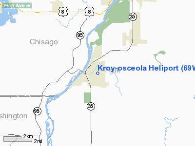
| From nearest city: | 0 nautical miles N of Osceola, WI |
| Location: | Polk County, WI |
| Magnetic Variation: | 03E (1985) |
Owner & Manager
| Ownership: | Privately owned |
| Owner: | Kroy, Inc. |
| Address: | 1728 Gervais Avenue
St Paul, MN 55109 |
| Phone number: | 612-770-7100 |
| Manager: | Cliff Nesseth |
| Address: | 108 Industrial Drive
Osceola, WI 54020 |
| Phone number: | 715-755-3248 |
Airport Operations and Facilities
| Airport Use: | Private |
| Wind indicator: | Yes |
| Segmented Circle: | No |
| Control Tower: | No |
| Landing fee charge: | No |
| Sectional chart: | Green Bay |
| Region: | AGL - Great Lakes |
| Boundary ARTCC: | ZMP - Minneapolis |
| Tie-in FSS: | GRB - Green Bay |
| FSS on Airport: | No |
| FSS Toll Free: | 1-800-WX-BRIEF |
Runway Information
Helipad H1
| Dimension: | 130 x 80 ft / 39.6 x 24.4 m |
| Surface: | TURF, |
| |
Runway H1 |
Runway |
| Traffic Pattern: | Left | Left |
|
Radio Navigation Aids
| ID |
Type |
Name |
Ch |
Freq |
Var |
Dist |
| OEO | NDB | Osceola | | 233.00 | 01E | 0.6 nm |
| RNH | NDB | New Richmond | | 257.00 | 02E | 12.3 nm |
| AHH | NDB | Ameron | | 278.00 | 01E | 13.6 nm |
| ROS | NDB | Rush City | | 282.00 | 02E | 25.3 nm |
| CBG | NDB | Cambridge | | 350.00 | 03E | 28.1 nm |
| PPI | NDB | Hopey | | 400.00 | 03E | 28.9 nm |
| UBE | NDB | Cumberland | | 375.00 | 01E | 32.1 nm |
| BXR | NDB | Big Doctor | | 203.00 | 02E | 33.0 nm |
| MS | NDB | Narco | | 266.00 | 02E | 34.3 nm |
| SSQ | NDB | Shell Lake | | 212.00 | 01E | 40.6 nm |
| PNM | NDB | Princeton | | 368.00 | 03E | 41.5 nm |
| JMR | NDB | Mora | | 327.00 | 03E | 42.1 nm |
| RZN | VOR/DME | Siren | 031X | 109.40 | 02E | 32.8 nm |
| MSP | VOR/DME | Minneapolis | 100X | 115.30 | 02E | 34.5 nm |
| RPD | VOR/DME | Rice Lake | 037X | 110.00 | 01E | 38.8 nm |
| FCM | VOR/DME | Flying Cloud | 055X | 111.80 | 06E | 44.1 nm |
| GEP | VORTAC | Gopher | 120X | 117.30 | 06E | 30.8 nm |
| FGT | VORTAC | Farmington | 104X | 115.70 | 06E | 46.4 nm |
| STP | VOT | St Paul | | 114.40 | | 27.7 nm |
| MSP | VOT | Minneapolis St Paul | | 111.00 | | 34.4 nm |
Remarks
- (E111-1) L O SIMENSTAD MUNI ARPT, OSCEOLA, WI. WIRES/BLDGS OBST THE REQUIRED 8:1 OBSTN CLNC SLOPE TO THE PRIM APCH SFC & THE ASSOC 2:1 TRSNL SFC SLPS.
- APCH/DEP OPNS ARE CONDUCTED IN AN AREA FROM 360 TO 270 DEGS CLOCKWISE USING PAD AS THE CENTER OF COMPASS ROSE; AREA IS APPROPRIATELY MARKED; WIND INDICATOR IS MAINTAINED.
Images and information placed above are from
http://www.airport-data.com/airport/69WI/
We thank them for the data!
| General Info
|
| Country |
United States
|
| State |
WISCONSIN
|
| FAA ID |
69WI
|
| Latitude |
45-19-11.870N
|
| Longitude |
092-41-15.746W
|
| Elevation |
910 feet
|
| Near City |
OSCEOLA
|
We don't guarantee the information is fresh and accurate. The data may
be wrong or outdated.
For more up-to-date information please refer to other sources.
|
|


