 |
|
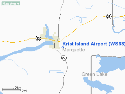
Location & QuickFacts
| FAA Information Effective: | 2008-09-25 |
| Airport Identifier: | WS68 |
| Airport Status: | Operational |
| Longitude/Latitude: | 089-18-28.4280W/43-46-53.9240N
-89.307897/43.781646 (Estimated) |
| Elevation: | 770 ft / 234.70 m (Surveyed) |
| Land: | 44 acres |
| From nearest city: | 1 nautical miles SE of Montello, WI |
| Location: | Marquette County, WI |
| Magnetic Variation: | 00W (1990) |
Owner & Manager
| Ownership: | Privately owned |
| Owner: | Paul Krist |
| Address: | P.o. Box 68
Montello, WI 53949-0068 |
| Phone number: | 608-297-7100 |
| Manager: | Paul Krist |
| Address: | P.o. Box 68
Montello, WI 53949-0068 |
| Phone number: | 608-297-7100 |
Airport Operations and Facilities
| Airport Use: | Private |
| Wind indicator: | Yes |
| Segmented Circle: | No |
| Control Tower: | No |
| Sectional chart: | Chicago |
| Region: | AGL - Great Lakes |
| Boundary ARTCC: | ZAU - Chicago |
| Tie-in FSS: | GRB - Green Bay |
| FSS Toll Free: | 1-800-WX-BRIEF |
Runway Information
Runway 17/35
| Dimension: | 1950 x 60 ft / 594.4 x 18.3 m |
| Surface: | TURF, Good Condition |
| |
Runway 17 |
Runway 35 |
| Traffic Pattern: | Left | Right |
| Obstruction: | 52 ft pline, 1040.0 ft from runway | |
|
Radio Navigation Aids
| ID |
Type |
Name |
Ch |
Freq |
Var |
Dist |
| UNU | NDB | Juneau | | 344.00 | 01W | 33.8 nm |
| PCZ | NDB | Waupaca | | 382.00 | 01W | 35.4 nm |
| ISW | NDB | Wisconsin Rapids | | 215.00 | 01W | 41.9 nm |
| MS | NDB | Monah | | 400.00 | 00E | 43.2 nm |
| RYV | NDB | Rock River | | 371.00 | 01W | 44.5 nm |
| HBW | NDB | Kickapoo | | 251.00 | 03E | 45.2 nm |
| AQ | NDB | Kooky | | 407.00 | 02W | 47.2 nm |
| HXF | NDB | Hartford | | 200.00 | 00E | 47.5 nm |
| VOK | TACAN | Volk | 041X | | 00E | 42.3 nm |
| LNR | VOR/DME | Lone Rock | 075X | 112.80 | 00E | 46.4 nm |
| DLL | VORTAC | Dells | 117X | 117.00 | 03E | 24.2 nm |
| OSH | VORTAC | Oshkosh | 055X | 111.80 | 02E | 34.9 nm |
| MSN | VORTAC | Madison | 023X | 108.60 | 03E | 38.3 nm |
| STE | VORTAC | Stevens Point | 043X | 110.60 | 01W | 46.8 nm |
Remarks
- PRVDD OBSTNS IN RY APCH SLOPE BE LOWERED OR REMOVED OR RY THR BE DSPLCD TO PRVD MIN 20:1 APCH CLNC OVER OBSTN; AREA 125 FT ON EITHER SIDE OF RY CNTRLN & 200 FT FM EITHER END OF RY END BE CLEAR OF OBSTNS.
Images and information placed above are from
http://www.airport-data.com/airport/WS68/
We thank them for the data!
| General Info
|
| Country |
United States
|
| State |
WISCONSIN
|
| FAA ID |
WS68
|
| Latitude |
43-46-53.924N
|
| Longitude |
089-18-28.428W
|
| Elevation |
770 feet
|
| Near City |
MONTELLO
|
We don't guarantee the information is fresh and accurate. The data may
be wrong or outdated.
For more up-to-date information please refer to other sources.
|
|


