 |
|
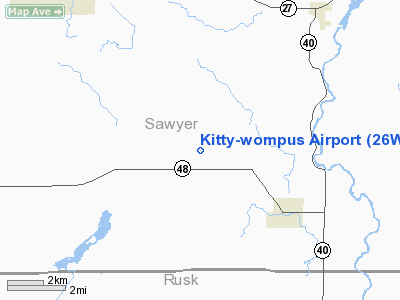
Location & QuickFacts
| FAA Information Effective: | 2008-09-25 |
| Airport Identifier: | 26WI |
| Airport Status: | Operational |
| Longitude/Latitude: | 091-18-12.5700W/45-41-56.8500N
-91.303492/45.699125 (Estimated) |
| Elevation: | 1336 ft / 407.21 m (Estimated) |
| Land: | 0 acres |
| From nearest city: | 4 nautical miles NW of Exeland, WI |
| Location: | Sawyer County, WI |
| Magnetic Variation: | 01E (1990) |
Owner & Manager
| Ownership: | Privately owned |
| Owner: | Jordan A. Arvold |
| Address: | 1339 Hungerford Pt.
St. Croix Falls, WI 54024 |
| Phone number: | 715-483-9783 |
| Manager: | Jordan A. Arvold |
| Address: | 1339 Hungerford Pt.
St. Croix Falls, WI 54024 |
| Phone number: | 715-483-9783 |
Airport Operations and Facilities
| Airport Use: | Private |
| Wind indicator: | Yes |
| Segmented Circle: | No |
| Control Tower: | No |
| Sectional chart: | Green Bay |
| Region: | AGL - Great Lakes |
| Boundary ARTCC: | ZMP - Minneapolis |
| Tie-in FSS: | GRB - Green Bay |
| FSS Toll Free: | 1-800-WX-BRIEF |
Runway Information
Runway 16/34
| Dimension: | 3000 x 200 ft / 914.4 x 61.0 m |
| Surface: | TURF, |
| |
Runway 16 |
Runway 34 |
| Traffic Pattern: | Left | Left |
|
Radio Navigation Aids
| ID |
Type |
Name |
Ch |
Freq |
Var |
Dist |
| RCX | NDB | Rusk County | | 356.00 | 00W | 17.4 nm |
| SLY | NDB | Seeley | | 344.00 | 01E | 25.1 nm |
| SSQ | NDB | Shell Lake | | 212.00 | 01E | 25.9 nm |
| UBE | NDB | Cumberland | | 375.00 | 01E | 30.5 nm |
| PBH | NDB | Phillips | | 263.00 | 00E | 37.4 nm |
| PKF | NDB | Park Falls | | 371.00 | 01W | 39.8 nm |
| OLG | NDB | Solon Springs | | 388.00 | 01E | 42.8 nm |
| BXR | NDB | Big Doctor | | 203.00 | 02E | 45.2 nm |
| HYR | VOR/DME | Hayward | 081X | 113.40 | 03E | 20.1 nm |
| RPD | VOR/DME | Rice Lake | 037X | 110.00 | 01E | 26.3 nm |
| RZN | VOR/DME | Siren | 031X | 109.40 | 02E | 45.5 nm |
| EAU | VORTAC | Eau Claire | 076X | 112.90 | 04E | 48.7 nm |
Remarks
- PRVDD AREA 125' EITHER SIDE OF RWY CL AND 200' FM EITHER END OF RWY CLEAR OF ANY OBST. OBST IN RWY APCH SLOPE SFC LOWERED/REMOVED OR RWY THR DSPLCD AND MKD TO PRVD 20:1 APCH CLNC OVER OBST.
Images and information placed above are from
http://www.airport-data.com/airport/26WI/
We thank them for the data!
| General Info
|
| Country |
United States
|
| State |
WISCONSIN
|
| FAA ID |
26WI
|
| Latitude |
45-41-56.850N
|
| Longitude |
091-18-12.570W
|
| Elevation |
1336 feet
|
| Near City |
EXELAND
|
We don't guarantee the information is fresh and accurate. The data may
be wrong or outdated.
For more up-to-date information please refer to other sources.
|
|


