 |
|
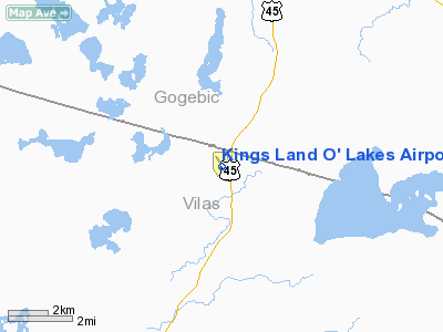
Kings Land O' Lakes Airport |
Location & QuickFacts
| FAA Information Effective: | 2008-09-25 |
| Airport Identifier: | LNL |
| Airport Status: | Operational |
| Longitude/Latitude: | 089-12-43.4857W/46-09-14.4417N
-89.212079/46.154012 (Estimated) |
| Elevation: | 1704 ft / 519.38 m (Surveyed) |
| Land: | 496 acres |
| From nearest city: | 1 nautical miles SE of Land O' Lakes, WI |
| Location: | Vilas County, WI |
| Magnetic Variation: | 02W (2000) |
Owner & Manager
| Ownership: | Publicly owned |
| Owner: | Town Of Land O'lakes |
| Address: | Box 327
Land O'lakes, WI 54540 |
| Phone number: | 715-547-3337 |
| Manager: | David Lane |
| Address: | Po Box 327
Land O'lakes, WI 54540 |
| Phone number: | 715-547-3337 |
Airport Operations and Facilities
| Airport Use: | Open to public |
| Wind indicator: | Yes |
| Segmented Circle: | No |
| Control Tower: | No |
| Lighting Schedule: | DUSK-DAWN
ACTVT MIRL RY 14/32 - CTAF. |
| Beacon Color: | Clear-Green (lighted land airport) |
| Landing fee charge: | No |
| Sectional chart: | Green Bay |
| Region: | AGL - Great Lakes |
| Boundary ARTCC: | ZMP - Minneapolis |
| Tie-in FSS: | GRB - Green Bay |
| FSS on Airport: | No |
| FSS Toll Free: | 1-800-WX-BRIEF |
| NOTAMs Facility: | LNL (NOTAM-d service avaliable) |
| Federal Agreements: | N |
Airport Communications
| CTAF: | 122.800 |
| Unicom: | 122.800 |
Airport Services
| Fuel available: | 100LL
24 HR SELF SERVICE |
| Airframe Repair: | MAJOR |
| Power Plant Repair: | MAJOR |
| Bottled Oxygen: | NONE |
| Bulk Oxygen: | NONE |
Runway Information
Runway 05/23
| Dimension: | 2580 x 130 ft / 786.4 x 39.6 m
500 FT TURF STWY S END & 200 FT STWY N END.
RY 14 NIGHT LANDING LENGTH 3600 FT. THLD LGHTS 400 FT FM END OF RY. |
| Surface: | TURF, Fair Condition |
| |
Runway 05 |
Runway 23 |
| Longitude: | 089-12-57.8920W | 089-12-31.5000W |
| Latitude: | 46-09-04.5290N | 46-09-22.2000N |
| Elevation: | 1697.00 ft | 1703.00 ft |
| Alignment: | 46 | 127 |
| Traffic Pattern: | Left | Left |
| Displaced threshold: | 0.00 ft | 600.00 ft |
| Obstruction: | 53 ft trees, 700.0 ft from runway, 100 ft right of centerline, 13:1 slope to clear | 70 ft trees, 800.0 ft from runway, 180 ft left of centerline, 11:1 slope to clear
RY 23 APCH RATIO 20:1 TO DSPLCD THR. |
|
Runway 14/32
| Dimension: | 4000 x 75 ft / 1219.2 x 22.9 m
500 FT TURF STWY S END & 200 FT STWY N END.
RY 14 NIGHT LANDING LENGTH 3600 FT. THLD LGHTS 400 FT FM END OF RY. |
| Surface: | ASPH, Good Condition |
| Weight Limit: | Single wheel: 12000 lbs. |
| Edge Lights: | Medium |
| |
Runway 14 |
Runway 32 |
| Longitude: | 089-12-59.9200W | 089-12-25.4900W |
| Latitude: | 46-09-30.8430N | 46-08-59.4300N |
| Elevation: | 1704.00 ft | 1704.00 ft |
| Alignment: | 127 | 127 |
| Traffic Pattern: | Left | Left |
| Markings: | Non-precision instrument, Good Condition | Non-precision instrument, Good Condition |
| Crossing Height: | 35.00 ft | 26.00 ft |
| Displaced threshold: | 200.00 ft | 0.00 ft |
| VASI: | 2-light PAPI on left side | 2-light PAPI on left side |
| Visual Glide Angle: | 4.00° | 3.00° |
| Runway End Identifier: | Yes | No |
| Centerline Lights: | No | No |
| Touchdown Lights: | No | No |
| Obstruction: | 60 ft trees, 1000.0 ft from runway, 220 ft right of centerline, 13:1 slope to clear
RY 14 APCH RATIO 20:1 FM DSPLCD THR.
INTERMITTENT USE RD 130-160 FT L OF CNTRLN; 0-200 FT FM THLD. | 18 ft road, 200.0 ft from runway, 250 ft right of centerline
RD 195 FT FM THLD;245 FT R OF CNTRLN. |
|
Radio Navigation Aids
| ID |
Type |
Name |
Ch |
Freq |
Var |
Dist |
| LNL | NDB | Land O Lakes | | 396.00 | 02W | 0.3 nm |
| RXW | NDB | Watersmeet | | 407.00 | 01E | 8.5 nm |
| EGV | NDB | Eagle River | | 341.00 | 02W | 13.5 nm |
| BDJ | NDB | Boulder Junction | | 206.00 | 02E | 18.5 nm |
| ARV | NDB | Arbor Vitae | | 221.00 | 01W | 25.6 nm |
| MHA | NDB | Manitowish | | 364.00 | 01W | 28.0 nm |
| DO | NDB | Dougy | | 236.00 | 01W | 28.9 nm |
| OGM | NDB | Ontonagon | | 375.00 | 00W | 42.3 nm |
| RHI | VORTAC | Rhinelander | 029X | 109.20 | 02E | 32.9 nm |
| IWD | VORTAC | Ironwood | 025X | 108.80 | 01E | 44.2 nm |
Remarks
- OCNL DEER ON & INVOF ARPT.
- GCO AVBL ON FREQ 121.725 THRU FLT SVCS.
Images and information placed above are from
http://www.airport-data.com/airport/LNL/
We thank them for the data!
| General Info
|
| Country |
United States
|
| State |
WISCONSIN
|
| FAA ID |
LNL
|
| Latitude |
46-09-15.443N
|
| Longitude |
089-12-42.093W
|
| Elevation |
1705 feet
|
| Near City |
LAND O' LAKES
|
We don't guarantee the information is fresh and accurate. The data may
be wrong or outdated.
For more up-to-date information please refer to other sources.
|
|


