 |
|
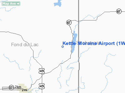
Location & QuickFacts
| FAA Information Effective: | 2008-09-25 |
| Airport Identifier: | 1WN1 |
| Airport Status: | Operational |
| Longitude/Latitude: | 088-11-43.3520W/43-40-04.9790N
-88.195376/43.668050 (Estimated) |
| Elevation: | 1040 ft / 316.99 m (Surveyed) |
| Land: | 0 acres |
| From nearest city: | 2 nautical miles NW of Dundee, WI |
| Location: | Fond Du Lac County, WI |
| Magnetic Variation: | 01W (1985) |
Owner & Manager
| Ownership: | Privately owned |
| Owner: | Donald Narges |
| Address: | W753 Airport Rd
Campbellsport, WI 53010 |
| Phone number: | 414-533-4575 |
| Address: |
|
Airport Operations and Facilities
| Airport Use: | Private |
| Wind indicator: | Yes |
| Segmented Circle: | No |
| Control Tower: | No |
| Landing fee charge: | No |
| Sectional chart: | Chicago |
| Region: | AGL - Great Lakes |
| Boundary ARTCC: | ZAU - Chicago |
| Tie-in FSS: | GRB - Green Bay |
| FSS on Airport: | No |
| FSS Toll Free: | 1-800-WX-BRIEF |
Airport Services
| Airframe Repair: | NONE |
| Power Plant Repair: | NONE |
Runway Information
Runway NE/SW
| Dimension: | 2600 x 100 ft / 792.5 x 30.5 m |
| Surface: | TURF, |
| |
Runway NE |
Runway SW |
| Traffic Pattern: | Left | Left |
| Obstruction: | | 15 ft road |
|
Radio Navigation Aids
| ID |
Type |
Name |
Ch |
Freq |
Var |
Dist |
| LLE | NDB | Kettle Moraine | | 329.00 | 01W | 14.9 nm |
| HXF | NDB | Hartford | | 200.00 | 00E | 21.1 nm |
| UNU | NDB | Juneau | | 344.00 | 01W | 26.3 nm |
| AQ | NDB | Kooky | | 407.00 | 02W | 34.1 nm |
| UES | NDB | Waukesha | | 359.00 | 01W | 37.5 nm |
| RYV | NDB | Rock River | | 371.00 | 01W | 37.7 nm |
| BL | NDB | Yanks | | 260.00 | 02W | 39.1 nm |
| SG | NDB | Depre | | 332.00 | 02W | 44.0 nm |
| GM | NDB | Teels | | 242.00 | 02W | 46.1 nm |
| BJB | VOR | West Bend | | 109.80 | 01W | 15.1 nm |
| FAH | VOR/DME | Falls | 37X | 110.00 | 02W | 16.2 nm |
| LJT | VOR/DME | Timmerman | 072X | 112.50 | 02W | 34.3 nm |
| MTW | VOR/DME | Manitowoc | 047X | 111.00 | 02W | 35.6 nm |
| OSH | VORTAC | Oshkosh | 055X | 111.80 | 02E | 24.9 nm |
| BAE | VORTAC | Badger | 111X | 116.40 | 02E | 33.4 nm |
| MKE | VOT | Milwaukee | | 109.00 | | 45.2 nm |
Images and information placed above are from
http://www.airport-data.com/airport/1WN1/
We thank them for the data!
| General Info
|
| Country |
United States
|
| State |
WISCONSIN
|
| FAA ID |
1WN1
|
| Latitude |
43-40-04.979N
|
| Longitude |
088-11-43.352W
|
| Elevation |
1040 feet
|
| Near City |
DUNDEE
|
We don't guarantee the information is fresh and accurate. The data may
be wrong or outdated.
For more up-to-date information please refer to other sources.
|
|


