 |
|
| Kenosha Regional Airport |
| IATA: ENW – ICAO: KENW – FAA LID: ENW |
| Summary |
| Airport type |
Public |
| Owner |
City of Kenosha |
| Serves |
Kenosha, Wisconsin |
| Elevation AMSL |
742 ft / 226 m |
| Coordinates |
42°35′44″N 087°55′40″W / 42.59556°N 87.92778°W / 42.59556; -87.92778 |
| Website |
www.kenosha.org/... |
| Runways |
| Direction |
Length |
Surface |
| ft |
m |
| 7L/25R |
5,499 |
1,676 |
Concrete |
| 7R/25L |
3,302 |
1,006 |
Asphalt/Concrete |
| 15/33 |
4,440 |
1,353 |
Concrete |
| Statistics (2006) |
| Aircraft operations |
65,722 |
| Based aircraft |
164 |
| Source: Federal Aviation Administration |
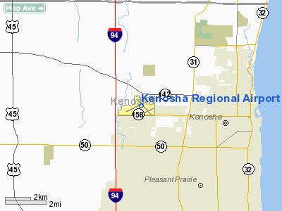
Kenosha Regional Airport (IATA: ENW, ICAO: KENW, FAA LID: ENW) is a city-owned, public-use airport located four nautical miles (7 km) west of the central business district of Kenosha, a city in Kenosha County, Wisconsin, United States.
The airport has three runways. It is an air traffic controlled general aviation facility with no scheduled passenger service. In 2005, there were 78,357 takeoffs and landings.
Facilities and aircraft
Kenosha Regional Airport covers an area of 959 acres (388 ha) at an elevation of 742 feet (226 m) above mean sea level. It has three runways: 7L/25R is 5,499 by 100 feet (1,676 x 30 m) with a concrete surface; 7R/25L is 3,302 by 75 feet (1,006 x 23 m) with an asphalt/concrete surface; 15/33 is 4,440 by 100 feet (1,353 x 30 m) with a concrete surface.
For the 12-month period ending December 31, 2006, the airport had 65,722 aircraft operations, an average of 180 per day: 95% general aviation, 4% air taxi and <1% military. At that time there were 164 aircraft based at this airport: 79% single-engine, 11% multi-engine, 7% jet and 2% helicopter.
The above content comes from Wikipedia and is published under free licenses – click here to read more.
Location & QuickFacts
| FAA Information Effective: | 2008-09-25 |
| Airport Identifier: | ENW |
| Airport Status: | Operational |
| Longitude/Latitude: | 087-55-40.1000W/42-35-44.5000N
-87.927806/42.595694 (Estimated) |
| Elevation: | 742 ft / 226.16 m (Surveyed) |
| Land: | 959 acres |
| From nearest city: | 4 nautical miles W of Kenosha, WI |
| Location: | Kenosha County, WI |
| Magnetic Variation: | 02W (1990) |
Owner & Manager
| Ownership: | Publicly owned |
| Owner: | City Of Kenosha |
| Address: | 625 52nd St
Kenosha, WI 53140 |
| Phone number: | 262-653-4020 |
| Manager: | Wayde Buck |
| Address: | 9900 52nd St
Kenosha, WI 53144 |
| Phone number: | 262-653-4160 |
Airport Operations and Facilities
| Airport Use: | Open to public |
| Wind indicator: | Yes |
| Segmented Circle: | Yes |
| Control Tower: | Yes |
| Lighting Schedule: | DUSK-DAWN
WHEN ATCT CLSD HIRL RY 06L/24R PRESET ON LOW INTST; TO INCR INTST & ACTVT HIRL RY 14/32; MIRL RY 06R/24L; VASI RY 32; PAPI RYS 24R; 06R & 24L; REIL RYS 14 & 24R; MALSR RY 06L - CTAF. VASI RY 14 OPERATE 24 HRS. |
| Beacon Color: | Clear-Green (lighted land airport) |
| Landing fee charge: | No |
| Sectional chart: | Chicago |
| Region: | AGL - Great Lakes |
| Boundary ARTCC: | ZAU - Chicago |
| Tie-in FSS: | GRB - Green Bay |
| FSS on Airport: | No |
| FSS Toll Free: | 1-800-WX-BRIEF |
| NOTAMs Facility: | ENW (NOTAM-d service avaliable) |
| Federal Agreements: | NGY |
Airport Communications
| CTAF: | 118.600 |
| Unicom: | 122.950 |
Airport Services
| Fuel available: | 100LLA |
| Airframe Repair: | MAJOR |
| Power Plant Repair: | MAJOR |
| Bottled Oxygen: | NONE |
| Bulk Oxygen: | HIGH/LOW |
Runway Information
Runway 06L/24R
| Dimension: | 5499 x 100 ft / 1676.1 x 30.5 m |
| Surface: | CONC, Good Condition |
| Surface Treatment: | Saw-cut or plastic Grooved |
| Weight Limit: | Single wheel: 62000 lbs.
Dual wheel: 73000 lbs.
Dual tandem wheel: 135000 lbs. |
| Edge Lights: | High |
| |
Runway 06L |
Runway 24R |
| Longitude: | 087-56-30.1808W | 087-55-24.2398W |
| Latitude: | 42-35-34.8020N | 42-35-58.8221N |
| Elevation: | 742.00 ft | 713.00 ft |
| Alignment: | 64 | 127 |
| ILS Type: | ILS
| |
| Traffic Pattern: | Left | Right |
| Markings: | Precision instrument, Good Condition | Precision instrument, Good Condition |
| Crossing Height: | 0.00 ft | 45.00 ft |
| VASI: | | 4-light PAPI on left side |
| Visual Glide Angle: | 0.00° | 3.00° |
| Approach lights: | MALSR | |
| Runway End Identifier: | | Yes |
| Obstruction: | , 50:1 slope to clear | 59 ft tree, 2672.0 ft from runway, 139 ft right of centerline, 41:1 slope to clear |
|
Runway 06R/24L
| Dimension: | 3302 x 75 ft / 1006.4 x 22.9 m |
| Surface: | ASPH-CONC, Fair Condition |
| Weight Limit: | Single wheel: 40000 lbs.
Dual wheel: 48000 lbs. |
| Edge Lights: | Medium |
| |
Runway 06R |
Runway 24L |
| Longitude: | 087-55-41.0583W | 087-55-01.4706W |
| Latitude: | 42-35-27.3561N | 42-35-41.7757N |
| Elevation: | 729.00 ft | 706.00 ft |
| Alignment: | 64 | 127 |
| Traffic Pattern: | Right | Left |
| Markings: | Basic, Good Condition | Basic, Good Condition |
| Crossing Height: | 25.00 ft | 25.00 ft |
| VASI: | 4-light PAPI on left side | 4-light PAPI on left side |
| Visual Glide Angle: | 3.25° | 3.25° |
| Runway End Identifier: | | No |
| Centerline Lights: | No | No |
| Touchdown Lights: | No | No |
| Obstruction: | 23 ft road, 889.0 ft from runway, 188 ft right of centerline, 29:1 slope to clear | 11 ft road, 532.0 ft from runway, 150 ft left of centerline, 30:1 slope to clear |
|
Runway 14/32
| Dimension: | 4440 x 100 ft / 1353.3 x 30.5 m |
| Surface: | CONC, Good Condition |
| Surface Treatment: | Saw-cut or plastic Grooved |
| Weight Limit: | Single wheel: 62000 lbs.
Dual wheel: 73000 lbs.
Dual tandem wheel: 135000 lbs. |
| Edge Lights: | High |
| |
Runway 14 |
Runway 32 |
| Longitude: | 087-55-50.4273W | 087-55-15.3173W |
| Latitude: | 42-36-06.8355N | 42-35-31.4764N |
| Elevation: | 716.00 ft | 716.00 ft |
| Alignment: | 127 | 127 |
| Traffic Pattern: | Left | Left |
| Markings: | Non-precision instrument, Good Condition | Non-precision instrument, Good Condition |
| Crossing Height: | 45.00 ft | 41.00 ft |
| VASI: | 4-box on left side | 4-box on left side |
| Visual Glide Angle: | 3.50° | 3.00° |
| Runway End Identifier: | Yes | No |
| Centerline Lights: | No | No |
| Touchdown Lights: | No | No |
| Obstruction: | 45 ft trees, 1100.0 ft from runway, 200 ft left of centerline, 20:1 slope to clear | , 50:1 slope to clear |
|
Radio Navigation Aids
| ID |
Type |
Name |
Ch |
Freq |
Var |
Dist |
| RA | NDB | Paser | | 206.00 | 00E | 5.4 nm |
| GM | NDB | Teels | | 242.00 | 02W | 19.5 nm |
| BL | NDB | Yanks | | 260.00 | 02W | 28.0 nm |
| LVV | NDB | Lake Lawn | | 404.00 | 00W | 30.1 nm |
| UES | NDB | Waukesha | | 359.00 | 01W | 30.2 nm |
| ME | NDB | Deana | | 350.00 | 00E | 38.0 nm |
| JVL | NDB | Janesville | | 375.00 | 03E | 49.3 nm |
| RYV | NDB | Rock River | | 371.00 | 01W | 49.4 nm |
| HXF | NDB | Hartford | | 200.00 | 00E | 49.7 nm |
| ENW | VOR/DME | Kenosha | 029X | 109.20 | 02W | 0.3 nm |
| HRK | VOR/DME | Horlick | 124X | 117.70 | 02W | 11.2 nm |
| BUU | VOR/DME | Burbun | 092X | 114.50 | 01W | 17.5 nm |
| OBK | VOR/DME | Northbrook | 077X | 113.00 | 02W | 22.5 nm |
| LJT | VOR/DME | Timmerman | 072X | 112.50 | 02W | 31.3 nm |
| ORD | VOR/DME | Chicago O'hare | 086X | 113.90 | 02E | 36.6 nm |
| DPA | VOR/DME | Dupage | 021X | 108.40 | 02E | 46.4 nm |
| BAE | VORTAC | Badger | 111X | 116.40 | 02E | 35.0 nm |
| MKE | VOT | Milwaukee | | 109.00 | | 21.2 nm |
| ORD | VOT | Chicago O'hare Intl | | 112.00 | | 36.9 nm |
| MDW | VOT | Chicago Midway | | 111.00 | | 49.3 nm |
Remarks
- DEER & BIRDS ON & INVOF ARPT.
- 440'RDO TWR 2.6 NMI SE OF ARPT 1/2 NMI L OF RWY 32 CL.
- CRANE, 190 FT, 1.5 NM SE OF ARPT, OPERS SR-SS.
Images and information placed above are from
http://www.airport-data.com/airport/ENW/
We thank them for the data!
| General Info
|
| Country |
United States
|
| State |
WISCONSIN
|
| FAA ID |
ENW
|
| Latitude |
42-35-44.547N
|
| Longitude |
087-55-40.092W
|
| Elevation |
743 feet
|
| Near City |
KENOSHA
|
We don't guarantee the information is fresh and accurate. The data may
be wrong or outdated.
For more up-to-date information please refer to other sources.
|
|


