 |
|
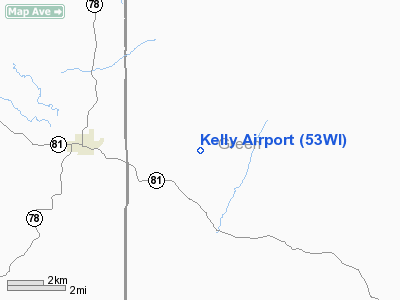
Location & QuickFacts
| FAA Information Effective: | 2008-09-25 |
| Airport Identifier: | 53WI |
| Airport Status: | Operational |
| Longitude/Latitude: | 089-47-12.4400W/42-41-53.0100N
-89.786789/42.698058 (Estimated) |
| Elevation: | 1020 ft / 310.90 m (Estimated) |
| Land: | 430 acres |
| From nearest city: | 4 nautical miles E of Argyle, WI |
| Location: | Green County, WI |
| Magnetic Variation: | 00E (1990) |
Owner & Manager
| Ownership: | Privately owned |
| Owner: | Clover Creek Farms Inc |
| Address: | P.o. Box 198
Monroe, WI 53566 |
| Phone number: | 800-421-2274 |
| Manager: | Thomas Kelly |
| Address: | N5146 County 'm'
Argyle, WI 53506 |
| Phone number: | 608-543-3312
FAX - 608-543-3313 |
Airport Operations and Facilities
| Airport Use: | Private |
| Wind indicator: | Yes |
| Segmented Circle: | No |
| Control Tower: | No |
| Sectional chart: | Chicago |
| Region: | AGL - Great Lakes |
| Boundary ARTCC: | ZAU - Chicago |
| Tie-in FSS: | GRB - Green Bay |
| FSS Toll Free: | 1-800-WX-BRIEF |
Runway Information
Runway 02/20
| Dimension: | 2200 x 50 ft / 670.6 x 15.2 m |
| Surface: | TURF, Good Condition |
| |
Runway 02 |
Runway 20 |
| Traffic Pattern: | Left | Left |
|
Radio Navigation Aids
| ID |
Type |
Name |
Ch |
Freq |
Var |
Dist |
| MRJ | NDB | Mineral Point | | 365.00 | 00W | 22.5 nm |
| FEP | NDB | Freeport | | 335.00 | 00E | 28.6 nm |
| PVB | NDB | Platteville | | 203.00 | 01E | 28.7 nm |
| MS | NDB | Monah | | 400.00 | 00E | 29.3 nm |
| JVL | NDB | Janesville | | 375.00 | 03E | 33.3 nm |
| JVL | VOR/DME | Janesville | 090X | 114.30 | 03E | 31.3 nm |
| RFD | VOR/DME | Rockford | 045X | 110.80 | 01E | 38.5 nm |
| LNR | VOR/DME | Lone Rock | 075X | 112.80 | 00E | 38.9 nm |
| PLL | VOR/DME | Polo | 049X | 111.20 | 03E | 45.5 nm |
| MSN | VORTAC | Madison | 023X | 108.60 | 03E | 33.3 nm |
| DBQ | VORTAC | Dubuque | 105X | 115.80 | 04E | 44.6 nm |
Remarks
- PRVDD ANY OBSTN IN RY APCH SLOPE SFC BE LOWERED OR REMOVED. OTHERWISE THE RY THR SHOULD BE DSPLCD AND MARKED TO PRVD A 20:1 APCH CLNC OVER OBSTN. AREA 125 FT EITHER SIDE OF RY C-LINE & 200 FT OF RY ENDS BE CLEAR OF ANY OBSTNS.
Images and information placed above are from
http://www.airport-data.com/airport/53WI/
We thank them for the data!
| General Info
|
| Country |
United States
|
| State |
WISCONSIN
|
| FAA ID |
53WI
|
| Latitude |
42-41-53.010N
|
| Longitude |
089-47-12.440W
|
| Elevation |
1020 feet
|
| Near City |
ARGYLE
|
We don't guarantee the information is fresh and accurate. The data may
be wrong or outdated.
For more up-to-date information please refer to other sources.
|
|


