 |
|
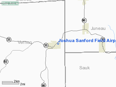
Joshua Sanford Field Airport |
Location & QuickFacts
| FAA Information Effective: | 2008-09-25 |
| Airport Identifier: | HBW |
| Airport Status: | Operational |
| Longitude/Latitude: | 090-19-41.4630W/43-39-23.9050N
-90.328184/43.656640 (Estimated) |
| Elevation: | 938 ft / 285.90 m (Surveyed) |
| Land: | 16 acres |
| From nearest city: | 1 nautical miles NE of Hillsboro, WI |
| Location: | Vernon County, WI |
| Magnetic Variation: | 01E (1985) |
Owner & Manager
| Ownership: | Publicly owned |
| Owner: | City Of Hillsboro |
| Address: | 836 Prairie Ave
Hillsboro, WI 54634 |
| Phone number: | 608-489-2521 |
| Manager: | Henry Peterson |
| Address: | Box 408
Hillsboro, WI 54634 |
| Phone number: | 608-489-3132 |
Airport Operations and Facilities
| Airport Use: | Open to public |
| Wind indicator: | Yes |
| Segmented Circle: | No |
| Control Tower: | No |
| Lighting Schedule: | RDO-CTL
ACTVT LIRL RY 05/23 - CTAF. |
| Landing fee charge: | No |
| Sectional chart: | Chicago |
| Region: | AGL - Great Lakes |
| Traffic Pattern Alt: | 1000 ft |
| Boundary ARTCC: | ZAU - Chicago |
| Tie-in FSS: | GRB - Green Bay |
| FSS on Airport: | No |
| FSS Toll Free: | 1-800-WX-BRIEF |
| NOTAMs Facility: | GRB (NOTAM-d service avaliable) |
Airport Communications
Airport Services
| Airframe Repair: | NONE |
| Power Plant Repair: | NONE |
| Bottled Oxygen: | NONE |
| Bulk Oxygen: | NONE |
Runway Information
Runway 05/23
| Dimension: | 3070 x 46 ft / 935.7 x 14.0 m |
| Surface: | ASPH, Good Condition |
| Edge Lights: | Non-standard lighting system
NSTD LIRL. RY 05 THLD LGTS BLACK (OBSCURED) & GREEN. RY 23 THLD LGTS LCTD 245 FT FM RELOCATED THLD. |
| |
Runway 05 |
Runway 23 |
| Traffic Pattern: | Left | Left |
| Markings: | Basic, Good Condition | Basic, Good Condition |
| Displaced threshold: | 733.00 ft | 0.00 ft |
| VASI: | | nonstandard system
SINGLE BOX VASI LEFT SIDE. |
| Runway End Identifier: | No | No |
| Centerline Lights: | No | No |
| Touchdown Lights: | No | No |
| Obstruction: | 7 ft fence, 200.0 ft from runway, 46 ft left of centerline
RWY 05 APCH RATIO 13::1 AT DSPLCD THLD TO +57 FT TREE 750 FT; 100 FT R.
RWY 05 7 FT FENCE 0 FT FM THLD 46 FT L; 57 FT TREES & 30 FT HNGR 20 FT FM THLD 100 FT R. | 15 ft trees, 200.0 ft from runway, 100 ft right of centerline
RWY 23 3 FT BRUSH 0-200 FT FM THLD 125 FT L. |
|
Radio Navigation Aids
| ID |
Type |
Name |
Ch |
Freq |
Var |
Dist |
| HBW | NDB | Kickapoo | | 251.00 | 03E | 0.2 nm |
| CMY | NDB | Mccoy | | 412.00 | 00E | 21.7 nm |
| BCK | NDB | Black River Falls | | 362.00 | 00E | 42.4 nm |
| MRJ | NDB | Mineral Point | | 365.00 | 00W | 46.4 nm |
| ISW | NDB | Wisconsin Rapids | | 215.00 | 01W | 47.5 nm |
| VOK | TACAN | Volk | 041X | | 00E | 17.5 nm |
| LNR | VOR/DME | Lone Rock | 075X | 112.80 | 00E | 23.4 nm |
| LSE | VOR/DME | La Crosse | 021X | 108.40 | 02E | 42.4 nm |
| DLL | VORTAC | Dells | 117X | 117.00 | 03E | 25.4 nm |
Remarks
Images and information placed above are from
http://www.airport-data.com/airport/HBW/
We thank them for the data!
| General Info
|
| Country |
United States
|
| State |
WISCONSIN
|
| FAA ID |
HBW
|
| Latitude |
43-39-23.905N
|
| Longitude |
090-19-41.463W
|
| Elevation |
938 feet
|
| Near City |
HILLSBORO
|
We don't guarantee the information is fresh and accurate. The data may
be wrong or outdated.
For more up-to-date information please refer to other sources.
|
|


