 |
|
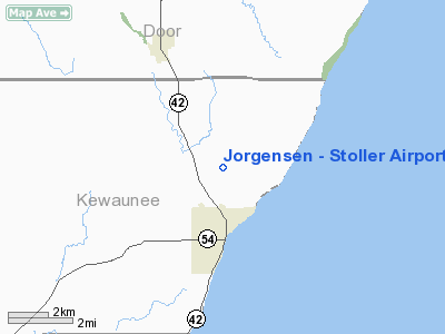
Jorgensen - Stoller Airport |
Location & QuickFacts
| FAA Information Effective: | 2008-09-25 |
| Airport Identifier: | 1WI8 |
| Airport Status: | Operational |
| Longitude/Latitude: | 087-26-24.8200W/44-38-09.0000N
-87.440228/44.635833 (Estimated) |
| Elevation: | 690 ft / 210.31 m (Estimated) |
| Land: | 15 acres |
| From nearest city: | 3 nautical miles N of Algoma, WI |
| Location: | Kewaunee County, WI |
| Magnetic Variation: | 03W (1995) |
Owner & Manager
| Ownership: | Privately owned |
| Owner: | Dale H Jorgensen |
| Address: | N 8621 Wolf River Rd
Algoma, WI 54201 |
| Phone number: | 920-487-3881 |
| Manager: | Dale H Jorgensen |
| Address: | N 8621 Wolf River Rd
Algoma, WI 54201 |
| Phone number: | 920-487-3881 |
Airport Operations and Facilities
| Airport Use: | Private |
| Wind indicator: | Yes |
| Segmented Circle: | No |
| Control Tower: | No |
| Sectional chart: | Green Bay |
| Region: | AGL - Great Lakes |
| Boundary ARTCC: | ZMP - Minneapolis |
| Tie-in FSS: | GRB - Green Bay |
| FSS Toll Free: | 1-800-WX-BRIEF |
Runway Information
Runway 18/36
| Dimension: | 2600 x 100 ft / 792.5 x 30.5 m |
| Surface: | TURF, |
| |
Runway 18 |
Runway 36 |
| Traffic Pattern: | Left | Left |
| Displaced threshold: | 0.00 ft | 200.00 ft |
|
Radio Navigation Aids
| ID |
Type |
Name |
Ch |
Freq |
Var |
Dist |
| SUE | NDB | Sturgeon Bay | | 414.00 | 03W | 12.1 nm |
| OCQ | NDB | Oconto | | 388.00 | 03W | 24.8 nm |
| SG | NDB | Depre | | 332.00 | 02W | 32.9 nm |
| AQ | NDB | Kooky | | 407.00 | 02W | 48.3 nm |
| MTW | VOR/DME | Manitowoc | 047X | 111.00 | 02W | 32.2 nm |
| MNM | VOR/DME | Menominee | 033X | 109.60 | 00E | 33.9 nm |
| GRB | VORTAC | Green Bay | 102X | 115.50 | 01E | 32.7 nm |
Remarks
- PRVDD COMPLY EITH LETTEROF AGREEMENT BTN THIS ARPT AND CARNOT FIELD, CLEAR 20:1 APCHS, CLEAR OBSTACLE FREE ZONE CLEAR RY SAFETY AREA.
Images and information placed above are from
http://www.airport-data.com/airport/1WI8/
We thank them for the data!
| General Info
|
| Country |
United States
|
| State |
WISCONSIN
|
| FAA ID |
1WI8
|
| Latitude |
44-38-09.000N
|
| Longitude |
087-26-24.820W
|
| Elevation |
690 feet
|
| Near City |
ALGOMA
|
We don't guarantee the information is fresh and accurate. The data may
be wrong or outdated.
For more up-to-date information please refer to other sources.
|
|


