 |
|
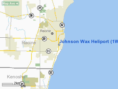
Location & QuickFacts
| FAA Information Effective: | 2008-09-25 |
| Airport Identifier: | 1WI4 |
| Airport Status: | Operational |
| Longitude/Latitude: | 087-47-30.2680W/42-42-30.0710N
-87.791741/42.708353 (Estimated) |
| Elevation: | 640 ft / 195.07 m (Estimated) |
| Land: | 0 acres |
| From nearest city: | 3 nautical miles SE of Racine, WI |
| Location: | Racine County, WI |
| Magnetic Variation: | 01W (1985) |
Owner & Manager
| Ownership: | Privately owned |
| Owner: | S C Johnson & Son, Inc |
| Address: | 1525 Howe St
Racine, WI 53403 |
| Phone number: | 414-631-2000 |
| Manager: | Robert W. Root |
| Address: | Racine Airport
Racine, WI 53404 |
| Phone number: | 414-631-2707 |
Airport Operations and Facilities
| Airport Use: | Private |
| Wind indicator: | Yes |
| Segmented Circle: | No |
| Control Tower: | No |
| Landing fee charge: | No |
| Sectional chart: | Chicago |
| Region: | AGL - Great Lakes |
| Boundary ARTCC: | ZAU - Chicago |
| Tie-in FSS: | GRB - Green Bay |
| FSS on Airport: | No |
| FSS Toll Free: | 1-800-WX-BRIEF |
Airport Communications
Airport Services
| Airframe Repair: | NONE |
| Power Plant Repair: | NONE |
Runway Information
Helipad H1
| Dimension: | 100 x 80 ft / 30.5 x 24.4 m |
| Surface: | ASPH, |
| |
Runway H1 |
Runway |
| Traffic Pattern: | Left | Left |
|
Radio Navigation Aids
| ID |
Type |
Name |
Ch |
Freq |
Var |
Dist |
| RA | NDB | Paser | | 206.00 | 00E | 5.0 nm |
| GM | NDB | Teels | | 242.00 | 02W | 16.3 nm |
| BL | NDB | Yanks | | 260.00 | 02W | 21.5 nm |
| UES | NDB | Waukesha | | 359.00 | 01W | 28.1 nm |
| LVV | NDB | Lake Lawn | | 404.00 | 00W | 35.4 nm |
| LLE | NDB | Kettle Moraine | | 329.00 | 01W | 45.5 nm |
| ME | NDB | Deana | | 350.00 | 00E | 45.7 nm |
| HXF | NDB | Hartford | | 200.00 | 00E | 46.7 nm |
| RYV | NDB | Rock River | | 371.00 | 01W | 49.7 nm |
| BJB | VOR | West Bend | | 109.80 | 01W | 45.3 nm |
| HRK | VOR/DME | Horlick | 124X | 117.70 | 02W | 3.4 nm |
| ENW | VOR/DME | Kenosha | 029X | 109.20 | 02W | 9.0 nm |
| BUU | VOR/DME | Burbun | 092X | 114.50 | 01W | 22.6 nm |
| LJT | VOR/DME | Timmerman | 072X | 112.50 | 02W | 26.4 nm |
| OBK | VOR/DME | Northbrook | 077X | 113.00 | 02W | 30.1 nm |
| ORD | VOR/DME | Chicago O'hare | 086X | 113.90 | 02E | 43.6 nm |
| BAE | VORTAC | Badger | 111X | 116.40 | 02E | 32.8 nm |
| MKE | VOT | Milwaukee | | 109.00 | | 15.1 nm |
| ORD | VOT | Chicago O'hare Intl | | 112.00 | | 43.9 nm |
Remarks
- PRIOR PERMISSION REQUIRED.
- NORTH/SOUTH ARRIVAL AND DEPARTURE PATHS ONLY.
Images and information placed above are from
http://www.airport-data.com/airport/1WI4/
We thank them for the data!
| General Info
|
| Country |
United States
|
| State |
WISCONSIN
|
| FAA ID |
1WI4
|
| Latitude |
42-42-30.071N
|
| Longitude |
087-47-30.268W
|
| Elevation |
640 feet
|
| Near City |
RACINE
|
We don't guarantee the information is fresh and accurate. The data may
be wrong or outdated.
For more up-to-date information please refer to other sources.
|
|


