 |
|
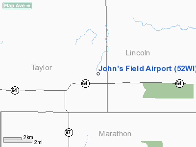
Location & QuickFacts
| FAA Information Effective: | 2008-09-25 |
| Airport Identifier: | 52WI |
| Airport Status: | Operational |
| Longitude/Latitude: | 090-03-24.7770W/45-09-34.7198N
-90.056883/45.159644 (Estimated) |
| Elevation: | 1450 ft / 441.96 m (Estimated) |
| Land: | 7 acres |
| From nearest city: | 12 nautical miles SS of Athens, WI |
| Location: | Taylor County, WI |
| Magnetic Variation: | () |
Owner & Manager
| Ownership: | Privately owned |
| Owner: | John Laub |
| Address: | N3443 Spring Drive
Athens, WI 54411 |
| Phone number: | 715-748-9034 |
| Manager: | John Laub |
| Address: | N3443 Spring Drive
Athens, WI 54411 |
| Phone number: | 715-748-9034 |
Airport Operations and Facilities
| Airport Use: | Private |
| Wind indicator: | Yes |
| Control Tower: | No |
| Sectional chart: | Green Bay |
| Region: | AGL - Great Lakes |
| Boundary ARTCC: | ZMP - Minneapolis |
| Tie-in FSS: | GRB - Green Bay |
| FSS Toll Free: | 1-800-WX-BRIEF |
Runway Information
Runway 18/36
| Dimension: | 2500 x 75 ft / 762.0 x 22.9 m |
| Surface: | TURF, |
| |
Runway 18 |
Runway 36 |
| Traffic Pattern: | Left | Left |
| Obstruction: | 30 ft trees, 700.0 ft from runway | 30 ft trees, 1000.0 ft from runway |
|
Radio Navigation Aids
| ID |
Type |
Name |
Ch |
Freq |
Var |
Dist |
| MDZ | NDB | Medford | | 335.00 | 00E | 11.2 nm |
| RRL | NDB | Merrill | | 257.00 | 01W | 15.1 nm |
| FZK | NDB | Wausau | | 243.00 | 01E | 23.0 nm |
| MFI | NDB | Marshfield | | 391.00 | 00E | 31.7 nm |
| PBH | NDB | Phillips | | 263.00 | 00E | 35.9 nm |
| AIG | NDB | Antigo | | 347.00 | 02W | 40.0 nm |
| VIQ | NDB | Neillsville | | 368.00 | 01W | 41.1 nm |
| DO | NDB | Dougy | | 236.00 | 01W | 42.8 nm |
| RCX | NDB | Rusk County | | 356.00 | 00W | 44.9 nm |
| ARV | NDB | Arbor Vitae | | 221.00 | 01W | 48.1 nm |
| ISW | NDB | Wisconsin Rapids | | 215.00 | 01W | 48.7 nm |
| AUW | VORTAC | Wausau | 053X | 111.60 | 02E | 27.4 nm |
| RHI | VORTAC | Rhinelander | 029X | 109.20 | 02E | 38.1 nm |
| STE | VORTAC | Stevens Point | 043X | 110.60 | 01W | 43.3 nm |
Remarks
- PRVDD VFR OPNS AND CLEAR 20:1 APCHS.
Images and information placed above are from
http://www.airport-data.com/airport/52WI/
We thank them for the data!
| General Info
|
| Country |
United States
|
| State |
WISCONSIN
|
| FAA ID |
52WI
|
| Latitude |
42-52-25.000N
|
| Longitude |
088-18-17.000W
|
| Elevation |
795 feet
|
| Near City |
MUKWONAGO
|
We don't guarantee the information is fresh and accurate. The data may
be wrong or outdated.
For more up-to-date information please refer to other sources.
|
|


