|
|
Coordinates: 42°45′38″N 087°48′55″W / 42.76056°N 87.81528°W / 42.76056; -87.81528
| John H. Batten Airport |
| IATA: RAC – ICAO: KRAC – FAA LID: RAC |
| Summary |
| Airport type |
Public |
| Owner |
Racine Commercial Airport Corp. |
| Serves |
Racine, Wisconsin |
| Elevation AMSL |
674 ft / 205 m |
| Website |
www.BattenAirport.aero |
| Runways |
| Direction |
Length |
Surface |
| ft |
m |
| 4/22 |
6,556 |
1,998 |
Concrete |
| 14/32 |
4,423 |
1,348 |
Asphalt |
| Statistics (2006) |
| Aircraft operations |
47,000 |
| Based aircraft |
93 |
| Source: Federal Aviation Administration |
John H. Batten Airport (IATA: RAC, ICAO: KRAC, FAA LID: RAC), also known as Batten International Airport, is a public use airport located two miles (3 km) northwest of the central business district of Racine, a city in Racine County, Wisconsin, United States. It is privately owned by the Racine Commercial Airport Corporation. The airport was founded in 1941 by Carlyle Godske on roughly 160 acres (0.65 km) of land purchased from local businessman J.A. Horlick. For most of its history the airport was known as Racine-Horlick Field, but on September 5, 1989 the name was changed to John H. Batten Field. John H. Batten was one of the airport's early founders and supporters as well as the longtime CEO of Racine's Twin Disc, Inc.
During World War II the newly established airport was used as a flight and ground school for the Army. Students were housed at Racine College on the south side of Racine. Ground school instruction was given at Horlick High School and the actual flight training took place at the airport. Today, the airport is used primarily by local aviation enthusiasts and by the corporate jets of large local companies like S.C. Johnson & Son and Twin Disc, Inc.
Facilities and aircraft
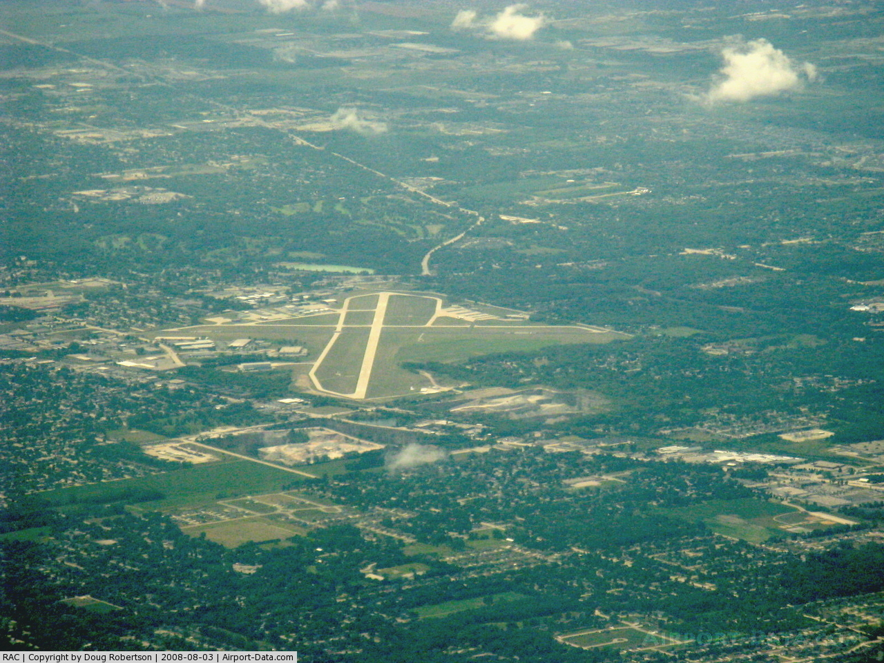
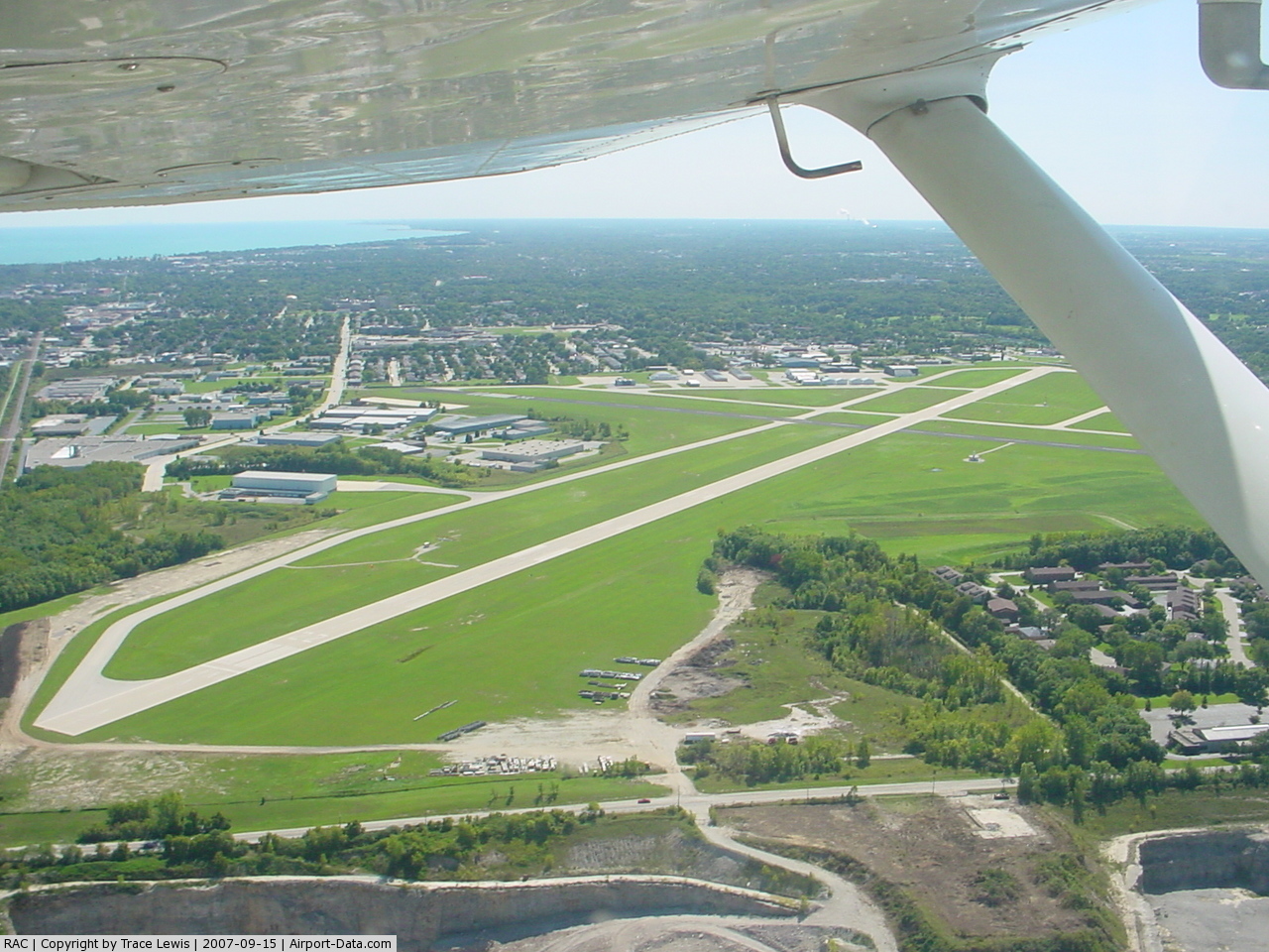
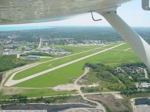
John H. Batten Airport covers an area of 467 acres (189 ha) which contains two paved runways: 4/22 with a 6,556 x 100 ft (1,998 x 30 m) concrete surface and 14/32 measuring 4,423 x 100 ft (1,348 x 30 m) with asphalt pavement.
For the 12-month period ending September 21, 2006, the airport had 47,000 aircraft operations, an average of 128 per day: 96% general aviation and 4% air taxi. There are 93 aircraft based at this airport: 74% single engine, 16% multi-engine, 9% jet aircraft and 1% helicopters.
The above content comes from Wikipedia and is published under free licenses – click here to read more.
 |
(Click on the photo to enlarge) |
 |
(Click on the photo to enlarge) |
 |
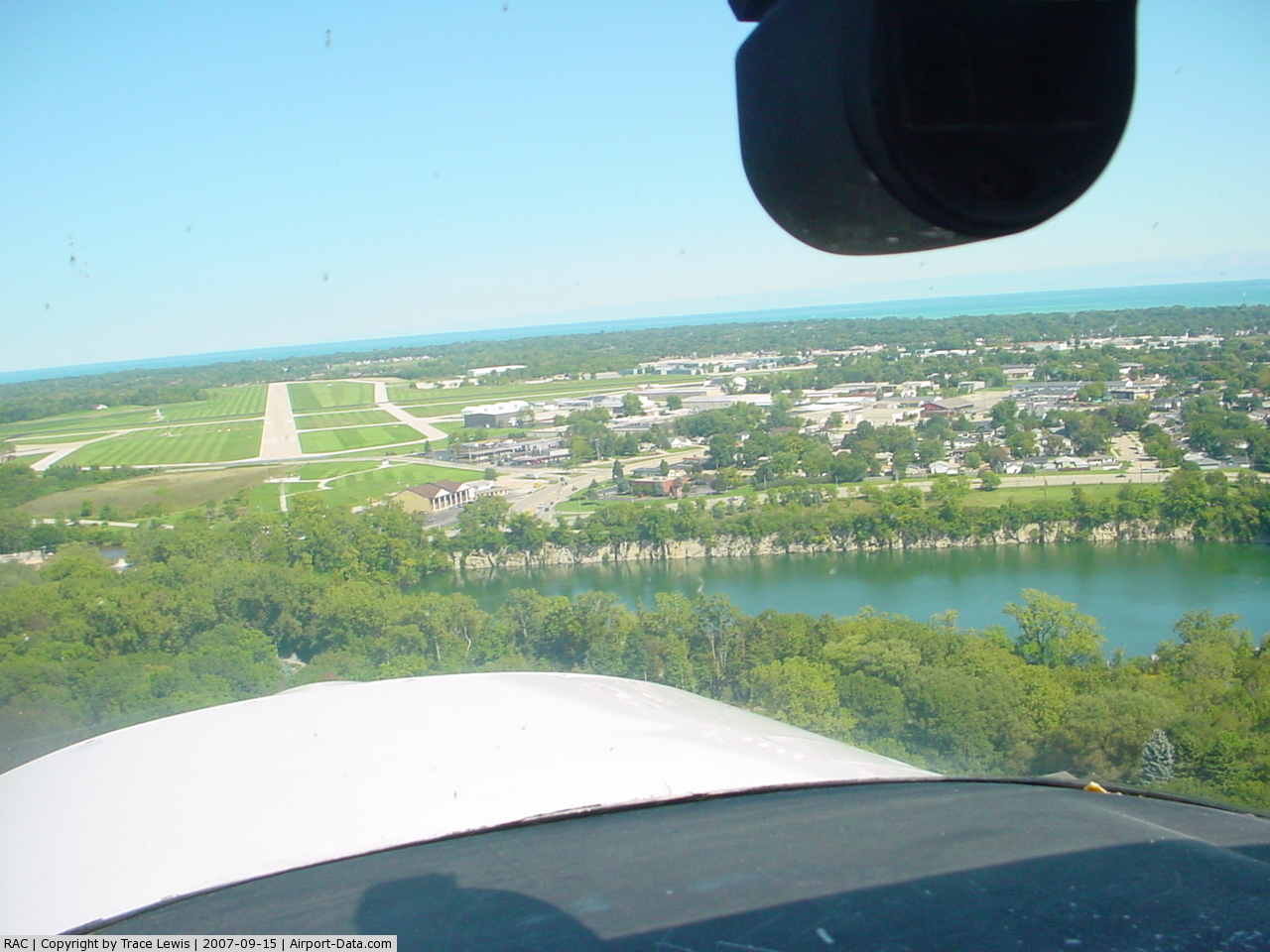
(Click on the photo to enlarge) |
Location & QuickFacts
| FAA Information Effective: | 2008-09-25 |
| Airport Identifier: | RAC |
| Airport Status: | Operational |
| Longitude/Latitude: | 087-48-50.1000W/42-45-40.2000N
-87.813917/42.761167 (Estimated) |
| Elevation: | 674 ft / 205.44 m (Surveyed) |
| Land: | 467 acres |
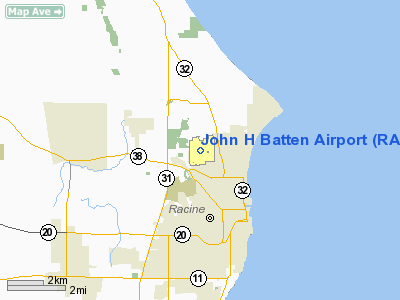
| From nearest city: | 2 nautical miles NW of Racine, WI |
| Location: | Racine County, WI |
| Magnetic Variation: | 02W (1995) |
Owner & Manager
| Ownership: | Privately owned |
| Owner: | Racine Commercial Aprt Corp. |
| Address: | 3239 N. Green Bay Rd
Racine, WI 53404 |
| Phone number: | 262-631-5620 |
| Manager: | David Mann |
| Address: | 3239 N. Green Bay Rd
Racine, WI 53404 |
| Phone number: | 262-631-5620
FAX NR 262-631-5638. |
Airport Operations and Facilities
| Airport Use: | Open to public |
| Wind indicator: | Yes |
| Segmented Circle: | No |
| Control Tower: | No |
| Lighting Schedule: | 24 HRS
ACTVT HIRL RY 04/22 & MIRL RY 14/32; PAPI RYS 04 & 14; REIL RYS 04; 22; 14 & 32; MALSF RY 04 - CTAF. PAPI RY 22 OPERS 24 HRS. |
| Beacon Color: | Clear-Green (lighted land airport) |
| Landing fee charge: | No |
| Sectional chart: | Chicago |
| Region: | AGL - Great Lakes |
| Boundary ARTCC: | ZAU - Chicago |
| Tie-in FSS: | GRB - Green Bay |
| FSS on Airport: | No |
| FSS Toll Free: | 1-800-WX-BRIEF |
| NOTAMs Facility: | RAC (NOTAM-d service avaliable) |
| Federal Agreements: | NBMY |
Airport Communications
| CTAF: | 123.075 |
| Unicom: | 123.075 |
Airport Services
| Fuel available: | 100LLA |
| Airframe Repair: | MINOR |
| Power Plant Repair: | MINOR |
| Bottled Oxygen: | NONE |
| Bulk Oxygen: | NONE |
Runway Information
Runway 04/22
| Dimension: | 6574 x 100 ft / 2003.8 x 30.5 m |
| Surface: | CONC, Good Condition |
| Surface Treatment: | Saw-cut or plastic Grooved |
| Weight Limit: | Single wheel: 50000 lbs.
Dual wheel: 65000 lbs. |
| Edge Lights: | High |
| |
Runway 04 |
Runway 22 |
| Longitude: | 087-49-13.3662W | 087-48-20.4112W |
| Latitude: | 42-45-15.6546N | 42-46-07.5613N |
| Elevation: | 673.00 ft | 665.00 ft |
| Alignment: | 37 | 127 |
| ILS Type: | ILS
| |
| Traffic Pattern: | Left | Left |
| Markings: | Precision instrument, Fair Condition | Precision instrument, Fair Condition |
| Displaced threshold: | 734.00 ft | 390.00 ft |
| VASI: | 4-light PAPI on left side | 4-light PAPI on left side |
| Approach lights: | MALSF | |
| Runway End Identifier: | Yes | Yes
INTMT W SIDE. |
| Centerline Lights: | No | No |
| Touchdown Lights: | No | No |
| Obstruction: | 6 ft road, 200.0 ft from runway, 140 ft right of centerline
APCH RATIO 38:1 BASED ON DSPLCD THLD; 40 FT POLES 1520 FT 350 FT L.
10 FT FENCE 53 FT FM RY END; RD 0 FT 200 FT FM THR. | 8 ft rr, 200.0 ft from runway, 50 ft left of centerline
APCH RATIO 50:1 BASED ON DSPLCD THLD.
RR 60 FT FM THLD 230 FT L OF CNTRLN. |
|
Runway 14/32
| Dimension: | 4422 x 100 ft / 1347.8 x 30.5 m |
| Surface: | ASPH, Good Condition |
| Weight Limit: | Single wheel: 25000 lbs.
Dual wheel: 35000 lbs. |
| Edge Lights: | Medium |
| |
Runway 14 |
Runway 32 |
| Longitude: | 087-49-16.3538W | 087-48-33.2215W |
| Latitude: | 42-45-53.1993N | 42-45-23.2357N |
| Elevation: | 674.00 ft | 658.00 ft |
| Alignment: | 127 | 127 |
| Traffic Pattern: | Left | Left |
| Markings: | Non-precision instrument, Good Condition | Non-precision instrument, Good Condition |
| Displaced threshold: | 806.00 ft | 0.00 ft |
| VASI: | 4-light PAPI on left side | |
| Runway End Identifier: | Yes | Yes |
| Centerline Lights: | No | No |
| Touchdown Lights: | No | No |
| Obstruction: | 15 ft road, 200.0 ft from runway
APCH RATIO 22:1 TO DSPLCD THLD.
10' FENCE 72' FM THR; ROAD AT 0-200' FM THR & HOUSE AT 200'FM THR. | 38 ft tree, 770.0 ft from runway, 100 ft left of centerline, 15:1 slope to clear |
|
Radio Navigation Aids
| ID |
Type |
Name |
Ch |
Freq |
Var |
Dist |
| RA | NDB | Paser | | 206.00 | 00E | 6.1 nm |
| GM | NDB | Teels | | 242.00 | 02W | 13.4 nm |
| BL | NDB | Yanks | | 260.00 | 02W | 18.2 nm |
| UES | NDB | Waukesha | | 359.00 | 01W | 25.2 nm |
| LVV | NDB | Lake Lawn | | 404.00 | 00W | 34.6 nm |
| LLE | NDB | Kettle Moraine | | 329.00 | 01W | 42.2 nm |
| HXF | NDB | Hartford | | 200.00 | 00E | 43.6 nm |
| RYV | NDB | Rock River | | 371.00 | 01W | 47.1 nm |
| ME | NDB | Deana | | 350.00 | 00E | 48.6 nm |
| BJB | VOR | West Bend | | 109.80 | 01W | 42.0 nm |
| ENW | VOR/DME | Kenosha | 029X | 109.20 | 02W | 11.0 nm |
| BUU | VOR/DME | Burbun | 092X | 114.50 | 01W | 22.0 nm |
| LJT | VOR/DME | Timmerman | 072X | 112.50 | 02W | 23.1 nm |
| OBK | VOR/DME | Northbrook | 077X | 113.00 | 02W | 33.0 nm |
| ORD | VOR/DME | Chicago O'hare | 086X | 113.90 | 02E | 46.7 nm |
| BAE | VORTAC | Badger | 111X | 116.40 | 02E | 29.8 nm |
| MKE | VOT | Milwaukee | | 109.00 | | 11.8 nm |
| ORD | VOT | Chicago O'hare Intl | | 112.00 | | 47.0 nm |
Remarks
- MIGRATORY WATERFOWL ON & INVOF ARPT.
- PAEW AER 22.
- EST PRIOR TO 1959.
Images and information placed above are from
http://www.airport-data.com/airport/RAC/
We thank them for the data!
| General Info
|
| Country |
United States
|
| State |
WISCONSIN
|
| FAA ID |
RAC
|
| Latitude |
42-45-38.216N
|
| Longitude |
087-48-54.784W
|
| Elevation |
674 feet
|
| Near City |
RACINE
|
We don't guarantee the information is fresh and accurate. The data may
be wrong or outdated.
For more up-to-date information please refer to other sources.
|
|