 |
|
Location & QuickFacts
| FAA Information Effective: | 2008-09-25 |
| Airport Identifier: | WI16 |
| Airport Status: | Operational |
| Longitude/Latitude: | 090-07-47.0000W/42-51-10.9900N
-90.129722/42.853053 (Estimated) |
| Elevation: | 1100 ft / 335.28 m (Estimated) |
| Land: | 5 acres |
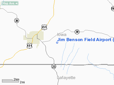
| From nearest city: | 2 nautical miles E of Mineral Point, WI |
| Location: | Iowa County, WI |
| Magnetic Variation: | 00E (1995) |
Owner & Manager
| Ownership: | Privately owned |
| Owner: | Donald J. & Edith L. Williams |
| Address: | 4563 Highway D-d
Mineral Point, WI 53565 |
| Phone number: | 608-987-2243 |
| Manager: | Donald J. Williams |
| Address: | 4563 Highway D-d
Mineral Point, WI 53565 |
| Phone number: | 608-987-2243 |
Airport Operations and Facilities
| Airport Use: | Private |
| Wind indicator: | Yes |
| Segmented Circle: | No |
| Control Tower: | No |
| Sectional chart: | Chicago |
| Region: | AGL - Great Lakes |
| Boundary ARTCC: | ZAU - Chicago |
| Tie-in FSS: | GRB - Green Bay |
| FSS on Airport: | No |
| FSS Toll Free: | 1-800-WX-BRIEF |
Runway Information
Runway 03/21
| Dimension: | 1800 x 75 ft / 548.6 x 22.9 m |
| Surface: | TURF, |
| |
Runway 03 |
Runway 21 |
| Traffic Pattern: | Left | Left |
| Obstruction: | | 57 ft pline, 1400.0 ft from runway |
|
Radio Navigation Aids
| ID |
Type |
Name |
Ch |
Freq |
Var |
Dist |
| MRJ | NDB | Mineral Point | | 365.00 | 00W | 4.8 nm |
| PVB | NDB | Platteville | | 203.00 | 01E | 16.8 nm |
| MS | NDB | Monah | | 400.00 | 00E | 36.7 nm |
| FEP | NDB | Freeport | | 335.00 | 00E | 43.7 nm |
| HBW | NDB | Kickapoo | | 251.00 | 03E | 49.0 nm |
| LNR | VOR/DME | Lone Rock | 075X | 112.80 | 00E | 26.5 nm |
| JVL | VOR/DME | Janesville | 090X | 114.30 | 03E | 48.6 nm |
| DBQ | VORTAC | Dubuque | 105X | 115.80 | 04E | 37.3 nm |
| MSN | VORTAC | Madison | 023X | 108.60 | 03E | 38.9 nm |
| DLL | VORTAC | Dells | 117X | 117.00 | 03E | 44.9 nm |
Remarks
- PRVDD OBSTNS LOWERED OR REMOVED FROM APCHS OR THLDS DSPLCD TO PROVIDE A CLEAR 20:1 APCH; AREA 125 FT EITHER SIDE OF CNTRLN & 200 FT OFF RY ENDS ARE CLEAR OF OBSTNS; AREA 60 FT EITHER SIDE OF CNTRLN & 240 FT OFF RY ENDS ARE CLEAR OF RUTS.
Images and information placed above are from
http://www.airport-data.com/airport/WI16/
We thank them for the data!
| General Info
|
| Country |
United States
|
| State |
WISCONSIN
|
| FAA ID |
WI16
|
| Latitude |
42-51-10.990N
|
| Longitude |
090-07-47.000W
|
| Elevation |
1100 feet
|
| Near City |
MINERAL POINT
|
We don't guarantee the information is fresh and accurate. The data may
be wrong or outdated.
For more up-to-date information please refer to other sources.
|
|


