 |
|
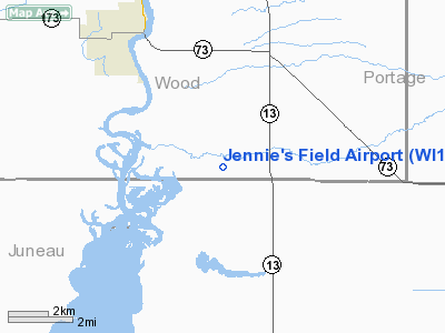
Location & QuickFacts
| FAA Information Effective: | 2008-09-25 |
| Airport Identifier: | WI13 |
| Airport Status: | Operational |
| Longitude/Latitude: | 089-50-22.2000W/44-15-17.4000N
-89.839500/44.254833 (Estimated) |
| Elevation: | 993 ft / 302.67 m (Estimated) |
| Land: | 0 acres |
| From nearest city: | 7 nautical miles S of Wisconsin Rapids, WI |
| Location: | Wood County, WI |
| Magnetic Variation: | () |
Owner & Manager
| Ownership: | Privately owned |
| Owner: | Gregory S. Ferkey |
| Address: | 860 Ten Mile Ave.
Wisconsin Rapids, WI 54494 |
| Phone number: | 715-325-6156 |
| Manager: | Gregory S. Ferkey |
| Address: | 860 Ten Mile Ave.
Wisconsin Rapids, WI 54494 |
| Phone number: | 715-325-6156 |
Airport Operations and Facilities
| Airport Use: | Private |
| Control Tower: | No |
| Sectional chart: | Chicago |
| Region: | AGL - Great Lakes |
| Boundary ARTCC: | ZMP - Minneapolis |
| Tie-in FSS: | GRB - Green Bay |
| FSS Toll Free: | 1-800-WX-BRIEF |
Runway Information
Runway 18/36
| Dimension: | 1300 x 60 ft / 396.2 x 18.3 m |
| Surface: | TURF, |
| |
Runway 18 |
Runway 36 |
| Traffic Pattern: | Left | Left |
| Obstruction: | 20 ft pline, 50.0 ft from runway | 30 ft trees, 0.0 ft from runway |
|
Radio Navigation Aids
| ID |
Type |
Name |
Ch |
Freq |
Var |
Dist |
| ISW | NDB | Wisconsin Rapids | | 215.00 | 01W | 6.6 nm |
| MFI | NDB | Marshfield | | 391.00 | 00E | 27.6 nm |
| VIQ | NDB | Neillsville | | 368.00 | 01W | 34.2 nm |
| PCZ | NDB | Waupaca | | 382.00 | 01W | 35.7 nm |
| CMY | NDB | Mccoy | | 412.00 | 00E | 39.5 nm |
| FZK | NDB | Wausau | | 243.00 | 01E | 41.5 nm |
| HBW | NDB | Kickapoo | | 251.00 | 03E | 41.9 nm |
| BCK | NDB | Black River Falls | | 362.00 | 00E | 43.5 nm |
| VOK | TACAN | Volk | 041X | | 00E | 26.1 nm |
| STE | VORTAC | Stevens Point | 043X | 110.60 | 01W | 21.8 nm |
| AUW | VORTAC | Wausau | 053X | 111.60 | 02E | 37.2 nm |
| DLL | VORTAC | Dells | 117X | 117.00 | 03E | 42.4 nm |
Remarks
- PRVDD VFR OPNS AND PVT USE.
Images and information placed above are from
http://www.airport-data.com/airport/WI13/
We thank them for the data!
| General Info
|
| Country |
United States
|
| State |
WISCONSIN
|
| FAA ID |
WI13
|
| Latitude |
45-07-08.937N
|
| Longitude |
087-46-53.383W
|
| Elevation |
640 feet
|
| Near City |
MARINETTE
|
We don't guarantee the information is fresh and accurate. The data may
be wrong or outdated.
For more up-to-date information please refer to other sources.
|
|


