 |
|
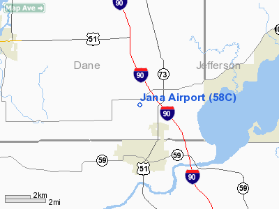
Location & QuickFacts
| FAA Information Effective: | 2008-09-25 |
| Airport Identifier: | 58C |
| Airport Status: | Operational |
| Longitude/Latitude: | 089-04-32.4050W/42-52-22.0160N
-89.075668/42.872782 (Estimated) |
| Elevation: | 842 ft / 256.64 m (Estimated) |
| Land: | 54 acres |
| From nearest city: | 3 nautical miles N of Edgerton, WI |
| Location: | Dane County, WI |
| Magnetic Variation: | 00W (1985) |
Owner & Manager
| Ownership: | Privately owned |
| Owner: | S. A. Jana Revocable Trust |
| Address: | 703 Ruskin Street
Madison, WI 53704 |
| Phone number: | 608-241-8140 |
| Manager: | Don Becker |
| Address: | 406 Highway Street
Edgerton, WI 53534 |
| Phone number: | 608-884-3403 |
Airport Operations and Facilities
| Airport Use: | Open to public |
| Wind indicator: | Yes |
| Segmented Circle: | No |
| Control Tower: | No |
| Lighting Schedule: | PHONE REQ
FOR LIRL RY 18/36 CALL 608-884-3403/3521. |
| Landing fee charge: | No
FEE FOR ACFT LNDG AT ARPT WITHOUT GAS PURCHASE (MAINT FEE). |
| Sectional chart: | Chicago |
| Region: | AGL - Great Lakes |
| Boundary ARTCC: | ZAU - Chicago |
| Tie-in FSS: | GRB - Green Bay |
| FSS on Airport: | No |
| FSS Toll Free: | 1-800-WX-BRIEF |
| NOTAMs Facility: | GRB (NOTAM-d service avaliable) |
Airport Communications
Airport Services
| Fuel available: | 100LL |
| Bottled Oxygen: | NONE |
| Bulk Oxygen: | NONE |
Runway Information
Runway 18/36
| Dimension: | 2305 x 135 ft / 702.6 x 41.1 m |
| Surface: | TURF, Good Condition |
| Edge Lights: | Non-standard lighting system
NSTD LIRL WITH REFLECTORS; ORANGE REFLECTORS INDICATING LAST 1000 FT OF RY BOTH DIRECTIONS. |
| |
Runway 18 |
Runway 36 |
| Longitude: | 089-04-32.4000W | 089-04-32.4000W |
| Latitude: | 42-52-33.0300N | 42-52-10.0100N |
| Elevation: | 842.00 ft | 840.00 ft |
| Traffic Pattern: | Left | Left |
| Markings: | None,
RWY 18 /36 MKD BY PAIRS OF RED METAL A-FRAMES; ENDS OF STWYS MKD WITH 3 RED METAL A-FRAMES ON CNTRLN. | None, |
| Runway End Identifier: | No | No |
| Centerline Lights: | No | No |
| Touchdown Lights: | No | No |
| Obstruction: | 42 ft tree, 420.0 ft from runway, 80 ft right of centerline, 10:1 slope to clear | 5 ft brush, 0.0 ft from runway, 70 ft right of centerline |
|
Radio Navigation Aids
| ID |
Type |
Name |
Ch |
Freq |
Var |
Dist |
| JVL | NDB | Janesville | | 375.00 | 03E | 15.6 nm |
| MS | NDB | Monah | | 400.00 | 00E | 16.5 nm |
| LVV | NDB | Lake Lawn | | 404.00 | 00W | 23.7 nm |
| RYV | NDB | Rock River | | 371.00 | 01W | 23.8 nm |
| UNU | NDB | Juneau | | 344.00 | 01W | 37.2 nm |
| UES | NDB | Waukesha | | 359.00 | 01W | 38.4 nm |
| HXF | NDB | Hartford | | 200.00 | 00E | 41.3 nm |
| FEP | NDB | Freeport | | 335.00 | 00E | 44.0 nm |
| GM | NDB | Teels | | 242.00 | 02W | 45.6 nm |
| JVL | VOR/DME | Janesville | 090X | 114.30 | 03E | 19.0 nm |
| BUU | VOR/DME | Burbun | 092X | 114.50 | 01W | 35.9 nm |
| RFD | VOR/DME | Rockford | 045X | 110.80 | 01E | 39.3 nm |
| LJT | VOR/DME | Timmerman | 072X | 112.50 | 02W | 47.8 nm |
| MSN | VORTAC | Madison | 023X | 108.60 | 03E | 20.1 nm |
| BAE | VORTAC | Badger | 111X | 116.40 | 02E | 37.8 nm |
Images and information placed above are from
http://www.airport-data.com/airport/58C/
We thank them for the data!
| General Info
|
| Country |
United States
|
| State |
WISCONSIN
|
| FAA ID |
58C
|
| Latitude |
42-52-22.016N
|
| Longitude |
089-04-32.405W
|
| Elevation |
842 feet
|
| Near City |
EDGERTON
|
We don't guarantee the information is fresh and accurate. The data may
be wrong or outdated.
For more up-to-date information please refer to other sources.
|
|


