 |
|
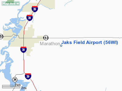
Location & QuickFacts
| FAA Information Effective: | 2008-09-25 |
| Airport Identifier: | 56WI |
| Airport Status: | Operational |
| Longitude/Latitude: | 089-35-37.4300W/44-46-24.3800N
-89.593731/44.773439 (Estimated) |
| Elevation: | 1190 ft / 362.71 m (Estimated) |
| Land: | 50 acres |
| From nearest city: | 5 nautical miles E of Mosinee, WI |
| Location: | Marathon County, WI |
| Magnetic Variation: | 01W (1995) |
Owner & Manager
| Ownership: | Privately owned |
| Owner: | James Shnowske |
| Address: | 1502 Wisconsin St
Mosinee, WI 55445 |
| Phone number: | 715-693-4254 |
| Manager: | James Shnowske |
| Address: | 1502 Wisconsin St
Mosinee, WI 54455 |
| Phone number: | 715-693-4254 |
Airport Operations and Facilities
| Airport Use: | Private |
| Wind indicator: | Yes |
| Segmented Circle: | No |
| Control Tower: | No |
| Sectional chart: | Green Bay |
| Region: | AGL - Great Lakes |
| Boundary ARTCC: | ZMP - Minneapolis |
| Tie-in FSS: | GRB - Green Bay |
| FSS Toll Free: | 1-800-WX-BRIEF |
Runway Information
Runway 09/27
| Dimension: | 1490 x 80 ft / 454.2 x 24.4 m |
| Surface: | TURF, |
| |
Runway 09 |
Runway 27 |
| Traffic Pattern: | Left | Left |
| Displaced threshold: | 600.00 ft
RY 09 & 27 DSPLCD THLDS MKD WITH PAINTED TIRES. | 300.00 ft |
| Obstruction: | 60 ft trees, 600.0 ft from runway | 30 ft trees, 300.0 ft from runway |
|
Radio Navigation Aids
| ID |
Type |
Name |
Ch |
Freq |
Var |
Dist |
| FZK | NDB | Wausau | | 243.00 | 01E | 9.4 nm |
| RRL | NDB | Merrill | | 257.00 | 01W | 26.0 nm |
| MFI | NDB | Marshfield | | 391.00 | 00E | 26.6 nm |
| ISW | NDB | Wisconsin Rapids | | 215.00 | 01W | 26.8 nm |
| AIG | NDB | Antigo | | 347.00 | 02W | 30.9 nm |
| PCZ | NDB | Waupaca | | 382.00 | 01W | 36.3 nm |
| MDZ | NDB | Medford | | 335.00 | 00E | 36.4 nm |
| CLI | NDB | Clintonville | | 209.00 | 02W | 37.9 nm |
| VIQ | NDB | Neillsville | | 368.00 | 01W | 41.5 nm |
| AUW | VORTAC | Wausau | 053X | 111.60 | 02E | 4.4 nm |
| STE | VORTAC | Stevens Point | 043X | 110.60 | 01W | 14.1 nm |
Remarks
- APCH TO RY 09 HAS 35 FT ELECTRICAL WIRES 260 FT FM THLD.
- PRVDD CLEAR 20:1 APCH, CLEAR OBSTACLE FREE ZONE AND CLEAR RY SAFETY AREA.
Images and information placed above are from
http://www.airport-data.com/airport/56WI/
We thank them for the data!
| General Info
|
| Country |
United States
|
| State |
WISCONSIN
|
| FAA ID |
56WI
|
| Latitude |
44-46-24.380N
|
| Longitude |
089-35-37.430W
|
| Elevation |
1190 feet
|
| Near City |
MOSINEE
|
We don't guarantee the information is fresh and accurate. The data may
be wrong or outdated.
For more up-to-date information please refer to other sources.
|
|


