 |
|
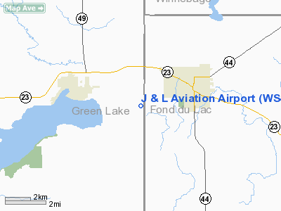
Location & QuickFacts
| FAA Information Effective: | 2008-09-25 |
| Airport Identifier: | WS46 |
| Airport Status: | Operational |
| Longitude/Latitude: | 088-53-19.4040W/43-49-51.4360N
-88.888723/43.830954 (Estimated) |
| Elevation: | 975 ft / 297.18 m (Estimated) |
| Land: | 10 acres |
| From nearest city: | 2 nautical miles SW of Ripon, WI |
| Location: | Green Lake County, WI |
| Magnetic Variation: | 01W (1995) |
Owner & Manager
| Ownership: | Privately owned |
| Owner: | Tom Willett |
| Address: | 5531 Brooklyn G
Ripon, WI 54971 |
| Phone number: | 414-748-7480 |
| Manager: | Tom Willett |
| Address: | 5531 Brooklyn G
Ripon, WI 54971 |
| Phone number: | 414-748-7480 |
Airport Operations and Facilities
| Airport Use: | Private |
| Wind indicator: | Yes |
| Segmented Circle: | No |
| Control Tower: | No |
| Lighting Schedule: | DUSK-DAWN |
| Sectional chart: | Chicago |
| Region: | AGL - Great Lakes |
| Boundary ARTCC: | ZAU - Chicago |
| Tie-in FSS: | GRB - Green Bay |
| FSS on Airport: | No |
| FSS Toll Free: | 1-800-WX-BRIEF |
Runway Information
Runway 09/27
| Dimension: | 2000 x 80 ft / 609.6 x 24.4 m |
| Surface: | TURF, |
| Edge Lights: | Non-standard lighting system
2 GREEN LGTS AT EACH RY END & 5 WHITE LGTS ON EACH SIDE OF RY. |
| |
Runway 09 |
Runway 27 |
| Traffic Pattern: | Left | Left |
| Obstruction: | 15 ft road, 200.0 ft from runway | |
|
Radio Navigation Aids
| ID |
Type |
Name |
Ch |
Freq |
Var |
Dist |
| UNU | NDB | Juneau | | 344.00 | 01W | 25.5 nm |
| PCZ | NDB | Waupaca | | 382.00 | 01W | 30.6 nm |
| AQ | NDB | Kooky | | 407.00 | 02W | 31.4 nm |
| HXF | NDB | Hartford | | 200.00 | 00E | 36.1 nm |
| RYV | NDB | Rock River | | 371.00 | 01W | 40.1 nm |
| LLE | NDB | Kettle Moraine | | 329.00 | 01W | 41.1 nm |
| SG | NDB | Depre | | 332.00 | 02W | 47.2 nm |
| CLI | NDB | Clintonville | | 209.00 | 02W | 47.8 nm |
| BJB | VOR | West Bend | | 109.80 | 01W | 41.3 nm |
| FAH | VOR/DME | Falls | 37X | 110.00 | 02W | 45.3 nm |
| OSH | VORTAC | Oshkosh | 055X | 111.80 | 02E | 17.3 nm |
| DLL | VORTAC | Dells | 117X | 117.00 | 03E | 41.6 nm |
| MSN | VORTAC | Madison | 023X | 108.60 | 03E | 45.7 nm |
Remarks
- PRVDD OBSTNS IN RY APCH LOWERED OR REMOVED TO PROVIDE 20:1 APCH CLNC; AREA 125 FT EITHER SIDE OF CNTRLN & 200 FT FM RY ENDS CLEAR OF OBSTNS; AREA 60 FT EITHER SIDE OF CNTRLN & 240 FT OFF RY END CLEAR & GRADED.
Images and information placed above are from
http://www.airport-data.com/airport/WS46/
We thank them for the data!
| General Info
|
| Country |
United States
|
| State |
WISCONSIN
|
| FAA ID |
WS46
|
| Latitude |
43-49-51.436N
|
| Longitude |
088-53-19.404W
|
| Elevation |
975 feet
|
| Near City |
RIPON
|
We don't guarantee the information is fresh and accurate. The data may
be wrong or outdated.
For more up-to-date information please refer to other sources.
|
|


