 |
|
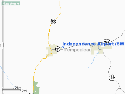
Location & QuickFacts
| FAA Information Effective: | 2008-09-25 |
| Airport Identifier: | 5WI6 |
| Airport Status: | Operational |
| Longitude/Latitude: | 091-23-45.0000W/44-22-01.0000N
-91.395833/44.366944 (Estimated) |
| Elevation: | 804 ft / 245.06 m (Estimated) |
| Land: | 3 acres |
| From nearest city: | 1 nautical miles W of Independence, WI |
| Location: | Trempealeau County, WI |
| Magnetic Variation: | 01E (1990) |
Owner & Manager
| Ownership: | Privately owned |
| Owner: | Bill Maliszewski |
| Address: | W22452 State Road 121
Independence, WI 54747-9005 |
| Phone number: | 715-985-2367 |
| Manager: | Bill Maliszewski |
| Address: | W22452 State Road 121
Independence, WI 54747-9005 |
| Phone number: | 715-985-2367 |
Airport Operations and Facilities
| Airport Use: | Private |
| Wind indicator: | Yes |
| Segmented Circle: | No |
| Control Tower: | No |
| Sectional chart: | Green Bay |
| Region: | AGL - Great Lakes |
| Boundary ARTCC: | ZMP - Minneapolis |
| Tie-in FSS: | GRB - Green Bay |
| FSS on Airport: | No |
| FSS Toll Free: | 1-800-WX-BRIEF |
Runway Information
Runway 18/36
| Dimension: | 2200 x 70 ft / 670.6 x 21.3 m |
| Surface: | TURF, Good Condition |
| |
Runway 18 |
Runway 36 |
| Traffic Pattern: | Left | Left |
|
Radio Navigation Aids
| ID |
Type |
Name |
Ch |
Freq |
Var |
Dist |
| BCK | NDB | Black River Falls | | 362.00 | 00E | 24.5 nm |
| VIQ | NDB | Neillsville | | 368.00 | 01W | 39.5 nm |
| CMY | NDB | Mccoy | | 412.00 | 00E | 41.5 nm |
| CHU | NDB | Caledonia | | 209.00 | 03E | 47.1 nm |
| ONA | VOR/DME | Winona | 051X | 111.40 | 01E | 22.0 nm |
| LSE | VOR/DME | La Crosse | 021X | 108.40 | 02E | 30.1 nm |
| ODI | VORTAC | Nodine | 126X | 117.90 | 01E | 27.5 nm |
| EAU | VORTAC | Eau Claire | 076X | 112.90 | 04E | 32.1 nm |
Remarks
- PRVDD ANY OBSTN IN APCH LOWERED OR REMOVED TO PRVD A CLEAR 20:1; AREA 125 FT EITHER SIDE OF RY IS CLEART OF OBSTNS.
Images and information placed above are from
http://www.airport-data.com/airport/5WI6/
We thank them for the data!
| General Info
|
| Country |
United States
|
| State |
WISCONSIN
|
| FAA ID |
5WI6
|
| Latitude |
44-22-01.000N
|
| Longitude |
091-23-45.000W
|
| Elevation |
804 feet
|
| Near City |
INDEPENDENCE
|
We don't guarantee the information is fresh and accurate. The data may
be wrong or outdated.
For more up-to-date information please refer to other sources.
|
|


