 |
|
Location & QuickFacts
| FAA Information Effective: | 2008-09-25 |
| Airport Identifier: | 21WI |
| Airport Status: | Operational |
| Longitude/Latitude: | 092-43-04.2000W/44-57-44.8000N
-92.717833/44.962444 (Estimated) |
| Elevation: | 858 ft / 261.52 m (Estimated) |
| Land: | 0 acres |
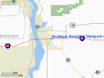
| From nearest city: | 1 nautical miles NW of Hudson, WI |
| Location: | St Croix County, WI |
| Magnetic Variation: | () |
Owner & Manager
| Ownership: | Privately owned |
| Owner: | Hudson Hospital |
| Address: | 405 Stageline Rd
Hudson, WI 54016 |
| Phone number: | 715-531-6000 |
| Manager: | Kendall Hicks |
| Address: | 405 Stageline Rd
Hudson, WI 54016 |
| Phone number: | 715-531-6012 |
Airport Operations and Facilities
| Airport Use: | Private |
| Wind indicator: | Yes |
| Segmented Circle: | No |
| Control Tower: | No |
| Lighting Schedule: | DUSK-DAWN |
| Beacon Color: | Clear-Green-Yellow (heliport) |
| Sectional chart: | Twin Cities |
| Region: | AGL - Great Lakes |
| Boundary ARTCC: | ZMP - Minneapolis |
| Tie-in FSS: | GRB - Green Bay |
| FSS Toll Free: | 1-800-WX-BRIEF |
Runway Information
Helipad HI
| Dimension: | 86 x 56 ft / 26.2 x 17.1 m |
| Surface: | CONC, |
| |
Runway HI |
Runway |
| Traffic Pattern: | Left | Left |
|
Radio Navigation Aids
| ID |
Type |
Name |
Ch |
Freq |
Var |
Dist |
| PPI | NDB | Hopey | | 400.00 | 03E | 11.0 nm |
| RNH | NDB | New Richmond | | 257.00 | 02E | 13.6 nm |
| MS | NDB | Narco | | 266.00 | 02E | 17.9 nm |
| OEO | NDB | Osceola | | 233.00 | 01E | 21.0 nm |
| AHH | NDB | Ameron | | 278.00 | 01E | 24.2 nm |
| CBG | NDB | Cambridge | | 350.00 | 03E | 42.5 nm |
| ROS | NDB | Rush City | | 282.00 | 02E | 45.3 nm |
| UBE | NDB | Cumberland | | 375.00 | 01E | 45.4 nm |
| MSP | VOR/DME | Minneapolis | 100X | 115.30 | 02E | 22.4 nm |
| FCM | VOR/DME | Flying Cloud | 055X | 111.80 | 06E | 32.5 nm |
| RPD | VOR/DME | Rice Lake | 037X | 110.00 | 01E | 48.2 nm |
| FGT | VORTAC | Farmington | 104X | 115.70 | 06E | 28.1 nm |
| GEP | VORTAC | Gopher | 120X | 117.30 | 06E | 29.9 nm |
| STP | VOT | St Paul | | 114.40 | | 14.6 nm |
| MSP | VOT | Minneapolis St Paul | | 111.00 | | 21.7 nm |
Remarks
- PRVDD APCH/DEP FM 180-060, AREA IS MKD & LIGHTED FOR NIGHT OPNS.
Images and information placed above are from
http://www.airport-data.com/airport/21WI/
We thank them for the data!
| General Info
|
| Country |
United States
|
| State |
WISCONSIN
|
| FAA ID |
21WI
|
| Latitude |
44-53-12.882N
|
| Longitude |
092-46-38.732W
|
| Elevation |
1000 feet
|
| Near City |
RIVER FALLS
|
We don't guarantee the information is fresh and accurate. The data may
be wrong or outdated.
For more up-to-date information please refer to other sources.
|
|


