 |
|
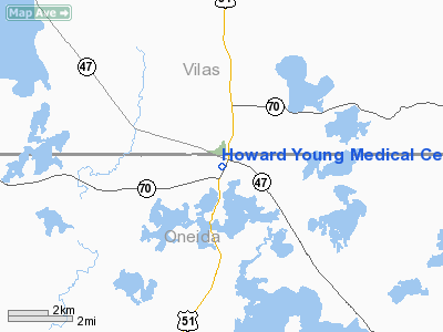
Howard Young Medical Center Heliport |
Location & QuickFacts
| FAA Information Effective: | 2008-09-25 |
| Airport Identifier: | 60WI |
| Airport Status: | Operational |
| Longitude/Latitude: | 089-42-06.5300W/45-53-35.8200N
-89.701814/45.893283 (Estimated) |
| Elevation: | 1598 ft / 487.07 m (Estimated) |
| Land: | 0 acres |
| From nearest city: | 0 nautical miles N of Woodruff, WI |
| Location: | Oneida County, WI |
| Magnetic Variation: | 01W (1990) |
Owner & Manager
| Ownership: | Privately owned |
| Owner: | Howard Young Medical Center |
| Address: | P.o. Box 470/240 Maple St
Woodruff, WI 54568 |
| Phone number: | 715-356-8000 |
| Manager: | Paul A. Miller, President |
| Address: | P.o. Box 470/240 Maple St
Woodruff, WI 54568 |
| Phone number: | 715-356-8102 |
Airport Operations and Facilities
| Airport Use: | Private
MEDICAL USE. |
| Wind indicator: | Yes |
| Segmented Circle: | No |
| Control Tower: | No |
| Lighting Schedule: | PHONE REQ
FOR ROTG BCN CALL 715-356-8102. |
| Beacon Color: | Clear-Green-Yellow (heliport) |
| Sectional chart: | Green Bay |
| Region: | AGL - Great Lakes |
| Boundary ARTCC: | ZMP - Minneapolis |
| Tie-in FSS: | GRB - Green Bay |
| FSS Toll Free: | 1-800-WX-BRIEF |
Airport Communications
Runway Information
Helipad H1
| Dimension: | 60 x 60 ft / 18.3 x 18.3 m |
| Surface: | CONC, |
| |
Runway H1 |
Runway |
| Traffic Pattern: | Left | Left |
|
Radio Navigation Aids
| ID |
Type |
Name |
Ch |
Freq |
Var |
Dist |
| ARV | NDB | Arbor Vitae | | 221.00 | 01W | 2.3 nm |
| DO | NDB | Dougy | | 236.00 | 01W | 3.7 nm |
| BDJ | NDB | Boulder Junction | | 206.00 | 02E | 14.6 nm |
| MHA | NDB | Manitowish | | 364.00 | 01W | 15.7 nm |
| EGV | NDB | Eagle River | | 341.00 | 02W | 18.5 nm |
| LNL | NDB | Land O Lakes | | 396.00 | 02W | 25.7 nm |
| RXW | NDB | Watersmeet | | 407.00 | 01E | 29.6 nm |
| PKF | NDB | Park Falls | | 371.00 | 01W | 30.5 nm |
| PBH | NDB | Phillips | | 263.00 | 00E | 31.9 nm |
| RRL | NDB | Merrill | | 257.00 | 01W | 41.8 nm |
| RHI | VORTAC | Rhinelander | 029X | 109.20 | 02E | 18.7 nm |
| IWD | VORTAC | Ironwood | 025X | 108.80 | 01E | 42.3 nm |
Remarks
- PRVDD APCH/DEP ROUTE OPS FM 350 TO 360 DEGS & FM 170 TO 180 DEGS; TKOF/LNDG ARE MARKED & WIND INDICATOR IS MAINTAINED.
Images and information placed above are from
http://www.airport-data.com/airport/60WI/
We thank them for the data!
| General Info
|
| Country |
United States
|
| State |
WISCONSIN
|
| FAA ID |
60WI
|
| Latitude |
45-53-35.820N
|
| Longitude |
089-42-06.530W
|
| Elevation |
1598 feet
|
| Near City |
WOODRUFF
|
We don't guarantee the information is fresh and accurate. The data may
be wrong or outdated.
For more up-to-date information please refer to other sources.
|
|


