 |
|
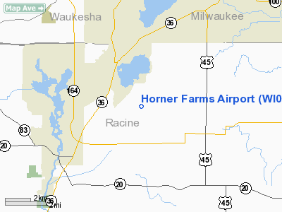
Location & QuickFacts
| FAA Information Effective: | 2008-09-25 |
| Airport Identifier: | WI03 |
| Airport Status: | Operational |
| Longitude/Latitude: | 088-08-00.3150W/42-47-53.0600N
-88.133421/42.798072 (Estimated) |
| Elevation: | 770 ft / 234.70 m (Estimated) |
| Land: | 10 acres |
| From nearest city: | 4 nautical miles NE of Union Grove, WI |
| Location: | Racine County, WI |
| Magnetic Variation: | 01W (1985) |
Owner & Manager
| Ownership: | Privately owned |
| Owner: | Horner Sod Farms, Ltd. |
| Address: | 5732 E. Wind Lake Road
Union Grove, WI 53182 |
| Phone number: | 414-895-7552 |
| Manager: | Mike Sanfelippo |
| Address: | 5732 E. Wind Lake Road
Union Grove, WI 53182 |
| Phone number: | 414-835-4661 |
Airport Operations and Facilities
| Airport Use: | Private |
| Wind indicator: | Yes |
| Segmented Circle: | No |
| Control Tower: | No |
| Landing fee charge: | No |
| Sectional chart: | Chicago |
| Region: | AGL - Great Lakes |
| Boundary ARTCC: | ZAU - Chicago |
| Tie-in FSS: | GRB - Green Bay |
| FSS on Airport: | No |
| FSS Toll Free: | 1-800-WX-BRIEF
OR LOCAL CALL 632-3363. |
Airport Services
| Airframe Repair: | NONE |
| Power Plant Repair: | NONE |
| Bottled Oxygen: | NONE |
| Bulk Oxygen: | NONE |
Runway Information
Runway 09/27
| Dimension: | 2000 x 100 ft / 609.6 x 30.5 m |
| Surface: | TURF, Good Condition |
| |
Runway 09 |
Runway 27 |
| Traffic Pattern: | Left | Left |
| Runway End Identifier: | No | No |
| Centerline Lights: | No | No |
| Touchdown Lights: | No | No |
| Obstruction: | 20 ft trees, 40 ft left of centerline
+15' TREES 50' LEFT OF CNTRLN. | 15 ft bldg, 50.0 ft from runway, 40 ft right of centerline, 3:1 slope to clear
+20' BLDG 25' RIGHT OF CNTRLN. |
|
Runway 18/36
| Dimension: | 1300 x 80 ft / 396.2 x 24.4 m |
| Surface: | TURF, Good Condition |
| |
Runway 18 |
Runway 36 |
| Traffic Pattern: | Left | Left |
| Runway End Identifier: | No | No |
| Centerline Lights: | No | No |
| Touchdown Lights: | No | No |
| Obstruction: | 20 ft pline, 50.0 ft from runway, 3:1 slope to clear
+25' PLINE RIGHT AND LEFT OF CNTRLN.
HAS A PLINE PERPENDICULAR TO RWY. | , 15.0 ft from runway, 1:1 slope to clear
+16' PLINE RIGHT AND LEFT OF CNTRLN.
HAS A ROAD PERPENDICULAR TO RWY. |
|
Radio Navigation Aids
| ID |
Type |
Name |
Ch |
Freq |
Var |
Dist |
| GM | NDB | Teels | | 242.00 | 02W | 7.8 nm |
| RA | NDB | Paser | | 206.00 | 00E | 12.4 nm |
| UES | NDB | Waukesha | | 359.00 | 01W | 15.5 nm |
| BL | NDB | Yanks | | 260.00 | 02W | 19.4 nm |
| LVV | NDB | Lake Lawn | | 404.00 | 00W | 21.2 nm |
| RYV | NDB | Rock River | | 371.00 | 01W | 34.5 nm |
| HXF | NDB | Hartford | | 200.00 | 00E | 35.0 nm |
| LLE | NDB | Kettle Moraine | | 329.00 | 01W | 37.7 nm |
| JVL | NDB | Janesville | | 375.00 | 03E | 41.6 nm |
| UNU | NDB | Juneau | | 344.00 | 01W | 45.4 nm |
| BJB | VOR | West Bend | | 109.80 | 01W | 37.5 nm |
| BUU | VOR/DME | Burbun | 092X | 114.50 | 01W | 9.9 nm |
| HRK | VOR/DME | Horlick | 124X | 117.70 | 02W | 14.2 nm |
| ENW | VOR/DME | Kenosha | 029X | 109.20 | 02W | 14.9 nm |
| LJT | VOR/DME | Timmerman | 072X | 112.50 | 02W | 19.2 nm |
| OBK | VOR/DME | Northbrook | 077X | 113.00 | 02W | 35.6 nm |
| JVL | VOR/DME | Janesville | 090X | 114.30 | 03E | 45.3 nm |
| ORD | VOR/DME | Chicago O'hare | 086X | 113.90 | 02E | 49.8 nm |
| BAE | VORTAC | Badger | 111X | 116.40 | 02E | 20.3 nm |
| MKE | VOT | Milwaukee | | 109.00 | | 13.8 nm |
Remarks
Images and information placed above are from
http://www.airport-data.com/airport/WI03/
We thank them for the data!
| General Info
|
| Country |
United States
|
| State |
WISCONSIN
|
| FAA ID |
WI03
|
| Latitude |
42-47-53.060N
|
| Longitude |
088-08-00.315W
|
| Elevation |
770 feet
|
| Near City |
UNION GROVE
|
We don't guarantee the information is fresh and accurate. The data may
be wrong or outdated.
For more up-to-date information please refer to other sources.
|
|


