 |
|
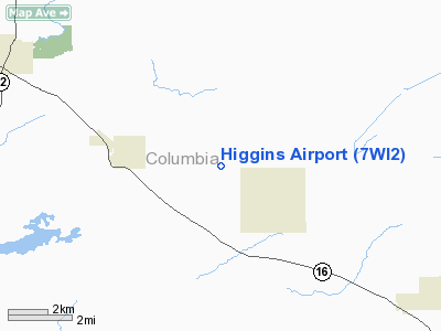
Location & QuickFacts
| FAA Information Effective: | 2008-09-25 |
| Airport Identifier: | 7WI2 |
| Airport Status: | Operational |
| Longitude/Latitude: | 089-10-41.4110W/43-26-34.9510N
-89.178170/43.443042 (Estimated) |
| Elevation: | 965 ft / 294.13 m (Estimated) |
| Land: | 4 acres |
| From nearest city: | 3 nautical miles E of Rio, WI |
| Location: | Columbia County, WI |
| Magnetic Variation: | 00E (1985) |
Owner & Manager
| Ownership: | Privately owned |
| Owner: | Frank & Patricia Higgins |
| Address: | W-3507 Larson Rd
Rio, WI 53960 |
| Phone number: | 414-992-3359 |
| Manager: | Frank & Patricia Higgins
AMGR LIVES AT ARPT. |
| Address: | W-3507 Larson Rd
Rio, WI 53960 |
| Phone number: | 414-992-3359 |
Airport Operations and Facilities
| Airport Use: | Private |
| Wind indicator: | Yes |
| Segmented Circle: | No |
| Control Tower: | No |
| Sectional chart: | Chicago |
| Region: | AGL - Great Lakes |
| Boundary ARTCC: | ZAU - Chicago |
| Tie-in FSS: | GRB - Green Bay |
| FSS Toll Free: | 1-800-WX-BRIEF |
Runway Information
Runway 18/36
| Dimension: | 2800 x 60 ft / 853.4 x 18.3 m |
| Surface: | TURF, |
| |
Runway 18 |
Runway 36 |
| Traffic Pattern: | Left | Left |
| Displaced threshold: | 400.00 ft
18/36 DSPLCD THRS MKD WITH BLACK & YELLOW 55 GALLON DRUMS. | 400.00 ft |
| Obstruction: | 20 ft plines, 686.0 ft from runway | 20 ft trees, 800.0 ft from runway |
|
Radio Navigation Aids
| ID |
Type |
Name |
Ch |
Freq |
Var |
Dist |
| UNU | NDB | Juneau | | 344.00 | 01W | 20.8 nm |
| MS | NDB | Monah | | 400.00 | 00E | 24.0 nm |
| RYV | NDB | Rock River | | 371.00 | 01W | 25.6 nm |
| HXF | NDB | Hartford | | 200.00 | 00E | 34.6 nm |
| LLE | NDB | Kettle Moraine | | 329.00 | 01W | 45.9 nm |
| UES | NDB | Waukesha | | 359.00 | 01W | 47.7 nm |
| BJB | VOR | West Bend | | 109.80 | 01W | 46.0 nm |
| LNR | VOR/DME | Lone Rock | 075X | 112.80 | 00E | 42.7 nm |
| MSN | VORTAC | Madison | 023X | 108.60 | 03E | 19.3 nm |
| DLL | VORTAC | Dells | 117X | 117.00 | 03E | 26.3 nm |
| OSH | VORTAC | Oshkosh | 055X | 111.80 | 02E | 42.6 nm |
| BAE | VORTAC | Badger | 111X | 116.40 | 02E | 43.8 nm |
Remarks
- PRVDD OBSTNS REMOVED/LOWERED OR THRS DSPLCD TO PRVD 20:1 APCH OVER 20' TREES N & S AND PLINE 3 MI NORTH; REF AC 150/5300-4B.
Images and information placed above are from
http://www.airport-data.com/airport/7WI2/
We thank them for the data!
| General Info
|
| Country |
United States
|
| State |
WISCONSIN
|
| FAA ID |
7WI2
|
| Latitude |
43-26-34.951N
|
| Longitude |
089-10-41.411W
|
| Elevation |
965 feet
|
| Near City |
RIO
|
We don't guarantee the information is fresh and accurate. The data may
be wrong or outdated.
For more up-to-date information please refer to other sources.
|
|


