 |
|
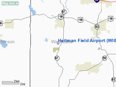
Location & QuickFacts
| FAA Information Effective: | 2008-09-25 |
| Airport Identifier: | WI09 |
| Airport Status: | Operational |
| Longitude/Latitude: | 088-28-33.0000W/42-58-38.0000N
-88.475833/42.977222 (Estimated) |
| Elevation: | 880 ft / 268.22 m (Estimated) |
| Land: | 95 acres |
| From nearest city: | 2 nautical miles S of Dousman, WI |
| Location: | Waukesha County, WI |
| Magnetic Variation: | 02W () |
Owner & Manager
| Ownership: | Privately owned |
| Owner: | Christopher J. Heitman |
| Address: | W362 S3601 State Road 67
Dousman, WI 53118 |
| Phone number: | 262-317-1203
DAYTIME PHONE NUMBER. |
| Manager: | Christopher J. Heitman |
| Address: | W362 S3601 State Road 67
Dousman, WI 53118 |
| Phone number: | 262-965-5885
EVENING PHONE NUMBER. |
Airport Operations and Facilities
| Airport Use: | Private |
| Wind indicator: | Yes |
| Segmented Circle: | Yes |
| Control Tower: | No |
| Sectional chart: | Chicago |
| Region: | AGL - Great Lakes |
| Boundary ARTCC: | ZAU - Chicago |
| Tie-in FSS: | GRB - Green Bay |
| FSS Toll Free: | 1-800-WX-BRIEF |
Runway Information
Runway 18/36
| Dimension: | 1700 x 70 ft / 518.2 x 21.3 m |
| Surface: | TURF, Good Condition |
| |
Runway 18 |
Runway 36 |
| Traffic Pattern: | Left | Left |
| Obstruction: | 18 ft bldg, 2600.0 ft from runway | 20 ft tree, 360.0 ft from runway |
|
Radio Navigation Aids
| ID |
Type |
Name |
Ch |
Freq |
Var |
Dist |
| UES | NDB | Waukesha | | 359.00 | 01W | 11.3 nm |
| RYV | NDB | Rock River | | 371.00 | 01W | 16.1 nm |
| LVV | NDB | Lake Lawn | | 404.00 | 00W | 17.5 nm |
| GM | NDB | Teels | | 242.00 | 02W | 19.6 nm |
| HXF | NDB | Hartford | | 200.00 | 00E | 22.6 nm |
| BL | NDB | Yanks | | 260.00 | 02W | 26.8 nm |
| UNU | NDB | Juneau | | 344.00 | 01W | 28.9 nm |
| LLE | NDB | Kettle Moraine | | 329.00 | 01W | 31.0 nm |
| RA | NDB | Paser | | 206.00 | 00E | 31.0 nm |
| JVL | NDB | Janesville | | 375.00 | 03E | 33.1 nm |
| MS | NDB | Monah | | 400.00 | 00E | 38.6 nm |
| BJB | VOR | West Bend | | 109.80 | 01W | 30.8 nm |
| BUU | VOR/DME | Burbun | 092X | 114.50 | 01W | 18.9 nm |
| LJT | VOR/DME | Timmerman | 072X | 112.50 | 02W | 20.8 nm |
| HRK | VOR/DME | Horlick | 124X | 117.70 | 02W | 31.9 nm |
| ENW | VOR/DME | Kenosha | 029X | 109.20 | 02W | 33.1 nm |
| JVL | VOR/DME | Janesville | 090X | 114.30 | 03E | 37.5 nm |
| BAE | VORTAC | Badger | 111X | 116.40 | 02E | 11.9 nm |
| MSN | VORTAC | Madison | 023X | 108.60 | 03E | 39.3 nm |
| MKE | VOT | Milwaukee | | 109.00 | | 25.5 nm |
Remarks
- BIRDS & DEER ON & INVOF ARPT.
- GND SLOPES DOWN APRXLY 5% BYD THE DEP END OF BOTH RY ENDS.
- RY NOT PLOWED IN WINTER.
- SEGMENTED CIRCLE MKD WITH CRUSHED LIMESTONE FLUSH WITH TURF & NOT VSBL WHEN SNOW COVERED.
- TRACTORS MAY BE OPERG IN FIELD N OF RY.
- PRVDD CLEAR 20:1 APCHS, CLEAR OBSTCL FREE ZONE & CLEAR RY SAFETY AREA.
Images and information placed above are from
http://www.airport-data.com/airport/WI09/
We thank them for the data!
| General Info
|
| Country |
United States
|
| State |
WISCONSIN
|
| FAA ID |
WI09
|
| Latitude |
42-58-38.000N
|
| Longitude |
088-28-33.000W
|
| Elevation |
880 feet
|
| Near City |
DOUSMAN
|
We don't guarantee the information is fresh and accurate. The data may
be wrong or outdated.
For more up-to-date information please refer to other sources.
|
|


