 |
|
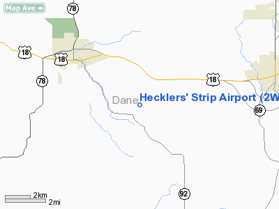
Location & QuickFacts
| FAA Information Effective: | 2008-09-25 |
| Airport Identifier: | 2WI7 |
| Airport Status: | Operational |
| Longitude/Latitude: | 089-39-55.4400W/42-58-10.9930N
-89.665400/42.969720 (Estimated) |
| Elevation: | 1130 ft / 344.42 m (Estimated) |
| Land: | 20 acres |
| From nearest city: | 2 nautical miles N of Mount Vernon, WI |
| Location: | Dane County, WI |
| Magnetic Variation: | 00E (1990) |
Owner & Manager
| Ownership: | Privately owned |
| Owner: | William K Garfoot |
| Address: | 2161 Springdale Center Rd
Verona, WI 53593 |
| Phone number: | 608-437-8088 |
| Manager: | William K Garfoot |
| Address: | 2161 Springdale Center Rd
Verona, WI 53593 |
| Phone number: | 608-437-8088 |
Airport Operations and Facilities
| Airport Use: | Private |
| Wind indicator: | Yes |
| Segmented Circle: | No |
| Control Tower: | No |
| Sectional chart: | Chicago |
| Region: | AGL - Great Lakes |
| Boundary ARTCC: | ZAU - Chicago |
| Tie-in FSS: | GRB - Green Bay |
| FSS Toll Free: | 1-800-WX-BRIEF |
Runway Information
Runway 04/22
| Dimension: | 2114 x 50 ft / 644.3 x 15.2 m |
| Surface: | TURF, Good Condition |
| |
Runway 04 |
Runway 22 |
| Traffic Pattern: | Left | Left |
| Obstruction: | 20 ft trees, 470.0 ft from runway | 16 ft bldg, 320.0 ft from runway |
|
Radio Navigation Aids
| ID |
Type |
Name |
Ch |
Freq |
Var |
Dist |
| MS | NDB | Monah | | 400.00 | 00E | 15.1 nm |
| MRJ | NDB | Mineral Point | | 365.00 | 00W | 25.2 nm |
| JVL | NDB | Janesville | | 375.00 | 03E | 34.8 nm |
| PVB | NDB | Platteville | | 203.00 | 01E | 38.0 nm |
| RYV | NDB | Rock River | | 371.00 | 01W | 43.1 nm |
| FEP | NDB | Freeport | | 335.00 | 00E | 43.7 nm |
| LVV | NDB | Lake Lawn | | 404.00 | 00W | 50.0 nm |
| LNR | VOR/DME | Lone Rock | 075X | 112.80 | 00E | 28.3 nm |
| JVL | VOR/DME | Janesville | 090X | 114.30 | 03E | 35.0 nm |
| RFD | VOR/DME | Rockford | 045X | 110.80 | 01E | 49.3 nm |
| MSN | VORTAC | Madison | 023X | 108.60 | 03E | 17.8 nm |
| DLL | VORTAC | Dells | 117X | 117.00 | 03E | 35.2 nm |
Remarks
- OBS REMOVED/LOWERED OR THR DSPLCD TO PRVD 20:1 SLOPE; 125' EITHER SIDE OF CNTRLN & 200' EITHER END BE CLEAR.
Images and information placed above are from
http://www.airport-data.com/airport/2WI7/
We thank them for the data!
| General Info
|
| Country |
United States
|
| State |
WISCONSIN
|
| FAA ID |
2WI7
|
| Latitude |
42-58-10.993N
|
| Longitude |
089-39-55.440W
|
| Elevation |
1130 feet
|
| Near City |
MOUNT VERNON
|
We don't guarantee the information is fresh and accurate. The data may
be wrong or outdated.
For more up-to-date information please refer to other sources.
|
|


