 |
|
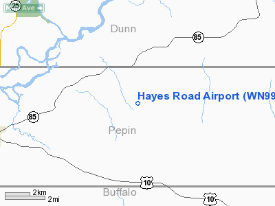
Location & QuickFacts
| FAA Information Effective: | 2008-09-25 |
| Airport Identifier: | WN99 |
| Airport Status: | Operational |
| Longitude/Latitude: | 091-48-31.0000W/44-39-26.0000N
-91.808611/44.657222 (Estimated) |
| Elevation: | 900 ft / 274.32 m (Estimated) |
| Land: | 0 acres |
| From nearest city: | 7 nautical miles N of Durand, WI |
| Location: | Pepin County, WI |
| Magnetic Variation: | 01E (2000) |
Owner & Manager
| Ownership: | Privately owned |
| Owner: | Omar G. Dougherty |
| Address: | N6880 Hayes Road
Durand, WI 54736 |
| Phone number: | 715-672-8629 |
| Manager: | Omar G. Dougherty |
| Address: | N6880 Hayes Road
Durand, WI 54736 |
| Phone number: | 715-672-8629 |
Airport Operations and Facilities
| Airport Use: | Private |
| Wind indicator: | Yes |
| Segmented Circle: | No |
| Control Tower: | No |
| Sectional chart: | Green Bay |
| Region: | AGL - Great Lakes |
| Boundary ARTCC: | ZMP - Minneapolis |
| Tie-in FSS: | GRB - Green Bay |
| FSS Toll Free: | 1-800-WX-BRIEF |
Runway Information
Runway 18/36
| Dimension: | 1000 x 60 ft / 304.8 x 18.3 m |
| Surface: | TURF, |
| |
Runway 18 |
Runway 36 |
| Traffic Pattern: | Left | Left |
| Displaced threshold: | 0.00 ft | 200.00 ft
DSPLCD THLD MARKED WITH PLYWOOD WITH RED & WHITE STRIPES. |
| Obstruction: | | 22 ft pline, 600.0 ft from runway |
|
Radio Navigation Aids
| ID |
Type |
Name |
Ch |
Freq |
Var |
Dist |
| RNH | NDB | New Richmond | | 257.00 | 02E | 42.7 nm |
| AHH | NDB | Ameron | | 278.00 | 01E | 44.5 nm |
| BCK | NDB | Black River Falls | | 362.00 | 00E | 47.8 nm |
| ONA | VOR/DME | Winona | 051X | 111.40 | 01E | 35.2 nm |
| RPD | VOR/DME | Rice Lake | 037X | 110.00 | 01E | 45.6 nm |
| EAU | VORTAC | Eau Claire | 076X | 112.90 | 04E | 20.2 nm |
| ODI | VORTAC | Nodine | 126X | 117.90 | 01E | 47.1 nm |
Remarks
- PRVDD CLEAR 20:1 APCH, CLEAR OBSTACLE FREE ZONE, AND CLEAR RUNWAY SAFETY AREA.
Images and information placed above are from
http://www.airport-data.com/airport/WN99/
We thank them for the data!
|
|


