 |
|
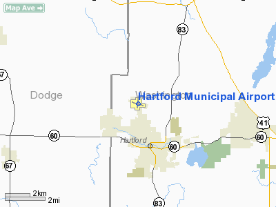
Location & QuickFacts
| FAA Information Effective: | 2008-09-25 |
| Airport Identifier: | HXF |
| Airport Status: | Operational |
| Longitude/Latitude: | 088-23-28.0510W/43-20-57.4010N
-88.391125/43.349278 (Estimated) |
| Elevation: | 1070 ft / 326.14 m (Estimated) |
| Land: | 195 acres |
| From nearest city: | 2 nautical miles NW of Hartford, WI |
| Location: | Washington County, WI |
| Magnetic Variation: | 01W (1985) |
Owner & Manager
| Ownership: | Publicly owned |
| Owner: | City Of Hartford |
| Address: | 109 N. Main
Hartford, WI 53027 |
| Phone number: | 262-673-8263 |
| Manager: | Darrly Kranz |
| Address: | 109 N Main
Hartford, WI 53027 |
| Phone number: | 262-673-8285 |
Airport Operations and Facilities
| Airport Use: | Open to public |
| Wind indicator: | Yes |
| Segmented Circle: | Yes |
| Control Tower: | No |
| Lighting Schedule: | DUSK-DAWN |
| Beacon Color: | Clear-Green (lighted land airport) |
| Landing fee charge: | No |
| Sectional chart: | Chicago |
| Region: | AGL - Great Lakes |
| Boundary ARTCC: | ZAU - Chicago |
| Tie-in FSS: | GRB - Green Bay |
| FSS on Airport: | No |
| FSS Toll Free: | 1-800-WX-BRIEF |
| NOTAMs Facility: | GRB (NOTAM-d service avaliable) |
| Federal Agreements: | NGY |
Airport Communications
| CTAF: | 123.000 |
| Unicom: | 123.000 |
Airport Services
| Fuel available: | 100LLMOGAS |
| Airframe Repair: | MAJOR |
| Power Plant Repair: | MAJOR |
| Bottled Oxygen: | NONE |
| Bulk Oxygen: | NONE |
Runway Information
Runway 11/29
| Dimension: | 3001 x 75 ft / 914.7 x 22.9 m |
| Surface: | ASPH, Fair Condition |
| Weight Limit: | Single wheel: 8000 lbs. |
| Edge Lights: | Medium |
| |
Runway 11 |
Runway 29 |
| Longitude: | 088-23-47.9680W | 088-23-09.8610W |
| Latitude: | 43-21-02.0720N | 43-20-51.8270N |
| Elevation: | 1051.00 ft | 1046.00 ft |
| Alignment: | 110 | 127 |
| Traffic Pattern: | Left | Left |
| Markings: | Non-precision instrument, Fair Condition | Non-precision instrument, Fair Condition |
| Runway End Identifier: | No | No |
| Centerline Lights: | No | No |
| Touchdown Lights: | No | No |
| Obstruction: | 9 ft road, 335.0 ft from runway, 260 ft right of centerline, 15:1 slope to clear | , 50:1 slope to clear |
|
Runway 18/36
| Dimension: | 2250 x 215 ft / 685.8 x 65.5 m |
| Surface: | TURF, Good Condition |
| |
Runway 18 |
Runway 36 |
| Longitude: | 088-23-25.3510W | 088-23-28.3510W |
| Latitude: | 43-21-09.0010N | 43-20-47.0020N |
| Elevation: | 1065.00 ft | 0.00 ft |
| Traffic Pattern: | Left | Left |
| Runway End Identifier: | No | No |
| Centerline Lights: | No | No |
| Touchdown Lights: | No | No |
| Obstruction: | 21 ft road, 580.0 ft from runway, 180 ft left of centerline, 27:1 slope to clear | , 50:1 slope to clear |
|
Radio Navigation Aids
| ID |
Type |
Name |
Ch |
Freq |
Var |
Dist |
| HXF | NDB | Hartford | | 200.00 | 00E | 0.2 nm |
| LLE | NDB | Kettle Moraine | | 329.00 | 01W | 12.4 nm |
| UNU | NDB | Juneau | | 344.00 | 01W | 14.4 nm |
| RYV | NDB | Rock River | | 371.00 | 01W | 18.0 nm |
| UES | NDB | Waukesha | | 359.00 | 01W | 19.5 nm |
| BL | NDB | Yanks | | 260.00 | 02W | 28.5 nm |
| GM | NDB | Teels | | 242.00 | 02W | 30.6 nm |
| LVV | NDB | Lake Lawn | | 404.00 | 00W | 40.1 nm |
| MS | NDB | Monah | | 400.00 | 00E | 45.2 nm |
| RA | NDB | Paser | | 206.00 | 00E | 45.5 nm |
| BJB | VOR | West Bend | | 109.80 | 01W | 12.4 nm |
| LJT | VOR/DME | Timmerman | 072X | 112.50 | 02W | 21.2 nm |
| FAH | VOR/DME | Falls | 37X | 110.00 | 02W | 34.6 nm |
| BUU | VOR/DME | Burbun | 092X | 114.50 | 01W | 39.9 nm |
| HRK | VOR/DME | Horlick | 124X | 117.70 | 02W | 43.4 nm |
| ENW | VOR/DME | Kenosha | 029X | 109.20 | 02W | 49.4 nm |
| BAE | VORTAC | Badger | 111X | 116.40 | 02E | 14.7 nm |
| OSH | VORTAC | Oshkosh | 055X | 111.80 | 02E | 39.2 nm |
| MSN | VORTAC | Madison | 023X | 108.60 | 03E | 43.3 nm |
| MKE | VOT | Milwaukee | | 109.00 | | 32.4 nm |
Remarks
- SLIGHT DOWNHILL SLOPE LNDG RWY 18.
- GLIDER & ULTRALIGHT ACTVTY ON ARPT.
- RY 36 +78 FT WATER TOWER 3885 FT FM APCH END.
Images and information placed above are from
http://www.airport-data.com/airport/HXF/
We thank them for the data!
|
|


