 |
|
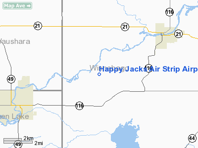
Happy Jacks Air Strip Airport |
Location & QuickFacts
| FAA Information Effective: | 2008-09-25 |
| Airport Identifier: | WI73 |
| Airport Status: | Operational |
| Longitude/Latitude: | 088-50-00.4040W/43-59-59.9330N
-88.833446/43.999981 (Estimated) |
| Elevation: | 800 ft / 243.84 m (Estimated) |
| Land: | 0 acres |
| From nearest city: | 0 nautical miles SE of Eureka, WI |
| Location: | Winnebago County, WI |
| Magnetic Variation: | 01W (1985) |
Owner & Manager
| Ownership: | Privately owned |
| Owner: | J. G. Langeberg |
| Address: | Po Box 63
Eureka, WI 54934 |
| Address: |
|
Airport Operations and Facilities
| Airport Use: | Private |
| Wind indicator: | No |
| Segmented Circle: | No |
| Control Tower: | No |
| Landing fee charge: | No |
| Sectional chart: | Green Bay |
| Region: | AGL - Great Lakes |
| Boundary ARTCC: | ZAU - Chicago |
| Tie-in FSS: | GRB - Green Bay |
| FSS on Airport: | No |
| FSS Toll Free: | 1-800-WX-BRIEF |
Airport Services
| Airframe Repair: | NONE |
| Power Plant Repair: | NONE |
Runway Information
Runway NW/SE
| Dimension: | 1200 x 75 ft / 365.8 x 22.9 m |
| Surface: | TURF, |
| |
Runway NW |
Runway SE |
| Traffic Pattern: | Left | Left |
|
Radio Navigation Aids
| ID |
Type |
Name |
Ch |
Freq |
Var |
Dist |
| PCZ | NDB | Waupaca | | 382.00 | 01W | 21.5 nm |
| AQ | NDB | Kooky | | 407.00 | 02W | 22.8 nm |
| UNU | NDB | Juneau | | 344.00 | 01W | 34.8 nm |
| CLI | NDB | Clintonville | | 209.00 | 02W | 37.4 nm |
| SG | NDB | Depre | | 332.00 | 02W | 38.5 nm |
| HXF | NDB | Hartford | | 200.00 | 00E | 43.5 nm |
| LLE | NDB | Kettle Moraine | | 329.00 | 01W | 46.2 nm |
| ISW | NDB | Wisconsin Rapids | | 215.00 | 01W | 48.6 nm |
| RYV | NDB | Rock River | | 371.00 | 01W | 49.9 nm |
| BJB | VOR | West Bend | | 109.80 | 01W | 46.4 nm |
| FAH | VOR/DME | Falls | 37X | 110.00 | 02W | 44.9 nm |
| OSH | VORTAC | Oshkosh | 055X | 111.80 | 02E | 12.0 nm |
| GRB | VORTAC | Green Bay | 102X | 115.50 | 01E | 43.2 nm |
| STE | VORTAC | Stevens Point | 043X | 110.60 | 01W | 44.3 nm |
| DLL | VORTAC | Dells | 117X | 117.00 | 03E | 48.6 nm |
Images and information placed above are from
http://www.airport-data.com/airport/WI73/
We thank them for the data!
| General Info
|
| Country |
United States
|
| State |
WISCONSIN
|
| FAA ID |
WI73
|
| Latitude |
43-59-59.933N
|
| Longitude |
088-50-00.404W
|
| Elevation |
800 feet
|
| Near City |
EUREKA
|
We don't guarantee the information is fresh and accurate. The data may
be wrong or outdated.
For more up-to-date information please refer to other sources.
|
|


