 |
|
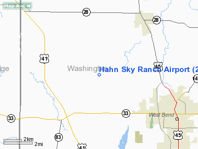
Location & QuickFacts
| FAA Information Effective: | 2008-09-25 |
| Airport Identifier: | 2T5 |
| Airport Status: | Operational |
| Longitude/Latitude: | 088-17-27.3470W/43-27-58.9920N
-88.290930/43.466387 (Estimated) |
| Elevation: | 1090 ft / 332.23 m (Estimated) |
| Land: | 20 acres |
| From nearest city: | 5 nautical miles NW of West Bend, WI |
| Location: | Washington County, WI |
| Magnetic Variation: | 01W (1985) |
Owner & Manager
| Ownership: | Privately owned |
| Owner: | Lester V. Hahn |
| Address: | 5045 Hwy D
West Bend, WI 53095 |
| Phone number: | 262-629-9255 |
| Manager: | Lester V. Hahn |
| Address: | 5045 Hwy D
West Bend, WI 53095 |
| Phone number: | 262-629-9255 |
Airport Operations and Facilities
| Airport Use: | Open to public |
| Wind indicator: | Yes |
| Segmented Circle: | No |
| Control Tower: | No |
| Landing fee charge: | No |
| Sectional chart: | Chicago |
| Region: | AGL - Great Lakes |
| Boundary ARTCC: | ZAU - Chicago |
| Tie-in FSS: | GRB - Green Bay |
| FSS on Airport: | No |
| FSS Toll Free: | 1-800-WX-BRIEF |
| NOTAMs Facility: | GRB (NOTAM-d service avaliable) |
Airport Communications
Airport Services
| Airframe Repair: | MINOR |
| Power Plant Repair: | MINOR |
Runway Information
Runway 10/28
| Dimension: | 2900 x 60 ft / 883.9 x 18.3 m |
| Surface: | TURF, Fair Condition
SFC ROUGH AND ROLLING. |
| |
Runway 10 |
Runway 28 |
| Traffic Pattern: | Left | Left |
| Markings: | None, | None, |
| Runway End Identifier: | No | No |
| Centerline Lights: | No | No |
| Touchdown Lights: | No | No |
| Obstruction: | 10 ft brush, 5.0 ft from runway, 50 ft right of centerline | 40 ft tree, 0.0 ft from runway, 120 ft right of centerline |
|
Radio Navigation Aids
| ID |
Type |
Name |
Ch |
Freq |
Var |
Dist |
| LLE | NDB | Kettle Moraine | | 329.00 | 01W | 7.6 nm |
| HXF | NDB | Hartford | | 200.00 | 00E | 8.5 nm |
| UNU | NDB | Juneau | | 344.00 | 01W | 18.1 nm |
| UES | NDB | Waukesha | | 359.00 | 01W | 25.5 nm |
| RYV | NDB | Rock River | | 371.00 | 01W | 25.9 nm |
| BL | NDB | Yanks | | 260.00 | 02W | 30.4 nm |
| GM | NDB | Teels | | 242.00 | 02W | 35.2 nm |
| AQ | NDB | Kooky | | 407.00 | 02W | 45.3 nm |
| LVV | NDB | Lake Lawn | | 404.00 | 00W | 48.0 nm |
| BJB | VOR | West Bend | | 109.80 | 01W | 7.7 nm |
| LJT | VOR/DME | Timmerman | 072X | 112.50 | 02W | 24.1 nm |
| FAH | VOR/DME | Falls | 37X | 110.00 | 02W | 26.5 nm |
| BUU | VOR/DME | Burbun | 092X | 114.50 | 01W | 46.7 nm |
| HRK | VOR/DME | Horlick | 124X | 117.70 | 02W | 47.2 nm |
| MTW | VOR/DME | Manitowoc | 047X | 111.00 | 02W | 47.8 nm |
| BAE | VORTAC | Badger | 111X | 116.40 | 02E | 21.0 nm |
| OSH | VORTAC | Oshkosh | 055X | 111.80 | 02E | 33.5 nm |
| MSN | VORTAC | Madison | 023X | 108.60 | 03E | 49.8 nm |
| MKE | VOT | Milwaukee | | 109.00 | | 35.6 nm |
Remarks
- RY 10/28 HAS SOFT AREAS APPROXIMATELY 1000' FM W END.
- THERE IS A BUMP WHERE THE ACTIVE FARM ROAD BISECTS THE RY.
- ULTRALIGHT ACTIVITY ON & INVOF ARPT.
Images and information placed above are from
http://www.airport-data.com/airport/2T5/
We thank them for the data!
| General Info
|
| Country |
United States
|
| State |
WISCONSIN
|
| FAA ID |
2T5
|
| Latitude |
43-27-58.992N
|
| Longitude |
088-17-27.347W
|
| Elevation |
1090 feet
|
| Near City |
WEST BEND
|
We don't guarantee the information is fresh and accurate. The data may
be wrong or outdated.
For more up-to-date information please refer to other sources.
|
|


