 |
|
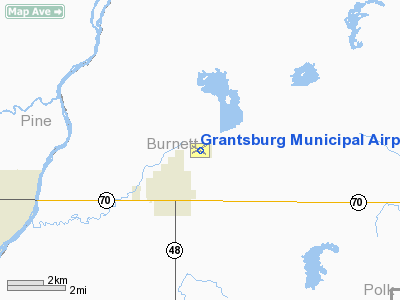
| Grantsburg Municipal Airport |
| IATA: GTG – ICAO: KGTG – FAA LID: GTG |
| Summary |
| Airport type |
Public |
| Owner |
Village of Grantsburg |
| Serves |
Grantsburg, Wisconsin |
| Elevation AMSL |
927 ft / 283 m |
| Coordinates |
45°47′53″N 092°39′52″W / 45.79806°N 92.66444°W / 45.79806; -92.66444 |
| Runways |
| Direction |
Length |
Surface |
| ft |
m |
| 12/30 |
3,000 |
914 |
Asphalt |
| 5/23 |
3,315 |
1,010 |
Turf |
| Statistics (2006) |
| Aircraft operations |
3,240 |
| Based aircraft |
19 |
| Source: Federal Aviation Administration |
Grantsburg Municipal Airport (IATA: GTG, ICAO: KGTG, FAA LID: GTG) is a public use airport located two nautical miles (3.7 km) northeast of the central business district of Grantsburg, a village in Burnett County, Wisconsin, United States. It is owned by the Village of Grantsburg. Facilities and aircraft
Grantsburg Municipal Airport covers an area of 280 acres (113 ha) at an elevation of 927 feet (283 m) above mean sea level. It has two runways: 12/30 is 3,000 by 60 feet (914 x 18 m) with an asphalt pavement; 5/23 is 3,315 by 120 feet (1,010 x 37 m) with a turf surface.
For the 12-month period ending August 22, 2006, the airport had 3,240 aircraft operations, an average of 270 per month: 93% general aviation, 6% air taxi and 1% military. At that time there were 19 aircraft based at this airport: 89% single-engine and 11% ultralight.
The above content comes from Wikipedia and is published under free licenses – click here to read more.
Location & QuickFacts
| FAA Information Effective: | 2008-09-25 |
| Airport Identifier: | GTG |
| Airport Status: | Operational |
| Longitude/Latitude: | 092-39-51.6550W/45-47-53.0330N
-92.664349/45.798065 (Estimated) |
| Elevation: | 927 ft / 282.55 m (Surveyed) |
| Land: | 280 acres |
| From nearest city: | 2 nautical miles NE of Grantsburg, WI |
| Location: | Burnett County, WI |
| Magnetic Variation: | 04E (1980) |
Owner & Manager
| Ownership: | Publicly owned |
| Owner: | Village Of Grantsburg |
| Address: |
Grantsburg, WI 54840 |
| Phone number: | 715-463-2405 |
| Manager: | Jennifer Zeiler |
| Address: | 316 S. Brad Street
Grantsburg, WI 54840 |
| Phone number: | 715-463-2405 |
Airport Operations and Facilities
| Airport Use: | Open to public |
| Wind indicator: | Yes |
| Segmented Circle: | Yes |
| Control Tower: | No |
| Lighting Schedule: | DUSK-DAWN
ACTVT MIRL RY 12/30 - CTAF. |
| Beacon Color: | Clear-Green (lighted land airport) |
| Landing fee charge: | No |
| Sectional chart: | Green Bay |
| Region: | AGL - Great Lakes |
| Traffic Pattern Alt: | 800 ft |
| Boundary ARTCC: | ZMP - Minneapolis |
| Tie-in FSS: | GRB - Green Bay |
| FSS on Airport: | No |
| FSS Toll Free: | 1-800-WX-BRIEF |
| NOTAMs Facility: | GRB (NOTAM-d service avaliable) |
Airport Communications
Airport Services
| Bottled Oxygen: | NONE |
| Bulk Oxygen: | NONE |
Runway Information
Runway 05/23
| Dimension: | 3315 x 120 ft / 1010.4 x 36.6 m |
| Surface: | TURF, Fair Condition |
| |
Runway 05 |
Runway 23 |
| Longitude: | 092-40-05.7310W | 092-39-26.9300W |
| Latitude: | 45-47-48.3280N | 45-48-06.6270N |
| Alignment: | 56 | 127 |
| Traffic Pattern: | Left | Left |
| Obstruction: | 44 ft trees, 1500.0 ft from runway, 34:1 slope to clear | 32 ft trees, 650.0 ft from runway, 150 ft left of centerline, 20:1 slope to clear |
|
Runway 12/30
| Dimension: | 3000 x 60 ft / 914.4 x 18.3 m |
| Surface: | ASPH, Good Condition |
| Edge Lights: | Medium |
| |
Runway 12 |
Runway 30 |
| Longitude: | 092-40-09.8560W | 092-39-33.4560W |
| Latitude: | 45-48-00.5950N | 45-47-45.4710N |
| Elevation: | 924.00 ft | 924.00 ft |
| Alignment: | 121 | 127 |
| Traffic Pattern: | Left | Left |
| Markings: | Non-precision instrument, Good Condition | Non-precision instrument, Good Condition |
| Runway End Identifier: | No | No |
| Centerline Lights: | No | No |
| Touchdown Lights: | No | No |
| Obstruction: | , 50:1 slope to clear | 44 ft trees, 1450.0 ft from runway, 28:1 slope to clear |
|
Radio Navigation Aids
| ID |
Type |
Name |
Ch |
Freq |
Var |
Dist |
| BXR | NDB | Big Doctor | | 203.00 | 02E | 12.6 nm |
| ROS | NDB | Rush City | | 282.00 | 02E | 13.7 nm |
| JMR | NDB | Mora | | 327.00 | 03E | 25.9 nm |
| CBG | NDB | Cambridge | | 350.00 | 03E | 29.0 nm |
| OEO | NDB | Osceola | | 233.00 | 01E | 29.3 nm |
| SSQ | NDB | Shell Lake | | 212.00 | 01E | 31.5 nm |
| AHH | NDB | Ameron | | 278.00 | 01E | 33.4 nm |
| UBE | NDB | Cumberland | | 375.00 | 01E | 33.7 nm |
| MZH | NDB | Moose Lake | | 362.00 | 02E | 37.6 nm |
| RNH | NDB | New Richmond | | 257.00 | 02E | 39.5 nm |
| PNM | NDB | Princeton | | 368.00 | 03E | 42.0 nm |
| OLG | NDB | Solon Springs | | 388.00 | 01E | 47.2 nm |
| RZN | VOR/DME | Siren | 031X | 109.40 | 02E | 12.2 nm |
| RPD | VOR/DME | Rice Lake | 037X | 110.00 | 01E | 43.8 nm |
| GEP | VORTAC | Gopher | 120X | 117.30 | 06E | 49.3 nm |
Remarks
- DEER & WATERFOWL ON AND INVOF ARPT.
- WATER TWR LCTD 5060 FT SW RY 05; 1100 FT MSL/182 FT AGL.
- EXISTED PRIOR TO 1959.
Images and information placed above are from
http://www.airport-data.com/airport/GTG/
We thank them for the data!
| General Info
|
| Country |
United States
|
| State |
WISCONSIN
|
| FAA ID |
GTG
|
| Latitude |
45-47-53.033N
|
| Longitude |
092-39-51.655W
|
| Elevation |
927 feet
|
| Near City |
GRANTSBURG
|
We don't guarantee the information is fresh and accurate. The data may
be wrong or outdated.
For more up-to-date information please refer to other sources.
|
|


