 |
|
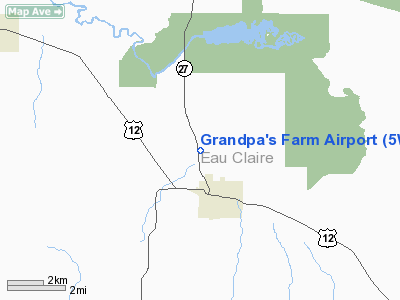
Location & QuickFacts
| FAA Information Effective: | 2008-09-25 |
| Airport Identifier: | 5WI0 |
| Airport Status: | Operational |
| Longitude/Latitude: | 091-08-01.5500W/44-42-09.8500N
-91.133764/44.702736 (Estimated) |
| Elevation: | 970 ft / 295.66 m (Estimated) |
| Land: | 6 acres |
| From nearest city: | 2 nautical miles SW of Augusta, WI |
| Location: | Eau Claire County, WI |
| Magnetic Variation: | 01E (1995) |
Owner & Manager
| Ownership: | Privately owned |
| Owner: | Jack Bennett |
| Address: | P.o. Box 364
De Kalb, IL 60115 |
| Phone number: | 815-756-7712 |
| Manager: | Jack Bennett |
| Address: | P.o. Box 364
De Kalb, IL 60115 |
| Phone number: | 815-756-7712 |
Airport Operations and Facilities
| Airport Use: | Private |
| Wind indicator: | Yes |
| Segmented Circle: | No |
| Control Tower: | No |
| Sectional chart: | Green Bay |
| Region: | AGL - Great Lakes |
| Boundary ARTCC: | ZMP - Minneapolis |
| Tie-in FSS: | GRB - Green Bay |
| FSS on Airport: | No |
| FSS Toll Free: | 1-800-WX-BRIEF |
Runway Information
Runway 18/36
| Dimension: | 2500 x 60 ft / 762.0 x 18.3 m |
| Surface: | TURF, |
| |
Runway 18 |
Runway 36 |
| Traffic Pattern: | Right | Left |
| Displaced threshold: | 0.00 ft | 300.00 ft
DSPLCD THLD MKD BY WHITE HALF DRUMS. |
| Obstruction: | | 14 ft bldg, 60.0 ft from runway |
|
Radio Navigation Aids
| ID |
Type |
Name |
Ch |
Freq |
Var |
Dist |
| VIQ | NDB | Neillsville | | 368.00 | 01W | 27.9 nm |
| BCK | NDB | Black River Falls | | 362.00 | 00E | 29.6 nm |
| MFI | NDB | Marshfield | | 391.00 | 00E | 40.6 nm |
| MDZ | NDB | Medford | | 335.00 | 00E | 42.7 nm |
| RCX | NDB | Rusk County | | 356.00 | 00W | 48.4 nm |
| ONA | VOR/DME | Winona | 051X | 111.40 | 01E | 45.0 nm |
| LSE | VOR/DME | La Crosse | 021X | 108.40 | 02E | 50.0 nm |
| EAU | VORTAC | Eau Claire | 076X | 112.90 | 04E | 18.8 nm |
| ODI | VORTAC | Nodine | 126X | 117.90 | 01E | 49.6 nm |
Remarks
- PRVDD AREA 125 FT EITHER SIDE OF CNTRLN & 200 FT FROM EITHER END OF RY IS CLEAR OF OBSTNS; OBSTNS IN RY APCH BE LOWERED/REMOVED TO PROVIDE 20:1 APCH CLNC.
Images and information placed above are from
http://www.airport-data.com/airport/5WI0/
We thank them for the data!
| General Info
|
| Country |
United States
|
| State |
WISCONSIN
|
| FAA ID |
5WI0
|
| Latitude |
44-42-09.850N
|
| Longitude |
091-08-01.550W
|
| Elevation |
970 feet
|
| Near City |
AUGUSTA
|
We don't guarantee the information is fresh and accurate. The data may
be wrong or outdated.
For more up-to-date information please refer to other sources.
|
|


