|
|
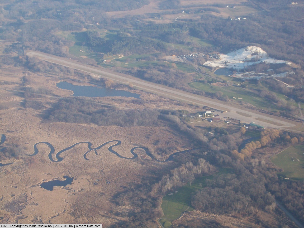
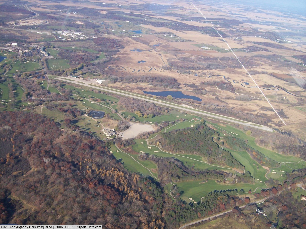
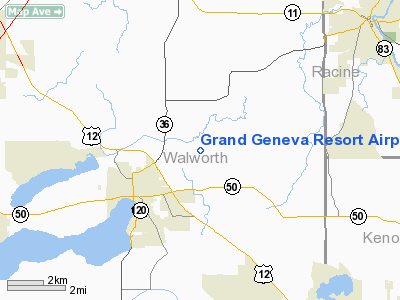
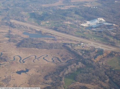
Grand Geneva Resort Airport |
 |
(Click on the photo to enlarge) |
 |
(Click on the photo to enlarge) |
Location & QuickFacts
| FAA Information Effective: | 2008-09-25 |
| Airport Identifier: | C02 |
| Airport Status: | Operational |
| Longitude/Latitude: | 088-23-22.5000W/42-36-53.7000N
-88.389583/42.614917 (Estimated) |
| Elevation: | 835 ft / 254.51 m (Estimated) |
| Land: | 20 acres |
| From nearest city: | 2 nautical miles EN of Lake Geneva, WI |
| Location: | Walworth County, WI |
| Magnetic Variation: | 01W (1985) |
Owner & Manager
| Ownership: | Privately owned |
| Owner: | Grand Geneva Resort |
| Address: | 7036 Grand Geneva Way
Lake Geneva, WI 53147-0130 |
| Phone number: | 262-249-7905 |
| Manager: | Jeff Fisk |
| Address: | 7036 Grand Geneva Way
Lake Geneva, WI 53147-0130 |
| Phone number: | 262-248-8811 |
Airport Operations and Facilities
| Airport Use: | Open to public |
| Wind indicator: | Yes |
| Segmented Circle: | Yes |
| Control Tower: | No |
| Lighting Schedule: | 24 HRS
MIRL RY 05/23 PRESET ON MED INTST DUSK-DAWN. |
| Beacon Color: | Clear-Green (lighted land airport)
OTS INDEFLY. |
| Sectional chart: | Chicago |
| Region: | AGL - Great Lakes |
| Boundary ARTCC: | ZAU - Chicago |
| Tie-in FSS: | GRB - Green Bay |
| FSS Toll Free: | 1-800-WX-BRIEF |
| NOTAMs Facility: | GRB (NOTAM-d service avaliable) |
Airport Communications
| CTAF: | 122.800 |
| Unicom: | 122.800 |
Airport Services
Runway Information
Runway 05/23
| Dimension: | 3830 x 75 ft / 1167.4 x 22.9 m |
| Surface: | ASPH, Fair Condition |
| Edge Lights: | Medium |
| |
Runway 05 |
Runway 23 |
| Longitude: | 088-23-42.9807W | 088-23-02.0322W |
| Latitude: | 42-36-42.2953N | 42-37-05.0263N |
| Elevation: | 834.00 ft | 835.00 ft |
| Alignment: | 53 | 127 |
| Traffic Pattern: | Right | Left |
| Markings: | Non-precision instrument, Poor Condition
RY 05/23 MARKINGS FADED. | Non-precision instrument, Poor Condition |
| Obstruction: | 30 ft trees, 320.0 ft from runway, 180 ft right of centerline, 4:1 slope to clear
RY 05 30 FT TREES 70 FT FM THLD 190 FT R. | 30 ft trees, 200.0 ft from runway, 150 ft left of centerline
20 FT TREES 100 FT FM THLD 90 FT L. |
|
Radio Navigation Aids
| ID |
Type |
Name |
Ch |
Freq |
Var |
Dist |
| LVV | NDB | Lake Lawn | | 404.00 | 00W | 10.3 nm |
| RA | NDB | Paser | | 206.00 | 00E | 22.0 nm |
| GM | NDB | Teels | | 242.00 | 02W | 23.4 nm |
| UES | NDB | Waukesha | | 359.00 | 01W | 26.7 nm |
| JVL | NDB | Janesville | | 375.00 | 03E | 28.8 nm |
| BL | NDB | Yanks | | 260.00 | 02W | 35.0 nm |
| RYV | NDB | Rock River | | 371.00 | 01W | 36.7 nm |
| ME | NDB | Deana | | 350.00 | 00E | 42.1 nm |
| DKB | NDB | Dekalb | | 209.00 | 02W | 43.3 nm |
| HXF | NDB | Hartford | | 200.00 | 00E | 44.1 nm |
| BJB | VOR | West Bend | | 109.80 | 01W | 49.9 nm |
| BUU | VOR/DME | Burbun | 092X | 114.50 | 01W | 5.9 nm |
| ENW | VOR/DME | Kenosha | 029X | 109.20 | 02W | 20.3 nm |
| HRK | VOR/DME | Horlick | 124X | 117.70 | 02W | 26.9 nm |
| OBK | VOR/DME | Northbrook | 077X | 113.00 | 02W | 30.6 nm |
| JVL | VOR/DME | Janesville | 090X | 114.30 | 03E | 31.9 nm |
| LJT | VOR/DME | Timmerman | 072X | 112.50 | 02W | 33.6 nm |
| RFD | VOR/DME | Rockford | 045X | 110.80 | 01E | 42.9 nm |
| ORD | VOR/DME | Chicago O'hare | 086X | 113.90 | 02E | 43.4 nm |
| DPA | VOR/DME | Dupage | 021X | 108.40 | 02E | 43.6 nm |
| BAE | VORTAC | Badger | 111X | 116.40 | 02E | 30.5 nm |
| MKE | VOT | Milwaukee | | 109.00 | | 29.6 nm |
| ORD | VOT | Chicago O'hare Intl | | 112.00 | | 43.6 nm |
Remarks
- FOR NOISE ABATEMENT USE RY 23.
- PRVDD TPA IS 800 FT OR LOWER; OBSTN ARE REMOVED OR LOWERED; AREA 125 FT EITHER SIDE & 200 FT OFF RWY ENDS ARE CLEAR; AREA 60 FT EITHER SIDE & 240 FT OFF RY ENDS IS CLEARED; NSTD PATTERN & TPA IS ANNOTATED IN THE AFD.
Images and information placed above are from
http://www.airport-data.com/airport/C02/
We thank them for the data!
| General Info
|
| Country |
United States
|
| State |
WISCONSIN
|
| FAA ID |
C02
|
| Latitude |
42-36-53.700N
|
| Longitude |
088-23-22.500W
|
| Elevation |
835 feet
|
| Near City |
LAKE GENEVA
|
We don't guarantee the information is fresh and accurate. The data may
be wrong or outdated.
For more up-to-date information please refer to other sources.
|
|