|
|
General Mitchell Intl Airport |
Coordinates: 42°56′50″N 087°53′48″W / 42.94722°N 87.89667°W / 42.94722; -87.89667
| General Mitchell International Airport |
 |
| IATA: MKE – ICAO: KMKE – FAA LID: MKE
Location of the General Mitchell International Airport
|
| Summary |
| Airport type |
Public |
| Owner/Operator |
Milwaukee County |
| Location |
Milwaukee, Wisconsin |
| Hub for |
- AirTran Airways
- Freight Runners Express
- Frontier Airlines
|
| Elevation AMSL |
723 ft / 220 m |
| Website |
www.MitchellAirport.com |
| Runways |
| Direction |
Length |
Surface |
| ft |
m |
| 01L/19R |
9,690 to be 10,690 |
2,954 |
Asphalt/Concrete |
| 01R/19L |
4,183 |
1,275 |
Asphalt/Concrete |
| 07L/25R |
4,801 |
1,463 |
Asphalt/Concrete |
| 07R/25L |
8,012 to be 9,012 |
2,442 |
Asphalt/Concrete |
| 13/31 |
5,868 |
1,789 |
Asphalt/Concrete |
| Statistics (2008) |
| Aircraft operations |
183,278 |
| Passengers |
7,956,968 |
| Sources: airport web site and FAA |
General Mitchell International Airport (IATA: MKE, ICAO: KMKE, FAA LID: MKE) is a county-owned public airport located five miles (8 km) south of the central business district of Milwaukee, a city in Milwaukee County, Wisconsin, United States.
It is named after United States Army Air Service General Billy Mitchell, who was raised in Milwaukee and is often regarded as the father of the United States Air Force. The airport is a hub for AirTran Airways and Frontier Airlines. Along with being the primary airport for Milwaukee, Mitchell International has sometimes been described as Chicago's third airport, as many Chicago travelers use it as an alternative to Chicago O'Hare and Chicago Midway. It is also used by travellers throughout Wisconsin and Northern Illinois. An Amtrak railway station opened at the airport in 2005. The station is served by the Hiawatha Service line running between Chicago and Milwaukee several times daily. History
The original airfield was established in 1920 as Hamilton Airport by business owner Thomas Hamilton. Milwaukee County purchased the land on October 19, 1926, for the Milwaukee County Airport. Kohler Aviation Corporation began providing passenger service across Lake Michigan on August 31, 1929. A passenger terminal was later constructed in 1940, and on March 17, 1941, the airport was renamed General Mitchell Field after Milwaukee's military airpower advocate, Brigadier General William "Billy" Mitchell. On January 4, 1945, Mitchell Field was leased to the War Department for use as a World War II prisoner-of-war camp. Over 3,000 prisoners and 250 enlisted men stayed at the work camp. Escaped German prisoners were often surprised to find a large German and Polish population just beyond the fence. The present terminal opened in 1955 and was expanded significantly between 1984 and 1990. On June 19, 1986, the Milwaukee County Board of Supervisors officially renamed Mitchell Field to General Mitchell International Airport.
The airport is still owned and operated by Milwaukee County; however, some Milwaukee business leaders and politicians have advocated privatization or leasing Mitchell Field to a third party for financial reasons.
Awards and recognition
In October 2008, a Condé Nast Traveler poll ranked Milwaukee County’s General Mitchell International Airport fourth in the nation using categories of Location and Access, Design, Customs and Baggage, Perceived Safety and Security, as well as Food, Shops and Amenities.
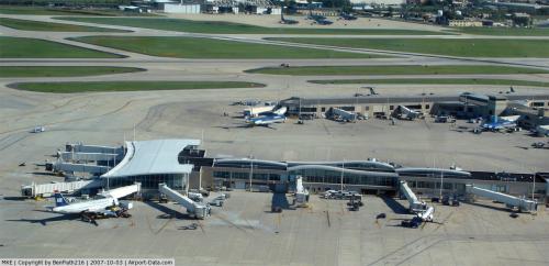
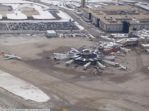
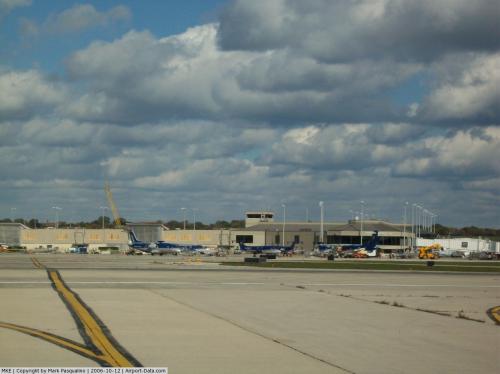
Facilities and operations
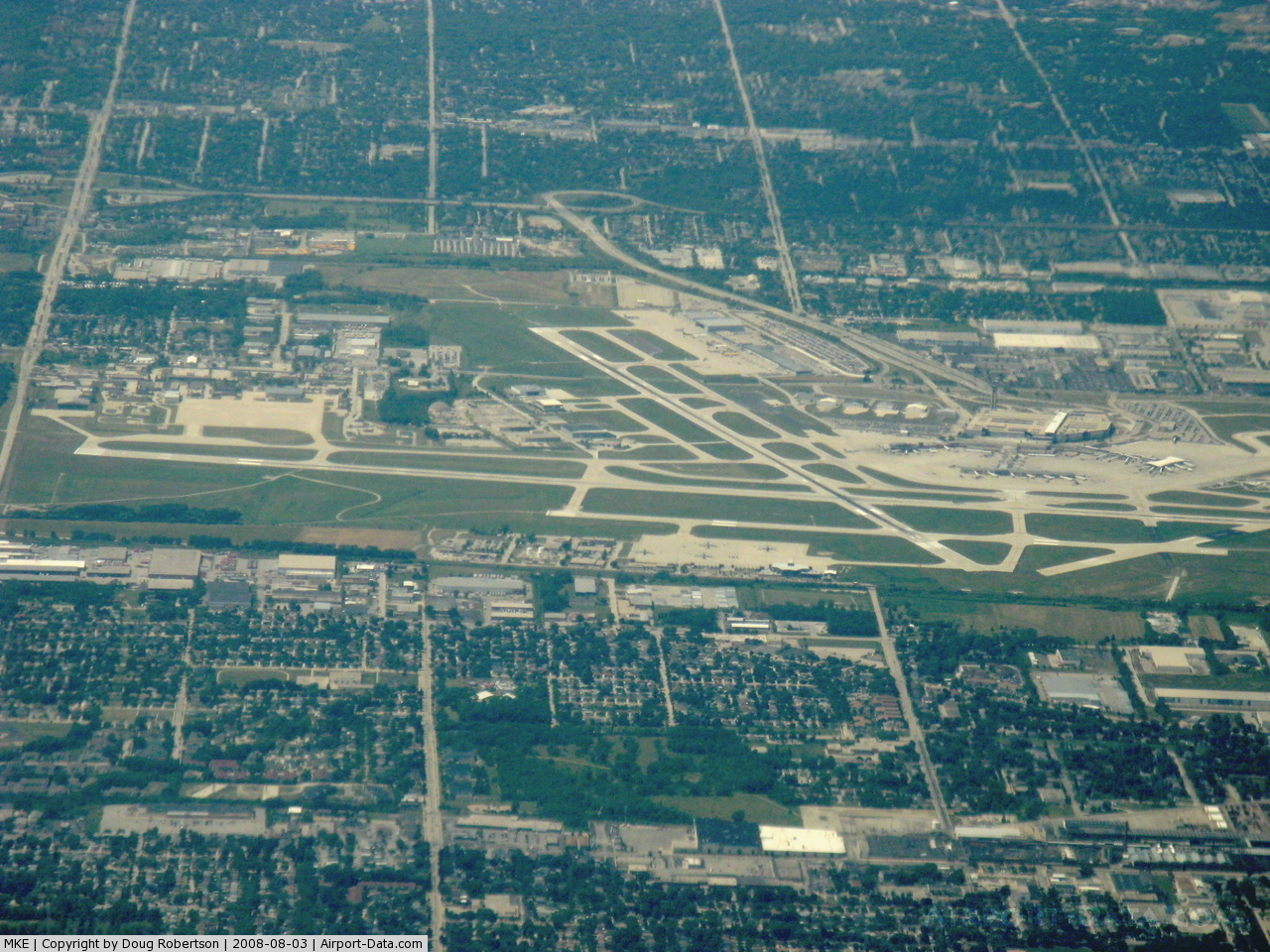
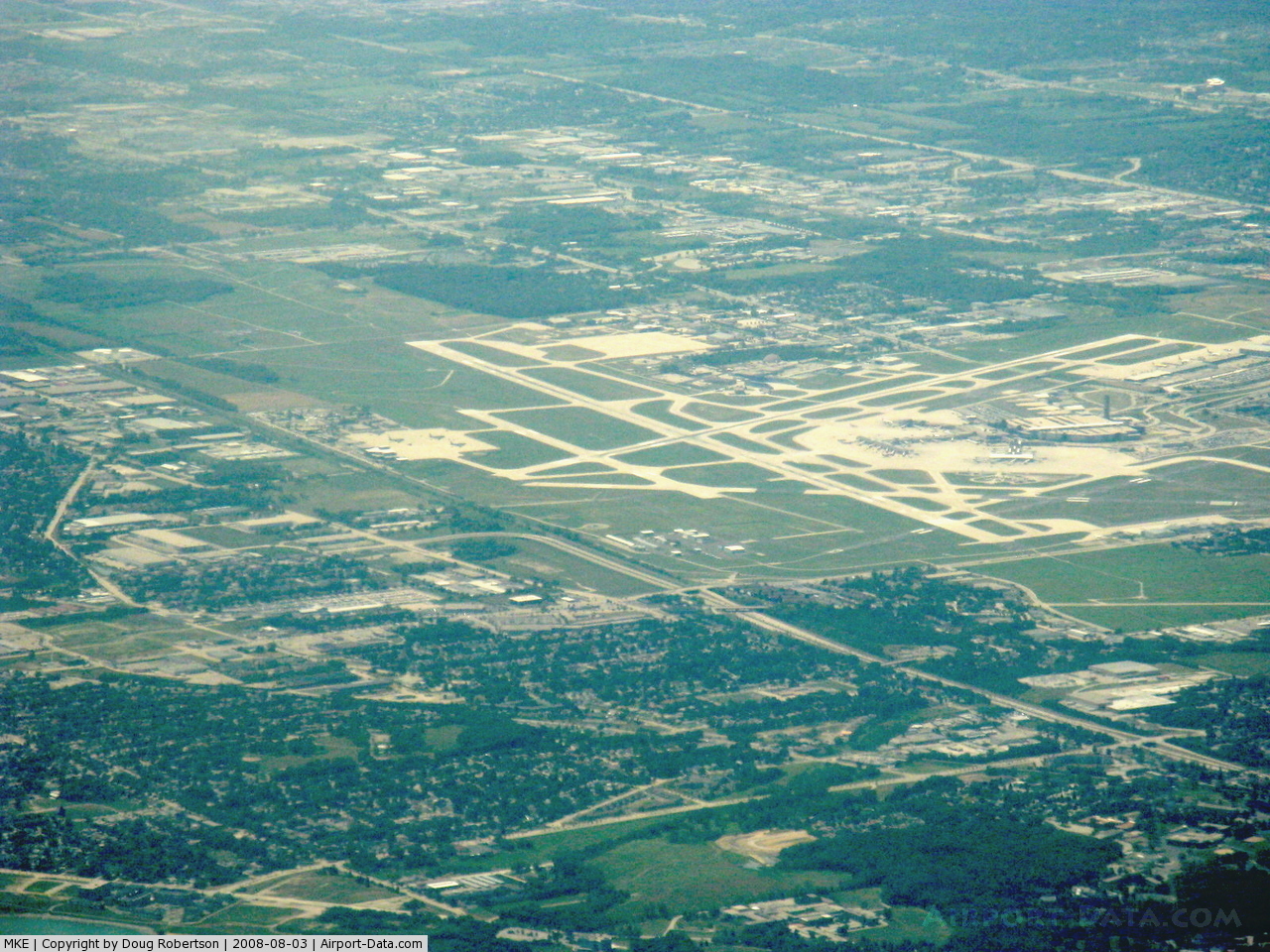
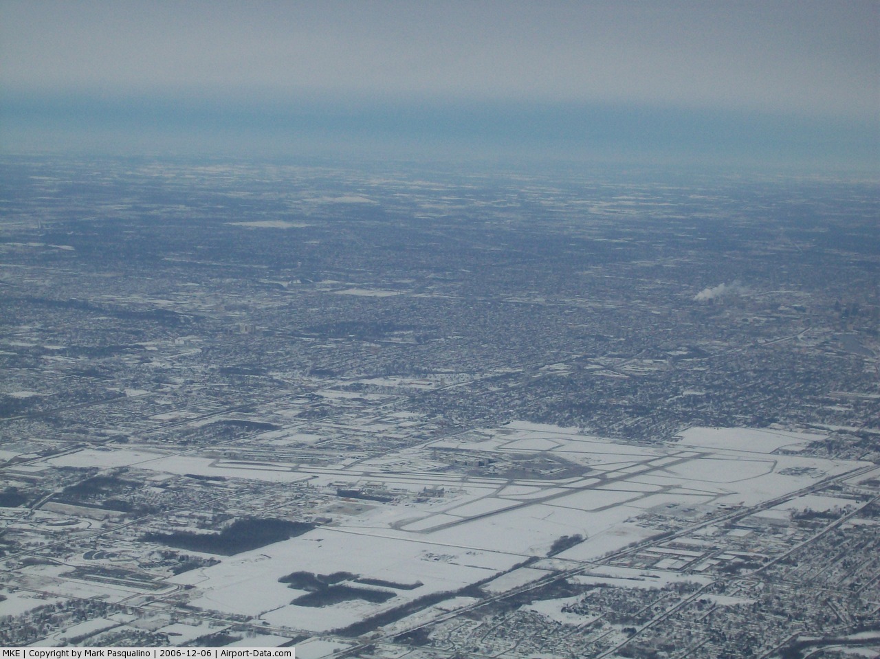
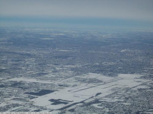
General Mitchell International Airport covers an area of 2,180 acres (882 ha) which contains five asphalt and concrete paved runways ranging in length from 4,183 to 9,690 ft (1,463 to 2,954 m). For the 12-month period ending December 31, 2005, the airport had 219,114 aircraft operations, an average of 600 per day: 56% air taxi, 32% scheduled commercial, 10% general aviation and 1% military. The main building houses the Mitchell Gallery of Flight, a non-profit museum on the concession level; the usual retail outlets, including a small food court; and a branch of Renaissance Books which is believed to be the world's first used book store in an airport. An observation lot along the northern edge of the airport is open to the public, and tower communications are rebroadcast using a low-power FM transmitter for visitors to tune in on their car radios. A Wisconsin historical marker documenting the airport's history is also located there.
 | |
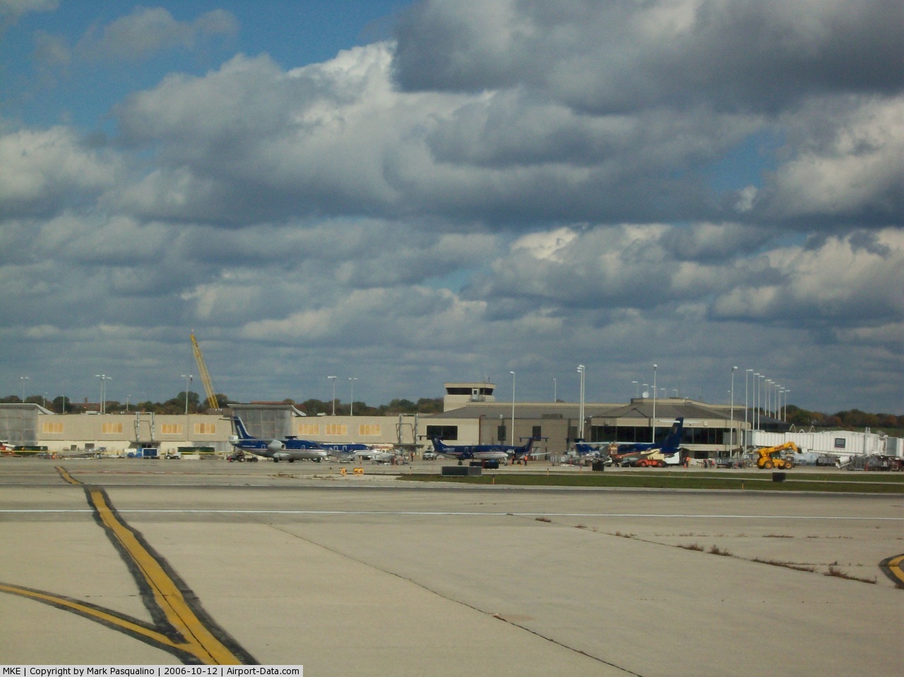
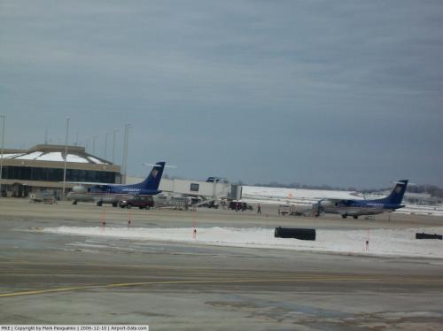
A Midwest Express Dornier 328JET on the tarmac in front of the airport's 200-foot-high (61 m) control tower |
Statistics
In 2009, 7,946,562 passengers used the airport, a -0.13% decrease over 2008 with 7,956,968. The airport is owned and operated by Milwaukee County. Mitchell's 10 airlines offer over 200 daily departures. Over 40 airports are served nonstop or direct from Mitchell International. It is the largest airport in Wisconsin. The airport terminal is open 24 hours a day.
Expansion
Mitchell International is expanding the buffer zone on their runways after an accident on January 21, 2007, when Northwest Airlines Flight 1726 skidded off the runway after aborting takeoff. According to the FAA, most airports are encouraged to have a buffer zone no shorter than 1,000 feet (305 m), although many airports do not meet this requirement.
Construction to provide this buffer zone began at the end of the summer of 2009. Current plans call for the completion by the summer of 2011. Work is being done to the west of the airport (6th Street) to move the road to allow enough room. Work is also being done to the south of the airport. College Avenue will be rebuilt to travel through a tunnel to allow a buffer zone over the road. This is similar to work already in place to the west on Howell Avenue.
There is also a "Master Plan" idea to significantly increase terminal area by either stretching the existing terminal (in some cases, to almost double the size) or begin construction of an entirely separate terminal. Nearly all cases will involve major reconstruction on the airport itself, and will have a huge impact on the airport's future traffic.
According to the Fall 2007 Newsletter, the proposed Concourses F and G would be built just below the Concourse E stem.
In July 2007, General Mitchell International Airport completed a 10 gate addition to Concourse C along with new rampside boarding gates for Midwest Connect in Concourse D. US Airways was moved to Concourse C, leaving all of Concourse D for Midwest Airlines and Midwest Connect until June 1, 2008 when Great Lakes Airlines started its Milwaukee service. Concourse E has also been renovated due to the larger passenger volume.
Airlines and destinations
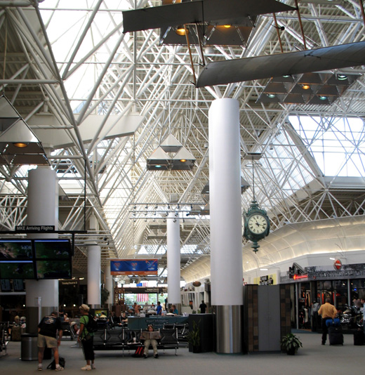 | |
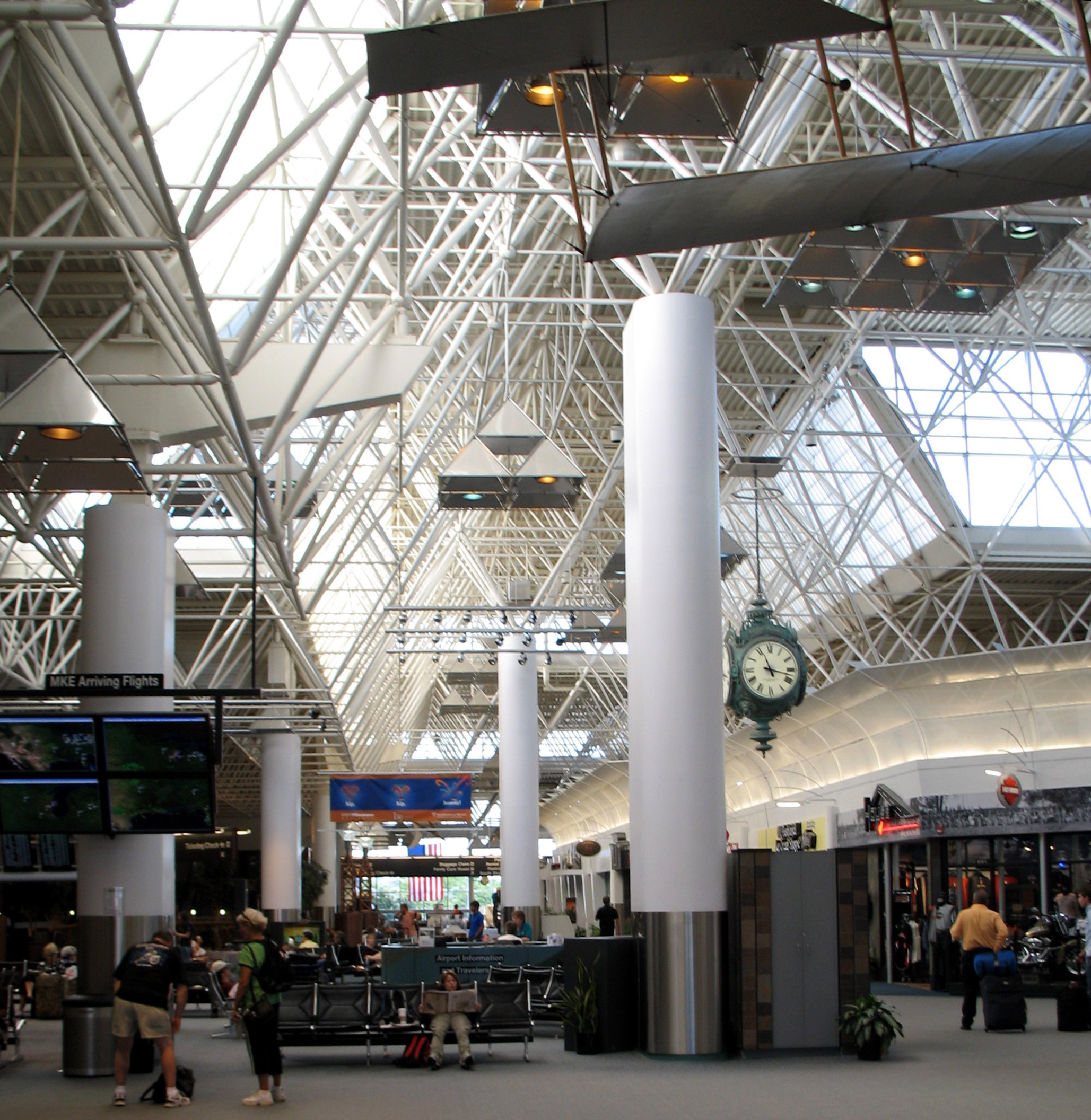
Interior of main terminal |
General Mitchell International Airport has 48 gates and 40 jetbridges on 3 concourses in one terminal. All international arrivals lacking border preclearance must pass through the International Arrivals Building.
Frontier Airlines is the largest carrier with the most gates at the airport. AirTran Airways and Delta Air Lines also have sizable presences.
| Airlines |
Destinations |
Concourse |
| Air Canada Jazz |
Toronto-Pearson |
C |
| AirTran Airways |
Atlanta, Baltimore, Boston, Dallas/Fort Worth, Denver, Fort Lauderdale, Fort Myers, Las Vegas, Los Angeles, Minneapolis/St Paul, New Orleans [begins October 7], New York LaGuardia, Orlando, Phoenix [seasonal], San Diego [seasonal], San Francisco, Sarasota/Bradenton [begins November 18], Seattle/Tacoma, Tampa, Washington-Reagan |
C |
| AirTran Airways operated by SkyWest Airlines |
Akron-Canton, Des Moines, Indianapolis, Omaha, Pittsburgh, St. Louis |
C |
| AmericanConnection operated by Chautauqua Airlines |
Chicago-O'Hare |
C |
| American Eagle |
Chicago-O'Hare, Dallas/Fort Worth |
C |
| Continental Express operated by ExpressJet Airlines |
Cleveland, Houston-Intercontinental, Newark |
E |
| Delta Air Lines |
Atlanta, Cancún [seasonal], Detroit, Minneapolis/St. Paul |
E |
| Delta Connection operated by Atlantic Southeast Airlines |
Atlanta |
E |
| Delta Connection operated by Comair |
Cincinnati/Northern Kentucky, Memphis |
E |
| Delta Connection operated by Mesaba Airlines |
Cincinnati/Northern Kentucky |
E |
| Delta Connection operated by Pinnacle Airlines |
Memphis |
E |
| Delta Connection operated by Shuttle America |
Atlanta |
E |
| Delta Connection operated by SkyWest Airlines |
Cincinnati/Northern Kentucky |
E |
| Frontier Airlines |
Boston, Denver, Las Vegas, Los Angeles, New York-LaGuardia, Orlando, Phoenix, Washington-Reagan [begins November 18]
Seasonal: Cancún [begins December 18], Fort Myers, St. Petersburg/Clearwater [begins November 18], San Diego, San Francisco, Tampa [ends November 17] |
D |
| Frontier Airlines operated by Chautauqua Airlines |
Appleton, Cleveland, Columbus (OH), Dayton, Des Moines, Flint, Grand Rapids, Green Bay, Hartford, Indianapolis, Louisville, Madison, Minneapolis/St. Paul, Nashville, Newark, Omaha, Philadelphia [ends November 17], Pittsburgh, St. Louis |
D |
| Frontier Airlines operated by Republic Airlines |
Boston [ends November 17], Dallas/Fort Worth, Denver, Kansas City, Minneapolis/St. Paul, New York-LaGuardia [ends November 17], Omaha, Philadelphia, Raleigh/Durham, San Antonio [begins November 19], Washington-Reagan [ends November 17]
Seasonal: Branson (MO), Fort Lauderdale, Seattle/Tacoma, Tucson [begins January 8] |
D |
| Great Lakes Airlines |
Ironwood, Manistee, Rhinelander |
D |
| Southwest Airlines |
Baltimore, Kansas City, Las Vegas, Orlando, Phoenix, Tampa [seasonal] |
D |
| United Express operated by SkyWest Airlines |
Chicago-O'Hare, Denver |
C |
| US Airways |
Phoenix |
C |
| US Airways Express operated by Air Wisconsin |
Charlotte, Philadelphia |
C |
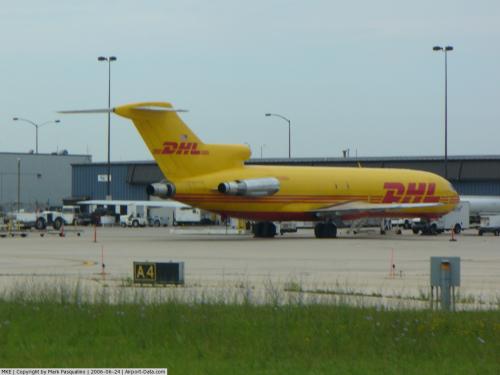
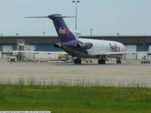
Cargo carriers
| Airlines |
Destinations |
| Berry Aviation |
Chicago-Executive Airport |
| CSA Air |
Marquette, Escanaba, Iron Mountain, Rhinelander |
| FedEx Express |
Appleton, Chicago-O'Hare, Indianapolis, Memphis |
| Flight Line |
Chicago-Midway |
| Freight Runners Express |
Appleton, Bloomington-Normal, Dillon, Green Bay, Lake Delton, Madison, Marinette, Menomonie, Rhinelander, Stevens Point, Wausau |
| Kalitta Air |
Kenosha |
| Martinaire |
Iron Mountain, Ironwood |
| Royal Air Freight |
Pontiac |
| UPS Airlines |
Louisville |
| U.S. Check |
Chicago-Midway, Green Bay, St. Paul-Downtown Airport |
Military presence
The airport also hosts the General Mitchell Air National Guard Station, home to the 128th Air Refueling Wing (128 ARW), an Air Mobility Command (AMC)-gained unit of the Wisconsin Air National Guard flying the KC-135R Stratotanker. The wing performs both Federal and State missions and consists of approximately 1000 Air National Guard personnel, both full-time Active Guard and Reserve (AGR) and Air Reserve Technicians (ART), as well as traditional part-time guardsmen, available for worldwide deployment in support of Air Mobility Command and combatant commander tasking. The wing also maintains a KC-135 flight simulator, providing training profciency for its own crews as well as other KC-135 flight crews in other air refueling wings and air mobility wings in the Regular U.S. Air Force, the Air Force Reserve Command and the Air National Guard.
Prior to 2007, the military installation was known as General Mitchell Air Reserve Station and was also home to the 440th Airlift Wing (440 AW), an Air Mobility Command (AMC)-gained unit of the Air Force Reserve Command (AFRC) flying the C-130H Hercules. While based at General Mitchell ARS, the 440 AW numbered in excess of 1500 full-time AGR, ART and part-time traditional reservists. Pursuant to Base Realignment and Closure (BRAC) 2005 action, the 440 AW relocated to Pope AFB, North Carolina in 2007 and the former AFRC facilities were turned over to the Air National Guard, resulting in the installation's renaming.
Ground transportation
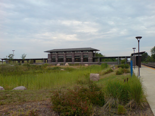 | |
The Milwaukee Airport Rail Station provides service to Milwaukee as well as Chicago. |
- Badger Coach has frequent trips between Mitchell Airport, Downtown Milwaukee, Madison, Johnson Creek, and Goerkes Corners.
- Airport Connection has routes from the Airport to the Amtrak Station, the Milwaukee Airport Rail Station, (MKA), parking lots, Sheboygan, and the Fox Valley Area.
- Milwaukee County Transit System Route 80 serves the Airport with a $2.25 fare to anywhere in the county.
- Amtrak has a station platform 3/4 of a mile from the airport and uses the Hiawatha Service. Free shuttle buses go between the train station and the baggage claim.
- Wisconsin Coach Lines as Airport Express operates frequently to O'Hare Airport (ORD), Midway Airport (MDW) and General Mitchell Airport (MKE) from Waukesha, Milwaukee(Downtown Amtrak/Greyhound Station), Racine, and Kenosha.
Incidents and accidents
- On 4 August 1968 a Convair CV-580, flying as North Central Airlines flight 261, collided in mid-air with a privately owned Cessna 150. The Cessna cabin remained attached to the Convair's forward baggage compartment. The Convair made a safe emergency landing at Milwaukee. The 3 Cessna occupants were killed. The Cessna was on a VFR flight from Lombard, Illinois to Sheboygan County Memorial Airport in Sheboygan Falls. It was determined that the inability of the Convair 580 flight crew to detect the Cessna 150 visually in sufficient time to take evasive action, despite having been provided with three radar traffic advisories caused the crash. Visual detection capabilities were reduced by the heavy accumulation of insect smears on the windows of the Convair. Visibility was further reduced by haze, smoke and sunglare, and by the inconspicuous colour and lack of relative motion of the Cessna.
- On September 6, 1985 Midwest Express Flight 105, Midwest's first and only fatal accident, crashed upon takeoff from Milwaukee. One of the airline's Douglas DC-9s crashed while taking off, bound for Atlanta's Hartsfield International Airport. According to NTSB reports, the crash was caused by improper pilot reaction when the plane’s right engine failed due to stress corrosion cracking. The improper flight control inputs caused an uncommanded roll and accelerated stall. The 31 people on board died.
- On August 31, 2005 a Midwest Airlines, Boeing 717 bumped a weed spraying truck and damaged the plane’s left wing. No one was hurt in the incident.
- A Northwest Airlines DC-9, Northwest Airlines Flight 1726 skidded 400 feet (120 m) off the end of a snowy runway 7R on January 21, 2007 at Milwaukee International Airport. The accident was due to an explosion in one of the engines, forcing the pilot to abort takeoff. The aircraft was headed for Detroit Metropolitan Wayne County Airport and was to continue on to Buffalo Niagara International Airport. Amongst the 104 people aboard, only one back injury was reported.
- On January 23, 2007 two Freight Runners Express cargo planes collided and burned on a taxiway. Both pilots were able to escape without injury. The planes were a Cessna 402 and a Beech 99. An NTSB investigation determined both pilots and air traffic control were at fault for the accident.
- On June 4, 2007 A Cessna Citation II crashed on take off after reporting a runaway trim tab. The pilot issued a distress signal within five minutes after taking off from KMKE. The plane then crashed into Lake Michigan two miles (3 km) off shore. The plane was carrying an organ transplant team from the University of Michigan back to Willow Run Airport. There was a crew of two and four passengers aboard. All six died.
- On November 13, 2007, a Midwest Connect flight from Milwaukee bound for Dayton was in a near-miss situation with a United Express jet heading to Chicago O'Hare International Airport from Greensboro while flying over northern Indiana. Air traffic controllers with Chicago Center directed the Midwest Connect flight to begin its descent while traveling head-on towards the United Express CRJ a few thousand feet below. The planes came as close as 1.3 miles (2.1 km) apart horizontally and 600 feet (183 m) vertically. The Midwest Connect Dornier 328JET was just above the United Express aircraft and descending while they were closing in on each other. An audible TCAS alarm in the Midwest Connect cockpit alerted the pilots of the proximity, allowing them to pull up in time.
- On April 22, 2008, a Chautauqua Airlines flight from St. Louis to Milwaukee experienced engine failure and landed safely at MidAmerica St. Louis Airport. Of the 32 passengers on board, none were injured.
- On September 12, 2008, at 7:13 PM, a Cirrus SR22 heading from Milwaukee bound for Lakeland Airport in Vilas County crashed a half a mile southwest of the Airport. All three people on board died.
The above content comes from Wikipedia and is published under free licenses – click here to read more.

 |
(Click on the photo to enlarge) |
 |
(Click on the photo to enlarge) |
 |
(Click on the photo to enlarge) |
 |
(Click on the photo to enlarge) |
 |
(Click on the photo to enlarge) |
 |
(Click on the photo to enlarge) |
 |
(Click on the photo to enlarge) |
 |
(Click on the photo to enlarge) |
 |
(Click on the photo to enlarge) |
 |
(Click on the photo to enlarge) |
 |
(Click on the photo to enlarge) |
 |
(Click on the photo to enlarge) |
Location & QuickFacts
| FAA Information Effective: | 2008-09-25 |
| Airport Identifier: | MKE |
| Airport Status: | Operational |
| Longitude/Latitude: | 087-53-47.7000W/42-56-50.0000N
-87.896583/42.947222 (Estimated) |
| Elevation: | 723 ft / 220.37 m (Surveyed) |
| Land: | 2180 acres |
| From nearest city: | 5 nautical miles S of Milwaukee, WI |
| Location: | Milwaukee County, WI |
| Magnetic Variation: | 02W (1995) |
Owner & Manager
| Ownership: | Publicly owned |
| Owner: | Milwaukee County |
| Address: | 907 N 10th St
Milwaukee, WI 53233 |
| Phone number: | 414-747-5300 |
| Manager: | C.b. Bateman |
| Address: | 5300 S Howell Ave
Milwaukee, WI 53207 |
| Phone number: | 414-747-5300 |
Airport Operations and Facilities
| Airport Use: | Open to public |
| Wind indicator: | Yes |
| Segmented Circle: | No |
| Control Tower: | Yes |
| Lighting Schedule: | DUSK-DAWN |
| Beacon Color: | Clear-Green (lighted land airport) |
| Landing fee charge: | No |
| Sectional chart: | Chicago |
| Region: | AGL - Great Lakes |
| Boundary ARTCC: | ZAU - Chicago |
| Tie-in FSS: | GRB - Green Bay |
| FSS on Airport: | No |
| FSS Toll Free: | 1-800-WX-BRIEF |
| NOTAMs Facility: | MKE (NOTAM-d service avaliable) |
| Certification type/date: | I C S 05/1973
ARFF INDEX D EQUIP AVBL UPON REQUEST. |
| Federal Agreements: | NGY3 |
Airport Communications
Airport Services
| Fuel available: | 100LLA |
| Airframe Repair: | MAJOR |
| Power Plant Repair: | MAJOR |
| Bottled Oxygen: | NONE |
| Bulk Oxygen: | HIGH |
Runway Information
Runway 01L/19R
| Dimension: | 9690 x 200 ft / 2953.5 x 61.0 m |
| Surface: | ASPH-CONC, Fair Condition |
| Surface Treatment: | Saw-cut or plastic Grooved |
| Weight Limit: | Single wheel: 100000 lbs.
Dual wheel: 185000 lbs.
Dual tandem wheel: 350000 lbs. |
| Edge Lights: | High |
| |
Runway 01L |
Runway 19R |
| Longitude: | 087-53-51.0154W | 087-53-34.7778W |
| Latitude: | 42-55-52.7347N | 42-57-27.6987N |
| Elevation: | 704.00 ft | 673.00 ft |
| Alignment: | 7 | 127 |
| ILS Type: | ILS
| ILS
|
| Traffic Pattern: | Left | Left |
| Markings: | Precision instrument, Good Condition | Precision instrument, Good Condition |
| Crossing Height: | 65.00 ft | 68.00 ft |
| Displaced threshold: | 0.00 ft | 785.00 ft |
| VASI: | 4-light PAPI on right side | 4-light PAPI on right side |
| Visual Glide Angle: | 3.00° | 3.00° |
| RVR Equipment: | touchdown, midfield, rollout | touchdown, midfield, rollout |
| Approach lights: | ALSF2 | MALSR |
| Runway End Identifier: | No | No |
| Centerline Lights: | Yes | Yes |
| Touchdown Lights: | Yes | No |
| Obstruction: | 82 ft tree, 3758.0 ft from runway, 985 ft left of centerline, 44:1 slope to clear | 6 ft fence, 249.0 ft from runway, 404 ft right of centerline, 8:1 slope to clear
APCH RATIO 36:1 TO DSPLCD THLD; 100 FT TREE 3641 FT TO DSPLCD THLD; 901 FT RIGHT.
FENCE 148 FT FM THLD; 391 FT R OF CNTRLN. |
|
Runway 01R/19L
| Dimension: | 4183 x 150 ft / 1275.0 x 45.7 m |
| Surface: | ASPH-CONC, Fair Condition |
| Weight Limit: | Single wheel: 85000 lbs.
Dual wheel: 115000 lbs.
Dual tandem wheel: 180000 lbs. |
| Edge Lights: | Medium |
| |
Runway 01R |
Runway 19L |
| Longitude: | 087-53-32.5066W | 087-53-25.4946W |
| Latitude: | 42-56-21.7606N | 42-57-02.7493N |
| Elevation: | 677.00 ft | 670.00 ft |
| Alignment: | 7 | 127 |
| Traffic Pattern: | Left | Left |
| Markings: | Non-precision instrument, Good Condition | Non-precision instrument, Good Condition |
| Runway End Identifier: | Yes | No |
| Centerline Lights: | No | No |
| Touchdown Lights: | No | No |
| Obstruction: | , 50:1 slope to clear | 125 ft tree, 4336.0 ft from runway, 463 ft left of centerline, 33:1 slope to clear |
|
Runway 07L/25R
| Dimension: | 4800 x 100 ft / 1463.0 x 30.5 m |
| Surface: | ASPH-CONC, Fair Condition |
| Weight Limit: | Single wheel: 30000 lbs.
Dual wheel: 35000 lbs.
Dual tandem wheel: 55000 lbs. |
| Edge Lights: | Medium |
| |
Runway 07L |
Runway 25R |
| Longitude: | 087-54-19.1462W | 087-53-17.8787W |
| Latitude: | 42-57-09.8810N | 42-57-24.8086N |
| Elevation: | 672.00 ft | 674.00 ft |
| Alignment: | 72 | 127 |
| Traffic Pattern: | Left | Left |
| Markings: | Basic, Good Condition | Basic, Good Condition |
| Crossing Height: | 37.00 ft | 40.00 ft |
| VASI: | 4-box on left side | 4-light PAPI on right side |
| Visual Glide Angle: | 3.10° | 3.00° |
| Runway End Identifier: | Yes | Yes |
| Centerline Lights: | No | No |
| Touchdown Lights: | No | No |
| Obstruction: | 44 ft tree, 1298.0 ft from runway, 187 ft right of centerline, 24:1 slope to clear | 77 ft pole, 1727.0 ft from runway, 195 ft right of centerline, 19:1 slope to clear |
|
Runway 07R/25L
| Dimension: | 8012 x 150 ft / 2442.1 x 45.7 m |
| Surface: | ASPH-CONC, Fair Condition |
| Surface Treatment: | Saw-cut or plastic Grooved |
| Weight Limit: | Single wheel: 100000 lbs.
Dual wheel: 185000 lbs.
Dual tandem wheel: 350000 lbs. |
| Edge Lights: | High |
| |
Runway 07R |
Runway 25L |
| Longitude: | 087-54-57.0385W | 087-53-14.8051W |
| Latitude: | 42-56-22.3449N | 42-56-47.2520N |
| Elevation: | 723.00 ft | 670.00 ft |
| Alignment: | 72 | 127 |
| ILS Type: | ILS/DME
| LOC/DME
|
| Traffic Pattern: | Left | Left |
| Markings: | Precision instrument, Good Condition | Precision instrument, Good Condition |
| Crossing Height: | 56.00 ft | 50.00 ft |
| Displaced threshold: | 0.00 ft | 683.00 ft |
| VASI: | 4-light PAPI on left side | 4-light PAPI on left side |
| Visual Glide Angle: | 3.00° | 3.00° |
| RVR Equipment: | touchdown | |
| Approach lights: | MALSR | |
| Runway End Identifier: | No | Yes |
| Centerline Lights: | No | No |
| Touchdown Lights: | No | No |
| Obstruction: | 80 ft tree, 3220.0 ft from runway, 305 ft left of centerline, 37:1 slope to clear | 41 ft pole, 456.0 ft from runway, 464 ft left of centerline, 8:1 slope to clear
RWY 25L APCH RATIO 29:1 TO DSPLCD THLD; 39 FT POLE, 1140 FT TO DSPLCD THLD; 544 FT LEFT. |
|
Runway 13/31
| Dimension: | 5868 x 150 ft / 1788.6 x 45.7 m |
| Surface: | ASPH-CONC, Fair Condition |
| Weight Limit: | Single wheel: 80000 lbs.
Dual wheel: 110000 lbs.
Dual tandem wheel: 170000 lbs. |
| Edge Lights: | Medium |
| |
Runway 13 |
Runway 31 |
| Longitude: | 087-54-12.3154W | 087-53-13.9099W |
| Latitude: | 42-57-29.2893N | 42-56-50.3248N |
| Elevation: | 671.00 ft | 670.00 ft |
| Alignment: | 127 | 127 |
| Traffic Pattern: | Left | Left |
| Markings: | Non-precision instrument, Good Condition | Non-precision instrument, Good Condition |
| Crossing Height: | 54.00 ft | 55.00 ft |
| Displaced threshold: | 741.00 ft | 534.00 ft |
| VASI: | 4-light PAPI on left side
FOR PAPI RY 13 & 31 CTC TWR. | 4-light PAPI on right side |
| Visual Glide Angle: | 3.00° | 3.00° |
| Runway End Identifier: | Yes | Yes |
| Centerline Lights: | No | No |
| Touchdown Lights: | No | No |
| Obstruction: | 33 ft pole, 486.0 ft from runway, 69 ft left of centerline, 8:1 slope to clear
APCH RATIO 27:1 TO DSPLCD THLD; 87 FT TREE 2375 FT TO DSPLCD THLD; 490 FT LEFT.
FENCE POST 197 FT FM RY END; 2442 L OF CNTRLN. | 42 ft rr, 626.0 ft from runway, 295 ft right of centerline, 10:1 slope to clear
APCH RATIO 27:1 TO DSPLCD THLD; 42 FT RR 1160 FT TO DSPLCD THLD; 290 FT R. |
|
Radio Navigation Aids
| ID |
Type |
Name |
Ch |
Freq |
Var |
Dist |
| GM | NDB | Teels | | 242.00 | 02W | 6.8 nm |
| BL | NDB | Yanks | | 260.00 | 02W | 6.8 nm |
| RA | NDB | Paser | | 206.00 | 00E | 15.9 nm |
| UES | NDB | Waukesha | | 359.00 | 01W | 16.0 nm |
| LLE | NDB | Kettle Moraine | | 329.00 | 01W | 30.5 nm |
| HXF | NDB | Hartford | | 200.00 | 00E | 32.6 nm |
| LVV | NDB | Lake Lawn | | 404.00 | 00W | 34.1 nm |
| RYV | NDB | Rock River | | 371.00 | 01W | 38.9 nm |
| UNU | NDB | Juneau | | 344.00 | 01W | 45.7 nm |
| BJB | VOR | West Bend | | 109.80 | 01W | 30.2 nm |
| LJT | VOR/DME | Timmerman | 072X | 112.50 | 02W | 11.6 nm |
| HRK | VOR/DME | Horlick | 124X | 117.70 | 02W | 11.7 nm |
| ENW | VOR/DME | Kenosha | 029X | 109.20 | 02W | 21.0 nm |
| BUU | VOR/DME | Burbun | 092X | 114.50 | 01W | 23.7 nm |
| OBK | VOR/DME | Northbrook | 077X | 113.00 | 02W | 43.7 nm |
| FAH | VOR/DME | Falls | 37X | 110.00 | 02W | 49.4 nm |
| BAE | VORTAC | Badger | 111X | 116.40 | 02E | 19.9 nm |
Remarks
- RY 07L/25R CLSD TO ALL JET ACFT & ACFT DESIGN GROUP BIII & LARGER.
- ALL APCHS ARE OVER NOISE SENSITIVE AREAS; ALL TURBOJET ACFT SHOULD REFRAIN FM CONDUCTING MULTI VFR TFC PATTERN APCHS & DEPS WO PRIOR APVL FM AMGR CALL C414-747-5325.
- TWY B CLSD BTN TWYS 'G' & 'D','R' & 'A1' TO B747 AND LARGER TYPE ACFT WITHOUT PRIOR PERMISSION FM AMGR AT 414-747-5235.
- RYS 07L/25R & 01R/19L & TWYS H/J/P NOT AUTHORIZED UNDER FAR PART 139 FOR SCHED OPNS INVOLV ACR ACFT DESIGNED FOR 10 OR MORE PASSENGER SEATS AND SCHED/UNSCHED ACR OPNS INVOLV ACFT DESIGNED 31 OR MORE PASSENGER SEATS.
- TWY F1 CLSD TO ACFT OVER 65000 LBS OR WINGSPAN OVER 79 FT WITHOUT PRIOR APPROVAL OF AMGR.
- TWY T CLSD FROM RY 07R/25L TO TWY S DURING CAT II & III OPNS.
- TWY 'A' CLSD FM TWY 'R' TO 'E' & TWY 'E' CLSD FM TWY 'T' TO 'M' AND TWY 'T' CLSD FM RY 07R/25L TO TWY 'E' TO DC10 B747 C-5 & MD11 DURING CAT II & III OPNS.
- TWY 'P' CLSD TO ACFT WITH WINGSPAN OVER 79 FT EXCEPT WITH PPR.
- TWY S CLSD DURING CAT II & III OPS.
- ANG: PPR ALL ACFT, 48HR PN, CTC AFLD OPS DSN 580-8241, C414-944-8241. 128ARW IS A FULLY OPERATIONAL KC-135R BASE WITH HRS OF OPERATION MON-FRI 1200Z-1930Z. CLOSED HOLIDAYS, SAT-SUN (EXCEPT UTA'S), CALL FOR AVAILABILITY.
- ANG: ANY MDS'S (OTHER THAN KC-135) IS LIMITED TO STANDARD TRANSIENT MARSHALLING AND PARKING. NO TECHNICAL DATA AVAILABLE FOR TRANSIENT MAINTENANCE. FUEL AND AGE EQUIPMENT SUPPORT AVAILABLE FOR SELF-SERVICE. THERE ARE NO ADDITIONAL CONFIGURATION ITEMS SUPPORTED SUCH AS LANTIRN PODS, EDM PODS, ETC.
- ANG: END OF RUNWAY FACILITIES, AIRCRAFT SHELTERS/REVETMENTS, AND ALERT FACILITIES ARE NOT AVAILABLE. AFLD/ACFT PARKING CONCERNS INCLUDE: LIMITED STATIC GROUNDING POINTS AND NO AIRCRAFT TIE DOWN POINTS.
- ANG: NO FLEET SVC/HOT CARGO PARKING AVAILABLE. CTC UPSET CTRL 20 MIN PRIOR TO ARR TO RCV CURRENT BIRD WATCH COND AND PARKING INFO.
- ASDE-X SURVEILLANCE SYSTEM IN USE: PILOTS SHOULD OPERATE TRANSPONDERS WITH MODE 'C' ON ALL TWYS & RYS.
- TWY 'D', 'D1', 'H', 'J', 'F' (W OF TWY 'Z' & E OF RY 01L/19R) CLSD TO DC-9 ACFT & LARGER WITHOUT PPR CALL ARPT MANAGER 414-747-5325.
- RY 13/31 CLSD TURBOJET ACFT W/O PPR AMGR - CALL 414-747-5325.
- RWY 1R CLSD TURBOJET TKOFS.
- RY HOLD SIGN LCTD ON TWY D FOR NBND TFC TO HOLD RETROREFLECTIVE ONLY. HOLD SHORT SIGN W TWY G FOR RY 13/31 RETROREFLECTIVE ONLY.
- PILOTS TRAVERSING EAST ON TWY M NOTE THE HOLDING POSITIONS FOR RY 25L INVOLVES AN UNUSUAL TWY CONFIGURATION. THE HOLDING SIGNS/MARKINGS FOR RY 25L ARE PHYSICALLY LOCATED ON TWY M (EASTBOUND), WELL IN ADVANCE OF RGT TURNS FOR DEP ON RY 25L.
- ACFT TAXIING FOR DEP ON RY 25L VIA EITHER TWY M OR RY 13/31 SHOULD REMAIN VIGILANT FOR THE LOCATION OF HOLDING POSITION SIGNS/MARKINGS FOR RY 25L.
- TWYS H/J/P NOT AUTHORIZED UNDER FAR PART 139 FOR SCHED OPNS INVOLV ACR ACFT DESIGNED FOR 10 OR MORE PASSENGER SEATS AND SCHED/UNSCHED ACR OPNS INVOLV ACFT DESIGNED 30 OR MORE PASSENGER SEATS.
- RY 07L/25R NO ACFT 65,000 POUNDS OR GREATER TAXI BTN TWY C & TWY E.
- TWY V AVBL FOR ALL TYPE ACFT WITH 8450 FT AVBL.
- TRNG FLGTS INVOLVING SUCCESSIVE USE OF ANY RY PROHIBITED 2200-0600.
- RYS 13/31 & 01R/19L & 07L/25R CLSD EXCP LGT WT SINGLE ENG ACFT 2200-0600 DLY.
- BIRDS ON & INVOF ARPT.
- PREFERRED USAGE BY ACFT BTN 2200-0600 IS TKOF RY 19R & LNDG RY 01L.
Images and information placed above are from
http://www.airport-data.com/airport/MKE/
We thank them for the data!
| General Info
|
| Country |
United States
|
| State |
WISCONSIN
|
| FAA ID |
MKE
|
| Latitude |
42-56-50.000N
|
| Longitude |
087-53-47.700W
|
| Elevation |
723 feet
|
| Near City |
MILWAUKEE
|
We don't guarantee the information is fresh and accurate. The data may
be wrong or outdated.
For more up-to-date information please refer to other sources.
|
|