 |
|
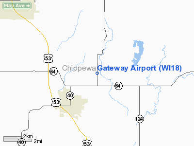
Location & QuickFacts
| FAA Information Effective: | 2008-09-25 |
| Airport Identifier: | WI18 |
| Airport Status: | Operational |
| Longitude/Latitude: | 091-27-00.5730W/45-07-59.8610N
-91.450159/45.133295 (Estimated) |
| Elevation: | 1021 ft / 311.20 m (Surveyed) |
| Land: | 42 acres |
| From nearest city: | 3 nautical miles NE of Bloomer, WI |
| Location: | Chippewa County, WI |
| Magnetic Variation: | 01E (1985) |
Owner & Manager
| Ownership: | Privately owned |
| Owner: | Don Zank |
| Address: | 19251 State Hwy 40
Bloomer, WI 54724 |
| Phone number: | 715-568-2244 |
| Manager: | Don Zank |
| Address: | 19251 State Hwy 40
Bloomer, WI 54724 |
| Phone number: | 715-568-2244 |
Airport Operations and Facilities
| Airport Use: | Private |
| Wind indicator: | Yes |
| Segmented Circle: | No |
| Control Tower: | No |
| Landing fee charge: | No |
| Sectional chart: | Green Bay |
| Region: | AGL - Great Lakes |
| Boundary ARTCC: | ZMP - Minneapolis |
| Tie-in FSS: | GRB - Green Bay |
| FSS on Airport: | No |
| FSS Toll Free: | 1-800-WX-BRIEF |
Airport Services
| Airframe Repair: | NONE |
| Power Plant Repair: | NONE |
| Bottled Oxygen: | NONE |
| Bulk Oxygen: | NONE |
Runway Information
Runway 18/36
| Dimension: | 2100 x 100 ft / 640.1 x 30.5 m |
| Surface: | TURF, Good Condition |
| |
Runway 18 |
Runway 36 |
| Traffic Pattern: | Left | Left |
| Markings: | None, | None, |
| Runway End Identifier: | No | No |
| Centerline Lights: | No | No |
| Touchdown Lights: | No | No |
| Obstruction: | 4 ft fence, 65 ft left of centerline
9' TREE 70' RIGHT OF EXTNDD CNTRLN. | 8 ft crops, 0.0 ft from runway, 65 ft right of centerline
4' FENCE & 7' CROPS RIGHT AND LEFT OF EXTNDD CNTRLN. |
|
Radio Navigation Aids
| ID |
Type |
Name |
Ch |
Freq |
Var |
Dist |
| RCX | NDB | Rusk County | | 356.00 | 00W | 29.2 nm |
| UBE | NDB | Cumberland | | 375.00 | 01E | 31.7 nm |
| AHH | NDB | Ameron | | 278.00 | 01E | 40.0 nm |
| SSQ | NDB | Shell Lake | | 212.00 | 01E | 40.8 nm |
| RNH | NDB | New Richmond | | 257.00 | 02E | 45.9 nm |
| MDZ | NDB | Medford | | 335.00 | 00E | 48.4 nm |
| RPD | VOR/DME | Rice Lake | 037X | 110.00 | 01E | 21.9 nm |
| EAU | VORTAC | Eau Claire | 076X | 112.90 | 04E | 14.2 nm |
Remarks
- RWY SOFT IN SPRING FOR ABOUT 2 WEEKS AFTER THAW.
- TWR 1579'MSL/499'AGL/1.5 NM SW OF ARPT.
- RY 18/36 HAS FENCE 4' HIGH & 280' LONG PARALLEL TO RY & ON EAST SIDE, BEGINNING AT THR.
- ARPT NOT PLOWED WINTER MONTHS.
Images and information placed above are from
http://www.airport-data.com/airport/WI18/
We thank them for the data!
| General Info
|
| Country |
United States
|
| State |
WISCONSIN
|
| FAA ID |
WI18
|
| Latitude |
45-07-59.861N
|
| Longitude |
091-27-00.573W
|
| Elevation |
1021 feet
|
| Near City |
BLOOMER
|
We don't guarantee the information is fresh and accurate. The data may
be wrong or outdated.
For more up-to-date information please refer to other sources.
|
|


