 |
|
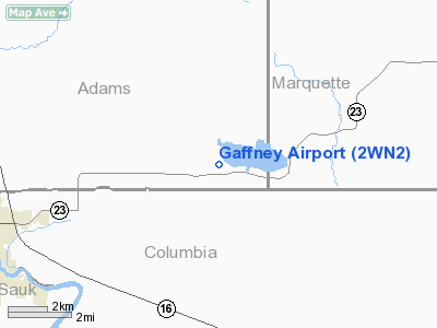
Location & QuickFacts
| FAA Information Effective: | 2008-09-25 |
| Airport Identifier: | 2WN2 |
| Airport Status: | Operational |
| Longitude/Latitude: | 089-37-49.0000W/43-39-15.1250N
-89.630278/43.654201 (Estimated) |
| Elevation: | 827 ft / 252.07 m (Estimated) |
| Land: | 0 acres |
| From nearest city: | 2 nautical miles W of Briggsville, WI |
| Location: | Adams County, WI |
| Magnetic Variation: | 01W () |
Owner & Manager
| Ownership: | Privately owned |
| Owner: | Michael J. Gaffney |
| Address: | 4119 2nd Lane
Briggsville, WI 53920 |
| Phone number: | 608-981-2238 |
| Manager: | Michael J. Gaffney |
| Address: | 4119 2nd Lane
Briggsville, WI 53920 |
| Phone number: | 608-981-2238 |
Airport Operations and Facilities
| Airport Use: | Private |
| Wind indicator: | Yes |
| Segmented Circle: | No |
| Control Tower: | No |
| Sectional chart: | Chicago |
| Region: | AGL - Great Lakes |
| Boundary ARTCC: | ZAU - Chicago |
| Tie-in FSS: | GRB - Green Bay |
| FSS Toll Free: | 1-800-WX-BRIEF |
Runway Information
Runway 18/36
| Dimension: | 1980 x 65 ft / 603.5 x 19.8 m |
| Surface: | TURF, |
| |
Runway 18 |
Runway 36 |
| Traffic Pattern: | Left | Left |
| Obstruction: | 30 ft trees, 920.0 ft from runway | 15 ft pline, 660.0 ft from runway |
|
Radio Navigation Aids
| ID |
Type |
Name |
Ch |
Freq |
Var |
Dist |
| HBW | NDB | Kickapoo | | 251.00 | 03E | 30.6 nm |
| MS | NDB | Monah | | 400.00 | 00E | 37.7 nm |
| UNU | NDB | Juneau | | 344.00 | 01W | 42.6 nm |
| ISW | NDB | Wisconsin Rapids | | 215.00 | 01W | 43.6 nm |
| CMY | NDB | Mccoy | | 412.00 | 00E | 47.1 nm |
| PCZ | NDB | Waupaca | | 382.00 | 01W | 48.6 nm |
| RYV | NDB | Rock River | | 371.00 | 01W | 48.9 nm |
| VOK | TACAN | Volk | 041X | | 00E | 32.3 nm |
| LNR | VOR/DME | Lone Rock | 075X | 112.80 | 00E | 30.8 nm |
| DLL | VORTAC | Dells | 117X | 117.00 | 03E | 8.5 nm |
| MSN | VORTAC | Madison | 023X | 108.60 | 03E | 33.1 nm |
Remarks
- PRVDD CLEAR 20:1 APCHS, CLEAR OBSTACLE FREE ZONE, AND CLEAR RY SAFETY AREA.
Images and information placed above are from
http://www.airport-data.com/airport/2WN2/
We thank them for the data!
| General Info
|
| Country |
United States
|
| State |
WISCONSIN
|
| FAA ID |
2WN2
|
| Latitude |
43-39-15.125N
|
| Longitude |
089-37-49.000W
|
| Elevation |
827 feet
|
| Near City |
BRIGGSVILLE
|
We don't guarantee the information is fresh and accurate. The data may
be wrong or outdated.
For more up-to-date information please refer to other sources.
|
|


