 |
|
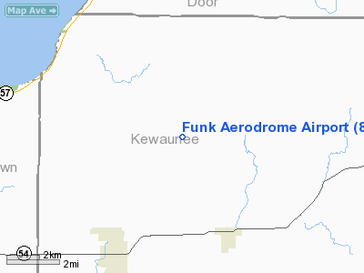
Location & QuickFacts
| FAA Information Effective: | 2008-09-25 |
| Airport Identifier: | 8WI6 |
| Airport Status: | Operational |
| Longitude/Latitude: | 087-39-10.3350W/44-36-34.9850N
-87.652871/44.609718 (Estimated) |
| Elevation: | 831 ft / 253.29 m (Surveyed) |
| Land: | 40 acres |
| From nearest city: | 5 nautical miles NE of Luxemburg, WI |
| Location: | Kewaunee County, WI |
| Magnetic Variation: | 02W (1985) |
Owner & Manager
| Ownership: | Privately owned |
| Owner: | Funk Aerodrome L. L. Corp |
| Address: | 1931 Airport Dr
Green Bay, WI 54313 |
| Phone number: | 414-487-5449 |
| Manager: | Ray Fulweiler |
| Address: | 1931 Airport Dr
Green Bay, WI 54313 |
| Phone number: | 414-494-3733 |
Airport Operations and Facilities
| Airport Use: | Private |
| Wind indicator: | Yes |
| Segmented Circle: | No |
| Control Tower: | No |
| Landing fee charge: | No |
| Sectional chart: | Green Bay |
| Region: | AGL - Great Lakes |
| Traffic Pattern Alt: | 1000 ft |
| Boundary ARTCC: | ZMP - Minneapolis |
| Tie-in FSS: | GRB - Green Bay |
| FSS on Airport: | No |
| FSS Toll Free: | 1-800-WX-BRIEF
OR LOCAL CALL 494-7417. |
Airport Services
| Airframe Repair: | NONE |
| Power Plant Repair: | NONE |
| Bottled Oxygen: | NONE |
| Bulk Oxygen: | NONE |
Runway Information
Runway 18/36
| Dimension: | 2250 x 75 ft / 685.8 x 22.9 m
SLOPES 6-8 FT DOWNHILL FM SOUTH END FOR FIRST 1000 FT. |
| Surface: | TURF, Fair Condition |
| |
Runway 18 |
Runway 36 |
| Traffic Pattern: | Left | Left |
| Markings: | None,
THR MKD WITH WHITE BARRELS. | None, |
| Obstruction: | 79 ft tree, 1580.0 ft from runway, 125 ft right of centerline, 20:1 slope to clear | , 50:1 slope to clear |
|
Radio Navigation Aids
| ID |
Type |
Name |
Ch |
Freq |
Var |
Dist |
| SUE | NDB | Sturgeon Bay | | 414.00 | 03W | 16.8 nm |
| OCQ | NDB | Oconto | | 388.00 | 03W | 19.5 nm |
| SG | NDB | Depre | | 332.00 | 02W | 24.2 nm |
| AQ | NDB | Kooky | | 407.00 | 02W | 39.8 nm |
| CLI | NDB | Clintonville | | 209.00 | 02W | 46.2 nm |
| MTW | VOR/DME | Manitowoc | 047X | 111.00 | 02W | 28.9 nm |
| MNM | VOR/DME | Menominee | 033X | 109.60 | 00E | 34.3 nm |
| GRB | VORTAC | Green Bay | 102X | 115.50 | 01E | 23.4 nm |
Remarks
- ARPT CLSD WINTERS DURG SNOW; FOR TRANSPORTATION CALL 414-837-7271/2253.
Images and information placed above are from
http://www.airport-data.com/airport/8WI6/
We thank them for the data!
| General Info
|
| Country |
United States
|
| State |
WISCONSIN
|
| FAA ID |
8WI6
|
| Latitude |
44-36-34.985N
|
| Longitude |
087-39-10.335W
|
| Elevation |
831 feet
|
| Near City |
LUXEMBURG
|
We don't guarantee the information is fresh and accurate. The data may
be wrong or outdated.
For more up-to-date information please refer to other sources.
|
|


