 |
|
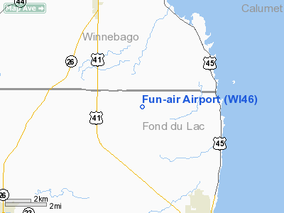
Location & QuickFacts
| FAA Information Effective: | 2008-09-25 |
| Airport Identifier: | WI46 |
| Airport Status: | Operational |
| Longitude/Latitude: | 088-32-23.5000W/43-52-58.1490N
-88.539861/43.882819 (Estimated) |
| Elevation: | 805 ft / 245.36 m (Estimated) |
| Land: | 0 acres |
| From nearest city: | 2 nautical miles E of Van Dyne, WI |
| Location: | Fond Du Lac County, WI |
| Magnetic Variation: | 02W (1995) |
Owner & Manager
| Ownership: | Privately owned |
| Owner: | Kenneth Appleby |
| Address: | N9393 Schultz Rd
Van Dyne, WI 54979 |
| Phone number: | 920-688-5108 |
| Manager: | Kenneth Appleby |
| Address: | N9393 Schultz Rd
Van Dyne, WI 54979 |
| Phone number: | 920-688-5108 |
Airport Operations and Facilities
| Airport Use: | Private |
| Segmented Circle: | No |
| Control Tower: | No |
| Sectional chart: | Chicago |
| Region: | AGL - Great Lakes |
| Boundary ARTCC: | ZAU - Chicago |
| Tie-in FSS: | GRB - Green Bay |
| FSS Toll Free: | 1-800-WX-BRIEF |
Runway Information
Runway 09/27
| Dimension: | 1400 x 60 ft / 426.7 x 18.3 m |
| Surface: | TURF, |
| |
Runway 09 |
Runway 27 |
| Longitude: | 089-48-47.5000W | 089-47-51.3700W |
| Latitude: | 45-28-10.0000N | 45-28-10.0000N |
| Elevation: | 1464.00 ft | 1486.00 ft |
| Traffic Pattern: | Left | Left |
| Obstruction: | 30 ft bldg, 50.0 ft from runway | |
|
Radio Navigation Aids
| ID |
Type |
Name |
Ch |
Freq |
Var |
Dist |
| AQ | NDB | Kooky | | 407.00 | 02W | 20.9 nm |
| UNU | NDB | Juneau | | 344.00 | 01W | 28.2 nm |
| HXF | NDB | Hartford | | 200.00 | 00E | 32.7 nm |
| LLE | NDB | Kettle Moraine | | 329.00 | 01W | 32.8 nm |
| PCZ | NDB | Waupaca | | 382.00 | 01W | 33.9 nm |
| SG | NDB | Depre | | 332.00 | 02W | 35.6 nm |
| RYV | NDB | Rock River | | 371.00 | 01W | 43.4 nm |
| CLI | NDB | Clintonville | | 209.00 | 02W | 45.0 nm |
| BJB | VOR | West Bend | | 109.80 | 01W | 33.1 nm |
| FAH | VOR/DME | Falls | 37X | 110.00 | 02W | 30.8 nm |
| MTW | VOR/DME | Manitowoc | 047X | 111.00 | 02W | 40.0 nm |
| OSH | VORTAC | Oshkosh | 055X | 111.80 | 02E | 6.5 nm |
| GRB | VORTAC | Green Bay | 102X | 115.50 | 01E | 43.1 nm |
| BAE | VORTAC | Badger | 111X | 116.40 | 02E | 47.4 nm |
Remarks
- ALL DEPS TO BE MADE TO THE E & ALL ARRS MADE FM THE W.
- PRVDD CLEAR 20:1 APCH, CLEAR OBSTACLE FREE ZONE & CLEAR RY SAFETY AREA.
Images and information placed above are from
http://www.airport-data.com/airport/WI46/
We thank them for the data!
| General Info
|
| Country |
United States
|
| State |
WISCONSIN
|
| FAA ID |
WI46
|
| Latitude |
43-52-58.149N
|
| Longitude |
088-32-23.500W
|
| Elevation |
805 feet
|
| Near City |
VAN DYNE
|
We don't guarantee the information is fresh and accurate. The data may
be wrong or outdated.
For more up-to-date information please refer to other sources.
|
|


