 |
|
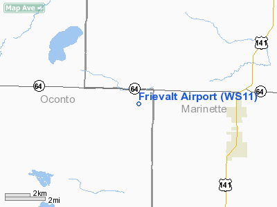
Location & QuickFacts
| FAA Information Effective: | 2008-09-25 |
| Airport Identifier: | WS11 |
| Airport Status: | Operational |
| Longitude/Latitude: | 088-08-00.3690W/45-06-00.9370N
-88.133436/45.100260 (Estimated) |
| Elevation: | 830 ft / 252.98 m (Estimated) |
| Land: | 0 acres |
| From nearest city: | 4 nautical miles W of Pound, WI |
| Location: | Oconto County, WI |
| Magnetic Variation: | 01W (1984) |
Owner & Manager
| Ownership: | Privately owned |
| Owner: | John K. Frievalt |
| Address: | 7539 Goldhorn Road
Pound, WI 54161-8700 |
| Phone number: | 414-897-3469 |
| Manager: | John K. Frievalt |
| Address: | 7539 Goldhorn Road
Pound, WI 54161-8700 |
| Phone number: | 414-897-3469 |
Airport Operations and Facilities
| Airport Use: | Private |
| Wind indicator: | Yes |
| Segmented Circle: | No |
| Control Tower: | No |
| Landing fee charge: | No |
| Sectional chart: | Green Bay |
| Region: | AGL - Great Lakes |
| Traffic Pattern Alt: | 1000 ft |
| Boundary ARTCC: | ZMP - Minneapolis |
| Tie-in FSS: | GRB - Green Bay |
| FSS on Airport: | No |
| FSS Toll Free: | 1-800-WX-BRIEF |
Runway Information
Runway 09/27
| Dimension: | 2050 x 25 ft / 624.8 x 7.6 m |
| Surface: | TURF, Good Condition |
| |
Runway 09 |
Runway 27 |
| Traffic Pattern: | Right | Left |
|
Radio Navigation Aids
| ID |
Type |
Name |
Ch |
Freq |
Var |
Dist |
| OCQ | NDB | Oconto | | 388.00 | 03W | 16.4 nm |
| SUE | NDB | Sturgeon Bay | | 414.00 | 03W | 34.1 nm |
| CLI | NDB | Clintonville | | 209.00 | 02W | 38.6 nm |
| AIG | NDB | Antigo | | 347.00 | 02W | 41.7 nm |
| SG | NDB | Depre | | 332.00 | 02W | 42.2 nm |
| MNM | VOR/DME | Menominee | 033X | 109.60 | 00E | 21.2 nm |
| IMT | VOR/DME | Iron Mountain | 049X | 111.20 | 02W | 43.0 nm |
| GRB | VORTAC | Green Bay | 102X | 115.50 | 01E | 32.9 nm |
Remarks
- STRIP NOT USEABLE DURING WINTER MONTHS AND SPRING THAW.
- SEVERE WIND SHEAR SHORT FINAL RWY 27 WHEN WINDS ARE S-SW.
Images and information placed above are from
http://www.airport-data.com/airport/WS11/
We thank them for the data!
| General Info
|
| Country |
United States
|
| State |
WISCONSIN
|
| FAA ID |
WS11
|
| Latitude |
45-06-00.937N
|
| Longitude |
088-08-00.369W
|
| Elevation |
830 feet
|
| Near City |
POUND
|
We don't guarantee the information is fresh and accurate. The data may
be wrong or outdated.
For more up-to-date information please refer to other sources.
|
|


