 |
|
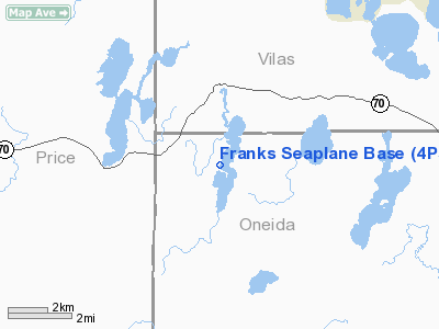
Franks Seaplane Base Airport |
Location & QuickFacts
| FAA Information Effective: | 2008-09-25 |
| Airport Identifier: | 4P5 |
| Airport Status: | Operational |
| Longitude/Latitude: | 090-00-00.5570W/45-52-59.8280N
-90.000155/45.883286 (Estimated) |
| Elevation: | 1650 ft / 502.92 m (Estimated) |
| Land: | 0 acres |
| From nearest city: | 7 nautical miles SW of Lac Du Flambeau, WI |
| Location: | Oneida County, WI |
| Magnetic Variation: | 00W (1985) |
Owner & Manager
| Ownership: | Privately owned |
| Owner: | Frank Gallina |
| Address: | 13726 Crissie Lane
Lac Du Flambeau, WI 54538 |
| Phone number: | 715-588-1433
WINTER PHONE 561-569-3473. |
| Manager: | Frank Gallina |
| Address: | 13726 Crissie Lane
Lac Du Flambeau, WI 54538 |
| Phone number: | 715-588-1433 |
Airport Operations and Facilities
| Airport Use: | Open to public |
| Wind indicator: | No |
| Segmented Circle: | No |
| Control Tower: | No |
| Landing fee charge: | No |
| Sectional chart: | Green Bay |
| Region: | AGL - Great Lakes |
| Boundary ARTCC: | ZMP - Minneapolis |
| Tie-in FSS: | GRB - Green Bay |
| FSS on Airport: | No |
| FSS Toll Free: | 1-800-WX-BRIEF |
| NOTAMs Facility: | GRB (NOTAM-d service avaliable) |
Airport Communications
Airport Services
| Fuel available: | 80
CALL AHEAD TO ENSURE FUEL AVBL. |
| Bottled Oxygen: | NONE |
| Bulk Oxygen: | NONE |
Runway Information
Runway E/W
| Dimension: | 2640 x 1000 ft / 804.7 x 304.8 m |
| Surface: | WATER, |
| |
Runway E |
Runway W |
| Traffic Pattern: | Left | Left |
|
Runway N/S
| Dimension: | 9000 x 1000 ft / 2743.2 x 304.8 m |
| Surface: | WATER, |
| |
Runway N |
Runway S |
| Traffic Pattern: | Left | Left |
|
Radio Navigation Aids
| ID |
Type |
Name |
Ch |
Freq |
Var |
Dist |
| ARV | NDB | Arbor Vitae | | 221.00 | 01W | 11.6 nm |
| DO | NDB | Dougy | | 236.00 | 01W | 11.7 nm |
| MHA | NDB | Manitowish | | 364.00 | 01W | 15.2 nm |
| PKF | NDB | Park Falls | | 371.00 | 01W | 18.3 nm |
| PBH | NDB | Phillips | | 263.00 | 00E | 20.4 nm |
| BDJ | NDB | Boulder Junction | | 206.00 | 02E | 20.8 nm |
| EGV | NDB | Eagle River | | 341.00 | 02W | 31.0 nm |
| LNL | NDB | Land O Lakes | | 396.00 | 02W | 36.6 nm |
| RXW | NDB | Watersmeet | | 407.00 | 01E | 38.7 nm |
| RRL | NDB | Merrill | | 257.00 | 01W | 43.0 nm |
| RCX | NDB | Rusk County | | 356.00 | 00W | 47.9 nm |
| MDZ | NDB | Medford | | 335.00 | 00E | 48.5 nm |
| RHI | VORTAC | Rhinelander | 029X | 109.20 | 02E | 27.2 nm |
| IWD | VORTAC | Ironwood | 025X | 108.80 | 01E | 39.4 nm |
Remarks
Images and information placed above are from
http://www.airport-data.com/airport/4P5/
We thank them for the data!
| General Info
|
| Country |
United States
|
| State |
WISCONSIN
|
| FAA ID |
4P5
|
| Latitude |
45-52-59.828N
|
| Longitude |
090-00-00.557W
|
| Elevation |
1650 feet
|
| Near City |
LAC DU FLAMBEAU
|
We don't guarantee the information is fresh and accurate. The data may
be wrong or outdated.
For more up-to-date information please refer to other sources.
|
|


