|
|
 |
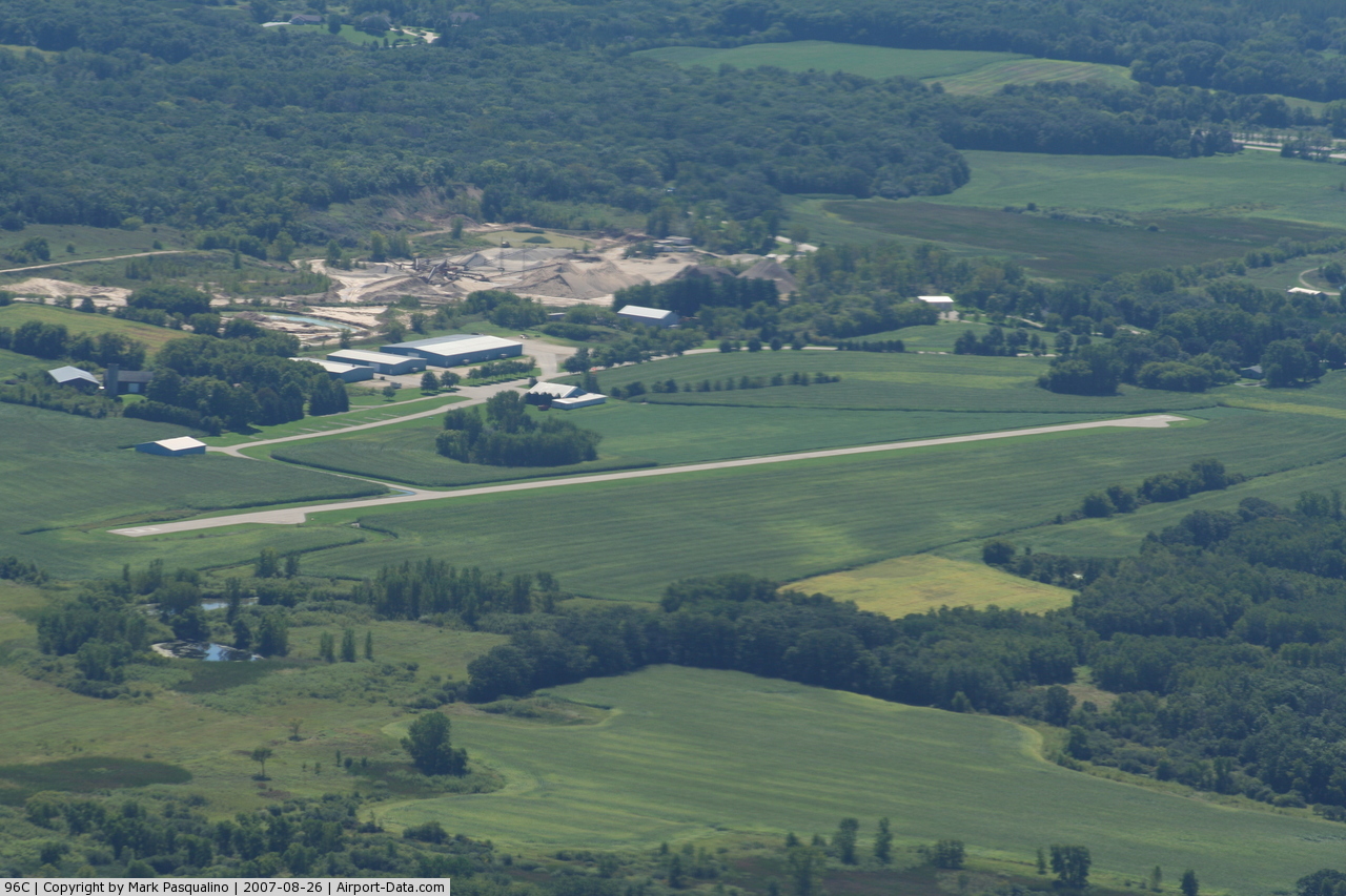
(Click on the photo to enlarge) |
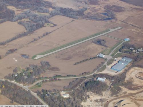 |
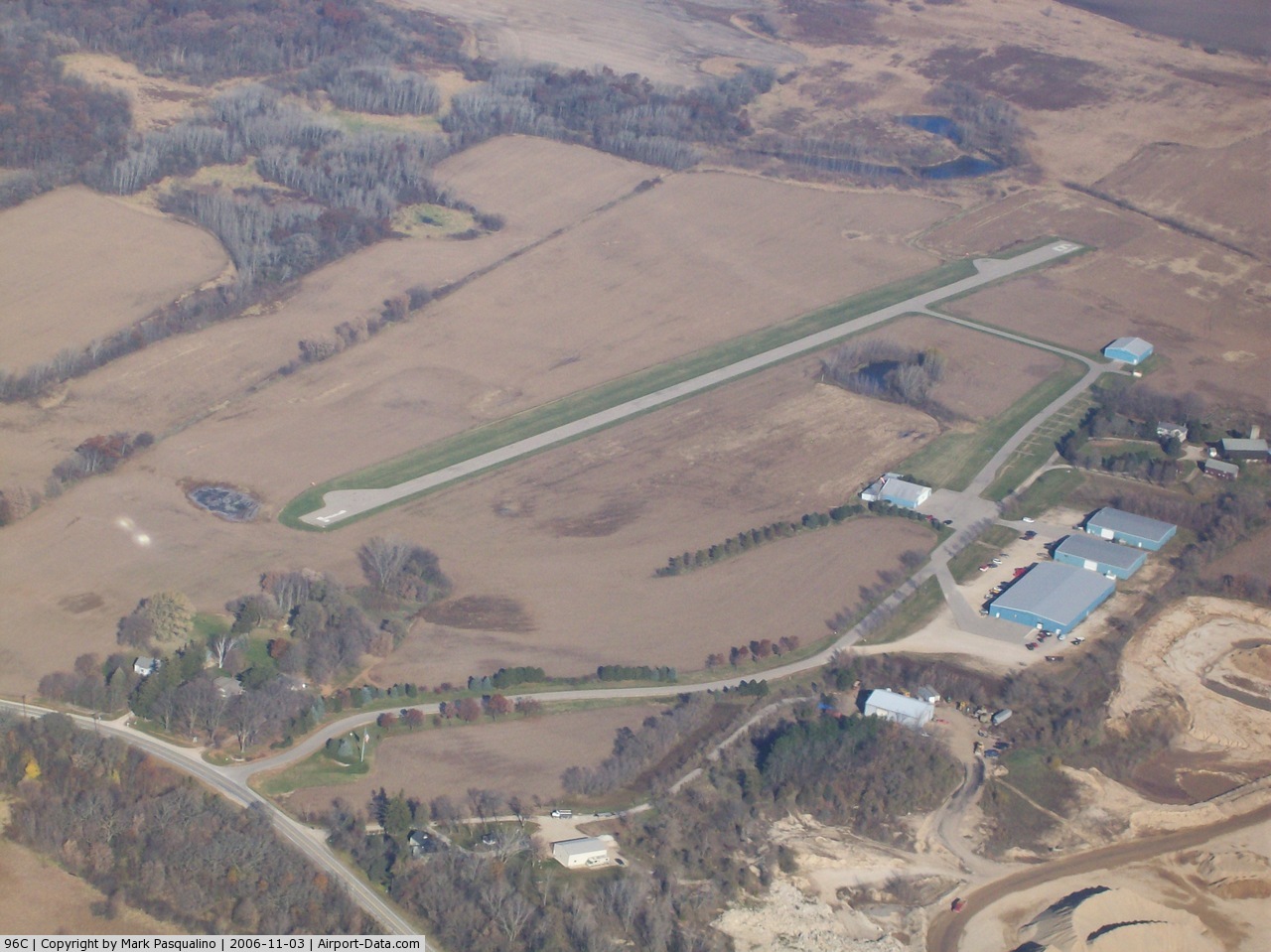
(Click on the photo to enlarge) |
Location & QuickFacts
| FAA Information Effective: | 2008-09-25 |
| Airport Identifier: | 96C |
| Airport Status: | Operational |
| Longitude/Latitude: | 088-15-03.3260W/42-45-00.0590N
-88.250924/42.750016 (Estimated) |
| Elevation: | 822 ft / 250.55 m (Estimated) |
| Land: | 20 acres |
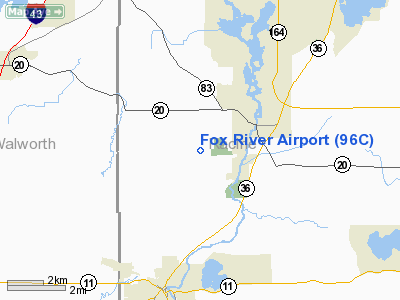
| From nearest city: | 2 nautical miles NW of Rochester, WI |
| Location: | Racine County, WI |
| Magnetic Variation: | 01W (1985) |
Owner & Manager
| Ownership: | Privately owned |
| Owner: | Jerry Kay Mehlhaff |
| Address: | Po Box 355
Rochester, WI 53167 |
| Phone number: | 262-534-6315 |
| Manager: | Jerry Kay Mehlhaff |
| Address: | Po Box 355
Rochester, WI 53167 |
| Phone number: | 262-534-6315 |
Airport Operations and Facilities
| Airport Use: | Open to public |
| Wind indicator: | Yes |
| Segmented Circle: | No |
| Control Tower: | No |
| Landing fee charge: | No |
| Sectional chart: | Chicago |
| Region: | AGL - Great Lakes |
| Boundary ARTCC: | ZAU - Chicago |
| Tie-in FSS: | GRB - Green Bay |
| FSS on Airport: | No |
| FSS Toll Free: | 1-800-WX-BRIEF |
| NOTAMs Facility: | GRB (NOTAM-d service avaliable) |
Airport Communications
Airport Services
Runway Information
Runway 01/19
| Dimension: | 2500 x 36 ft / 762.0 x 11.0 m
RWY ASPH IS 10-15'WIDER LAST 300'EA END. |
| Surface: | ASPH, Good Condition |
| |
Runway 01 |
Runway 19 |
| Longitude: | 088-15-00.3200W | 088-15-02.3800W |
| Latitude: | 42-44-51.0500N | 42-45-15.7600N |
| Elevation: | 822.00 ft | 822.00 ft |
| Traffic Pattern: | Left | Left |
| Markings: | Basic, Good Condition | Basic, Good Condition |
| Runway End Identifier: | No | No |
| Centerline Lights: | No | No |
| Touchdown Lights: | No | No |
| Obstruction: | 50 ft trees, 1000.0 ft from runway, 120 ft right of centerline, 16:1 slope to clear | 20 ft trees, 300.0 ft from runway, 80 ft left of centerline, 5:1 slope to clear |
|
Radio Navigation Aids
| ID |
Type |
Name |
Ch |
Freq |
Var |
Dist |
| GM | NDB | Teels | | 242.00 | 02W | 13.3 nm |
| LVV | NDB | Lake Lawn | | 404.00 | 00W | 15.4 nm |
| RA | NDB | Paser | | 206.00 | 00E | 16.0 nm |
| UES | NDB | Waukesha | | 359.00 | 01W | 17.7 nm |
| BL | NDB | Yanks | | 260.00 | 02W | 24.9 nm |
| RYV | NDB | Rock River | | 371.00 | 01W | 32.9 nm |
| JVL | NDB | Janesville | | 375.00 | 03E | 35.9 nm |
| HXF | NDB | Hartford | | 200.00 | 00E | 36.5 nm |
| LLE | NDB | Kettle Moraine | | 329.00 | 01W | 40.9 nm |
| UNU | NDB | Juneau | | 344.00 | 01W | 45.4 nm |
| ME | NDB | Deana | | 350.00 | 00E | 48.1 nm |
| BJB | VOR | West Bend | | 109.80 | 01W | 40.8 nm |
| BUU | VOR/DME | Burbun | 092X | 114.50 | 01W | 4.3 nm |
| ENW | VOR/DME | Kenosha | 029X | 109.20 | 02W | 16.8 nm |
| HRK | VOR/DME | Horlick | 124X | 117.70 | 02W | 19.3 nm |
| LJT | VOR/DME | Timmerman | 072X | 112.50 | 02W | 23.6 nm |
| OBK | VOR/DME | Northbrook | 077X | 113.00 | 02W | 34.4 nm |
| JVL | VOR/DME | Janesville | 090X | 114.30 | 03E | 39.5 nm |
| ORD | VOR/DME | Chicago O'hare | 086X | 113.90 | 02E | 48.3 nm |
| BAE | VORTAC | Badger | 111X | 116.40 | 02E | 22.1 nm |
| MKE | VOT | Milwaukee | | 109.00 | | 19.6 nm |
| ORD | VOT | Chicago O'hare Intl | | 112.00 | | 48.6 nm |
Images and information placed above are from
http://www.airport-data.com/airport/96C/
We thank them for the data!
| General Info
|
| Country |
United States
|
| State |
WISCONSIN
|
| FAA ID |
96C
|
| Latitude |
42-45-00.059N
|
| Longitude |
088-15-03.326W
|
| Elevation |
822 feet
|
| Near City |
ROCHESTER
|
We don't guarantee the information is fresh and accurate. The data may
be wrong or outdated.
For more up-to-date information please refer to other sources.
|
|