|
|
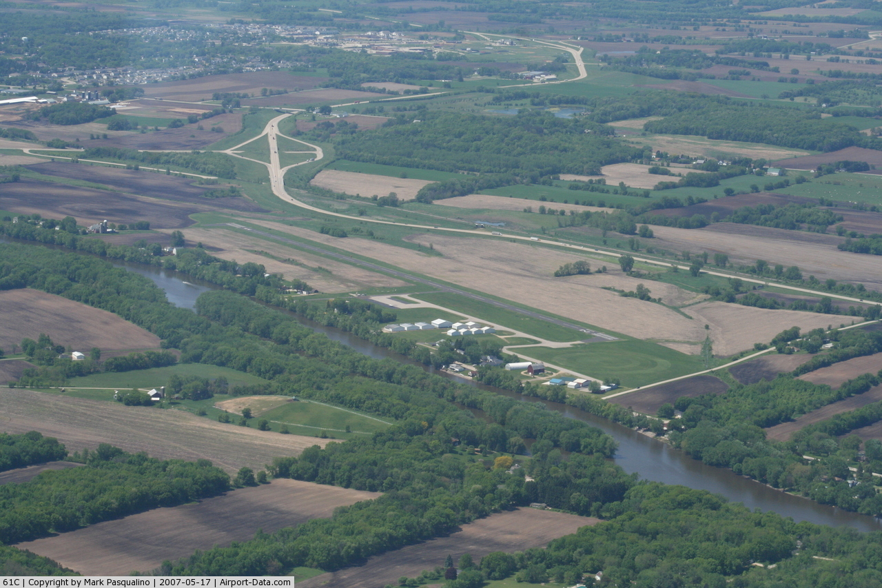
Fort Atkinson Muni Airport |
 |
(Click on the photo to enlarge) |
 |
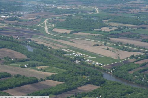
(Click on the photo to enlarge) |
Location & QuickFacts
| FAA Information Effective: | 2008-09-25 |
| Airport Identifier: | 61C |
| Airport Status: | Operational |
| Longitude/Latitude: | 088-49-03.4610W/42-57-47.5300N
-88.817628/42.963203 (Estimated) |
| Elevation: | 800 ft / 243.84 m (Surveyed) |
| Land: | 118 acres |
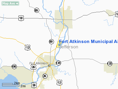
| From nearest city: | 3 nautical miles NE of Fort Atkinson, WI |
| Location: | Jefferson County, WI |
| Magnetic Variation: | 02W (2000) |
Owner & Manager
| Ownership: | Publicly owned |
| Owner: | City Of Ft. Atkinson |
| Address: | 101 North Main St
Fort Atkinson, WI 53538 |
| Phone number: | 920-563-7760 |
| Manager: | Jeff Woods |
| Address: | 101 N Main St
Fort Atkinson, WI 53538 |
| Phone number: | 920-563-7760 |
Airport Operations and Facilities
| Airport Use: | Open to public |
| Wind indicator: | Yes |
| Segmented Circle: | Yes |
| Control Tower: | No |
| Lighting Schedule: | DUSK-DAWN
MIRL RY 03/21 PRESET ON LOW INTST; TO ACTVT HIGHER INTST & PAPI RY 21- CTAF. |
| Beacon Color: | Clear-Green (lighted land airport) |
| Landing fee charge: | No |
| Sectional chart: | Chicago |
| Region: | AGL - Great Lakes |
| Traffic Pattern Alt: | 1000 ft |
| Boundary ARTCC: | ZAU - Chicago |
| Tie-in FSS: | GRB - Green Bay |
| FSS on Airport: | No |
| FSS Toll Free: | 1-800-WX-BRIEF |
| NOTAMs Facility: | GRB (NOTAM-d service avaliable) |
| Federal Agreements: | NGY |
Airport Communications
Airport Services
| Fuel available: | 100LLMOGAS
FUEL AVBL PPR CALL 920-563-7760. |
| Airframe Repair: | NONE |
| Power Plant Repair: | NONE |
| Bottled Oxygen: | NONE |
| Bulk Oxygen: | NONE |
Runway Information
Runway 03/21
| Dimension: | 3801 x 60 ft / 1158.5 x 18.3 m |
| Surface: | ASPH, Good Condition |
| Weight Limit: | Single wheel: 12000 lbs. |
| Edge Lights: | Medium |
| |
Runway 03 |
Runway 21 |
| Longitude: | 088-49-15.5260W | 088-48-51.3940W |
| Latitude: | 42-57-30.9820N | 42-58-04.0760N |
| Elevation: | 798.00 ft | 795.00 ft |
| Alignment: | 28 | 127 |
| Traffic Pattern: | Left | Left |
| Markings: | Non-precision instrument, Good Condition | Non-precision instrument, Good Condition |
| Crossing Height: | 0.00 ft | 30.00 ft |
| VASI: | | 2-light PAPI on left side |
| Visual Glide Angle: | 0.00° | 3.00° |
| Obstruction: | 47 ft tree, 1350.0 ft from runway, 220 ft right of centerline, 24:1 slope to clear | 26 ft trees, 800.0 ft from runway, 23:1 slope to clear |
|
Radio Navigation Aids
| ID |
Type |
Name |
Ch |
Freq |
Var |
Dist |
| RYV | NDB | Rock River | | 371.00 | 01W | 13.3 nm |
| LVV | NDB | Lake Lawn | | 404.00 | 00W | 18.7 nm |
| JVL | NDB | Janesville | | 375.00 | 03E | 23.1 nm |
| MS | NDB | Monah | | 400.00 | 00E | 24.0 nm |
| UES | NDB | Waukesha | | 359.00 | 01W | 26.1 nm |
| UNU | NDB | Juneau | | 344.00 | 01W | 28.5 nm |
| HXF | NDB | Hartford | | 200.00 | 00E | 29.6 nm |
| GM | NDB | Teels | | 242.00 | 02W | 34.3 nm |
| LLE | NDB | Kettle Moraine | | 329.00 | 01W | 41.1 nm |
| BL | NDB | Yanks | | 260.00 | 02W | 41.8 nm |
| RA | NDB | Paser | | 206.00 | 00E | 43.9 nm |
| BJB | VOR | West Bend | | 109.80 | 01W | 41.0 nm |
| JVL | VOR/DME | Janesville | 090X | 114.30 | 03E | 27.5 nm |
| BUU | VOR/DME | Burbun | 092X | 114.50 | 01W | 28.1 nm |
| LJT | VOR/DME | Timmerman | 072X | 112.50 | 02W | 35.4 nm |
| ENW | VOR/DME | Kenosha | 029X | 109.20 | 02W | 44.8 nm |
| HRK | VOR/DME | Horlick | 124X | 117.70 | 02W | 45.8 nm |
| RFD | VOR/DME | Rockford | 045X | 110.80 | 01E | 47.4 nm |
| BAE | VORTAC | Badger | 111X | 116.40 | 02E | 25.2 nm |
| MSN | VORTAC | Madison | 023X | 108.60 | 03E | 25.4 nm |
| MKE | VOT | Milwaukee | | 109.00 | | 40.5 nm |
Remarks
- RY 03/21 PILOTS REQUESTED TO FLY RY HEADING & CLIMB TO 1400 FT MSL BEFORE TURNING EAST.
- ULTRALIGHT ACTVTY ON & IN VCNTY OF ARPT.
- CONSTR PRIOR TO 1959
Images and information placed above are from
http://www.airport-data.com/airport/61C/
We thank them for the data!
| General Info
|
| Country |
United States
|
| State |
WISCONSIN
|
| FAA ID |
61C
|
| Latitude |
42-57-47.530N
|
| Longitude |
088-49-03.461W
|
| Elevation |
800 feet
|
| Near City |
FORT ATKINSON
|
We don't guarantee the information is fresh and accurate. The data may
be wrong or outdated.
For more up-to-date information please refer to other sources.
|
|