 |
|
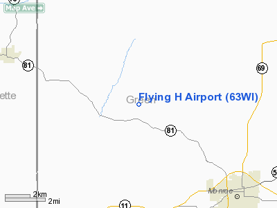
Location & QuickFacts
| FAA Information Effective: | 2008-09-25 |
| Airport Identifier: | 63WI |
| Airport Status: | Operational |
| Longitude/Latitude: | 089-44-15.4380W/42-39-57.0220N
-89.737622/42.665839 (Estimated) |
| Elevation: | 1020 ft / 310.90 m (Estimated) |
| Land: | 0 acres |
| From nearest city: | 6 nautical miles NW of Monroe, WI |
| Location: | Green County, WI |
| Magnetic Variation: | 01E (1985) |
Owner & Manager
| Ownership: | Privately owned |
| Owner: | Charles W. Huber |
| Address: | Hwy 81w 7684
Monroe, WI 53566 |
| Phone number: | 608-325-5483 |
| Manager: | Charles W. Huber |
| Address: | Hwy 81w 7684
Monroe, WI 53566 |
| Phone number: | 608-325-5483 |
Airport Operations and Facilities
| Airport Use: | Private |
| Wind indicator: | Yes |
| Segmented Circle: | No |
| Control Tower: | No |
| Landing fee charge: | No |
| Sectional chart: | Chicago |
| Region: | AGL - Great Lakes |
| Boundary ARTCC: | ZAU - Chicago |
| Tie-in FSS: | GRB - Green Bay |
| FSS on Airport: | No |
| FSS Toll Free: | 1-800-WX-BRIEF |
Runway Information
Runway 14/32
| Dimension: | 2250 x 50 ft / 685.8 x 15.2 m |
| Surface: | TURF, |
| |
Runway 14 |
Runway 32 |
| Traffic Pattern: | Left | Left |
| Obstruction: | 30 ft pline, 2500.0 ft from runway | |
|
Radio Navigation Aids
| ID |
Type |
Name |
Ch |
Freq |
Var |
Dist |
| MRJ | NDB | Mineral Point | | 365.00 | 00W | 25.4 nm |
| FEP | NDB | Freeport | | 335.00 | 00E | 26.1 nm |
| MS | NDB | Monah | | 400.00 | 00E | 29.4 nm |
| PVB | NDB | Platteville | | 203.00 | 01E | 30.9 nm |
| JVL | NDB | Janesville | | 375.00 | 03E | 30.9 nm |
| JVL | VOR/DME | Janesville | 090X | 114.30 | 03E | 28.7 nm |
| RFD | VOR/DME | Rockford | 045X | 110.80 | 01E | 35.6 nm |
| LNR | VOR/DME | Lone Rock | 075X | 112.80 | 00E | 41.6 nm |
| PLL | VOR/DME | Polo | 049X | 111.20 | 03E | 43.1 nm |
| MSN | VORTAC | Madison | 023X | 108.60 | 03E | 33.7 nm |
| DBQ | VORTAC | Dubuque | 105X | 115.80 | 04E | 45.9 nm |
Images and information placed above are from
http://www.airport-data.com/airport/63WI/
We thank them for the data!
| General Info
|
| Country |
United States
|
| State |
WISCONSIN
|
| FAA ID |
63WI
|
| Latitude |
42-39-57.022N
|
| Longitude |
089-44-15.438W
|
| Elevation |
1020 feet
|
| Near City |
MONROE
|
We don't guarantee the information is fresh and accurate. The data may
be wrong or outdated.
For more up-to-date information please refer to other sources.
|
|


