 |
|
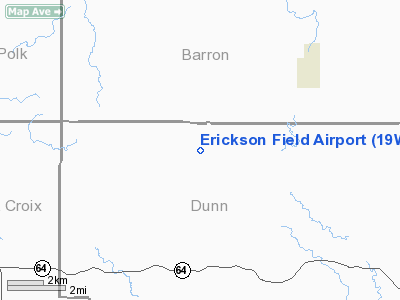
Location & QuickFacts
| FAA Information Effective: | 2008-09-25 |
| Airport Identifier: | 19WI |
| Airport Status: | Operational |
| Longitude/Latitude: | 092-03-25.6520W/45-11-42.8640N
-92.057126/45.195240 (Estimated) |
| Elevation: | 1180 ft / 359.66 m (Estimated) |
| Land: | 0 acres |
| From nearest city: | 4 nautical miles SW of Prairie Farm, WI |
| Location: | Dunn County, WI |
| Magnetic Variation: | 02E (1985) |
Owner & Manager
| Ownership: | Privately owned |
| Owner: | Melvin Erickson |
| Address: | Rte 1
Prairie Farm, WI 54762 |
| Phone number: | 715-455-1656 |
| Manager: | Melvin Erickson |
| Address: | Rte 1
Prairie Farm, WI 54762 |
| Phone number: | 715-455-1656 |
Airport Operations and Facilities
| Airport Use: | Private |
| Wind indicator: | Yes |
| Segmented Circle: | No |
| Control Tower: | No |
| Sectional chart: | Green Bay |
| Region: | AGL - Great Lakes |
| Boundary ARTCC: | ZMP - Minneapolis |
| Tie-in FSS: | GRB - Green Bay |
| FSS on Airport: | No |
| FSS Toll Free: | 1-800-WX-BRIEF |
Runway Information
Runway N/S
| Dimension: | 2200 x 50 ft / 670.6 x 15.2 m |
| Surface: | TURF, |
| |
Runway N |
Runway S |
| Traffic Pattern: | Left | Left |
|
Radio Navigation Aids
| ID |
Type |
Name |
Ch |
Freq |
Var |
Dist |
| AHH | NDB | Ameron | | 278.00 | 01E | 14.3 nm |
| UBE | NDB | Cumberland | | 375.00 | 01E | 19.2 nm |
| RNH | NDB | New Richmond | | 257.00 | 02E | 20.4 nm |
| OEO | NDB | Osceola | | 233.00 | 01E | 27.6 nm |
| SSQ | NDB | Shell Lake | | 212.00 | 01E | 32.5 nm |
| BXR | NDB | Big Doctor | | 203.00 | 02E | 39.8 nm |
| PPI | NDB | Hopey | | 400.00 | 03E | 42.3 nm |
| RCX | NDB | Rusk County | | 356.00 | 00W | 48.3 nm |
| ROS | NDB | Rush City | | 282.00 | 02E | 48.4 nm |
| MS | NDB | Narco | | 266.00 | 02E | 49.2 nm |
| RPD | VOR/DME | Rice Lake | 037X | 110.00 | 01E | 17.7 nm |
| RZN | VOR/DME | Siren | 031X | 109.40 | 02E | 39.9 nm |
| EAU | VORTAC | Eau Claire | 076X | 112.90 | 04E | 30.4 nm |
| STP | VOT | St Paul | | 114.40 | | 45.2 nm |
Remarks
- FILED FOR RECORD PURPOSES ONLY.
Images and information placed above are from
http://www.airport-data.com/airport/19WI/
We thank them for the data!
| General Info
|
| Country |
United States
|
| State |
WISCONSIN
|
| FAA ID |
19WI
|
| Latitude |
45-11-42.864N
|
| Longitude |
092-03-25.652W
|
| Elevation |
1180 feet
|
| Near City |
PRAIRIE FARM
|
We don't guarantee the information is fresh and accurate. The data may
be wrong or outdated.
For more up-to-date information please refer to other sources.
|
|


