|
|
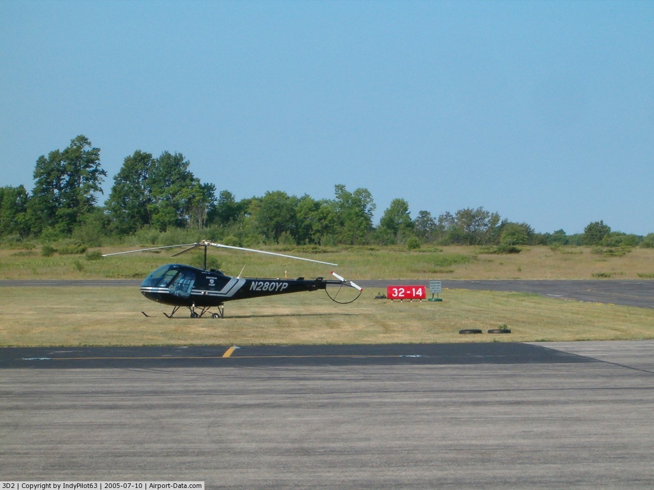
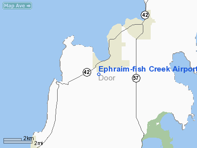
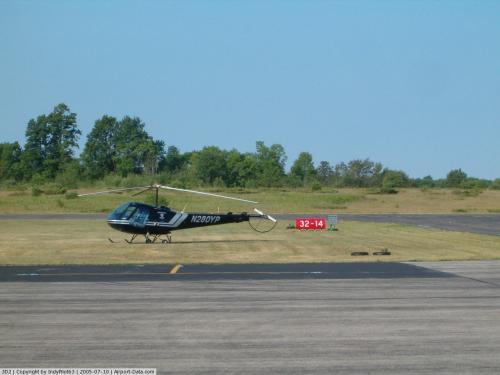
Ephraim-fish Creek Airport |
 |
(Click on the photo to enlarge) |
 |
(Click on the photo to enlarge) |
Location & QuickFacts
| FAA Information Effective: | 2008-09-25 |
| Airport Identifier: | 3D2 |
| Airport Status: | Operational |
| Longitude/Latitude: | 087-11-09.1160W/45-08-07.2880N
-87.185866/45.135358 (Estimated) |
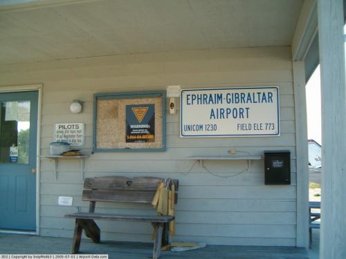
| Elevation: | 773 ft / 235.61 m (Surveyed) |
| Land: | 160 acres |
| From nearest city: | 1 nautical miles SW of Ephraim, WI |
| Location: | Door County, WI |
| Magnetic Variation: | 04W (2000) |
Owner & Manager
| Ownership: | Publicly owned
ARPT LEASED TO EAGLE HARBOR AIR SERVICE INC. |
| Owner: | Village Of Ephraim
& TOWN OF GIBRALTAR, BETH HAGEN TOWN CLERK. |
| Address: | Village Board
Ephraim, WI 54211 |
| Phone number: | 920-868-1714 |
| Manager: | Pete Newkirk |
| Address: | 11472 Lake View Road
Ellison Bay, WI 54210 |
| Phone number: | 920-854-1147
APT PHONE NUMBER 920-854-9711, CELL 920-421-0607 |
Airport Operations and Facilities
| Airport Use: | Open to public |
| Wind indicator: | Yes |
| Segmented Circle: | Yes |
| Control Tower: | No |
| Lighting Schedule: | DUSK-DAWN
ACTVT MIRL RY 14/32, PAPI RWYS 14/32 - CTAF. |
| Beacon Color: | Clear-Green (lighted land airport) |
| Landing fee charge: | No |
| Sectional chart: | Green Bay |
| Region: | AGL - Great Lakes |
| Boundary ARTCC: | ZMP - Minneapolis |
| Tie-in FSS: | GRB - Green Bay |
| FSS on Airport: | No |
| FSS Toll Free: | 1-800-WX-BRIEF |
| NOTAMs Facility: | GRB (NOTAM-d service avaliable) |
| Federal Agreements: | NY1 |
Airport Communications
| CTAF: | 123.000 |
| Unicom: | 123.000 |
Airport Services
| Fuel available: | 100LL |
| Airframe Repair: | MINOR |
| Power Plant Repair: | MINOR |
| Bottled Oxygen: | NONE |
| Bulk Oxygen: | NONE |
Runway Information
Runway 01/19
| Dimension: | 1980 x 80 ft / 603.5 x 24.4 m |
| Surface: | TURF, Fair Condition
SLOPES MDTELY DOWN TO SOUTH--CANNOT SEE ONE END FM THE OTHER. |
| |
Runway 01 |
Runway 19 |
| Traffic Pattern: | Left | Left |
| Markings: | None,
01/19 ENDS & EDGES MKD WITH YELLOW BARRELS. | None, |
| Obstruction: | 25 ft trees, 950.0 ft from runway, 150 ft right of centerline, 38:1 slope to clear | 45 ft trees, 900.0 ft from runway, 200 ft left of centerline, 20:1 slope to clear |
|
Runway 14/32
| Dimension: | 2700 x 60 ft / 823.0 x 18.3 m |
| Surface: | ASPH, Good Condition
SLOPES MDTELY DOWN TO SOUTH--CANNOT SEE ONE END FM THE OTHER. |
| Weight Limit: | Single wheel: 12500 lbs. |
| Edge Lights: | Medium |
| |
Runway 14 |
Runway 32 |
| Longitude: | 087-11-22.1380W | 087-10-56.0950W |
| Latitude: | 45-08-16.9120N | 45-07-57.6620N |
| Elevation: | 762.00 ft | 750.00 ft |
| Alignment: | 127 | 127 |
| Traffic Pattern: | Left | Left |
| Markings: | Non-precision instrument, Fair Condition | Non-precision instrument, Fair Condition |
| Crossing Height: | 24.00 ft | 25.00 ft |
| VASI: | 2-light PAPI on left side | 2-light PAPI on left side |
| Visual Glide Angle: | 3.50° | 3.00° |
| Runway End Identifier: | No | No |
| Centerline Lights: | No | No |
| Touchdown Lights: | No | No |
| Obstruction: | 60 ft trees, 1400.0 ft from runway, 210 ft left of centerline, 20:1 slope to clear | 40 ft trees, 1000.0 ft from runway, 300 ft right of centerline, 20:1 slope to clear |
|
Radio Navigation Aids
| ID |
Type |
Name |
Ch |
Freq |
Var |
Dist |
| SUE | NDB | Sturgeon Bay | | 414.00 | 03W | 20.6 nm |
| OCQ | NDB | Oconto | | 388.00 | 03W | 34.6 nm |
| MNM | VOR/DME | Menominee | 033X | 109.60 | 00E | 19.7 nm |
| ESC | VOR/DME | Escanaba | 045X | 110.80 | 00E | 35.5 nm |
Images and information placed above are from
http://www.airport-data.com/airport/3D2/
We thank them for the data!
| General Info
|
| Country |
United States
|
| State |
WISCONSIN
|
| FAA ID |
3D2
|
| Latitude |
45-08-07.288N
|
| Longitude |
087-11-09.116W
|
| Elevation |
773 feet
|
| Near City |
EPHRAIM
|
We don't guarantee the information is fresh and accurate. The data may
be wrong or outdated.
For more up-to-date information please refer to other sources.
|
|