 |
|
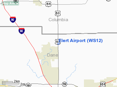
Location & QuickFacts
| FAA Information Effective: | 2008-09-25 |
| Airport Identifier: | WS12 |
| Airport Status: | Operational |
| Longitude/Latitude: | 089-19-23.4180W/43-15-51.9660N
-89.323172/43.264435 (Estimated) |
| Elevation: | 972 ft / 296.27 m (Surveyed) |
| Land: | 0 acres |
| From nearest city: | 1 nautical miles NE of De Forest, WI |
| Location: | Dane County, WI |
| Magnetic Variation: | 00W (1985) |
Owner & Manager
| Ownership: | Privately owned |
| Owner: | Blayde Elert |
| Address: |
|
| Phone number: | 608-846-2550 |
| Manager: | Blayde Elert |
| Address: | 517 W. North St
De Forest, WI 53532 |
| Phone number: | 608-846-2550 |
Airport Operations and Facilities
| Airport Use: | Private |
| Wind indicator: | Yes |
| Segmented Circle: | No |
| Control Tower: | No |
| Sectional chart: | Chicago |
| Region: | AGL - Great Lakes |
| Boundary ARTCC: | ZAU - Chicago |
| Tie-in FSS: | GRB - Green Bay |
| FSS on Airport: | No |
| FSS Toll Free: | 1-800-WX-BRIEF |
Runway Information
Runway N/S
| Dimension: | 1978 x 50 ft / 602.9 x 15.2 m |
| Surface: | TURF, |
| |
Runway N |
Runway S |
| Traffic Pattern: | Left | Left |
|
Radio Navigation Aids
| ID |
Type |
Name |
Ch |
Freq |
Var |
Dist |
| MS | NDB | Monah | | 400.00 | 00E | 12.2 nm |
| RYV | NDB | Rock River | | 371.00 | 01W | 26.8 nm |
| UNU | NDB | Juneau | | 344.00 | 01W | 28.9 nm |
| HXF | NDB | Hartford | | 200.00 | 00E | 40.8 nm |
| JVL | NDB | Janesville | | 375.00 | 03E | 41.0 nm |
| MRJ | NDB | Mineral Point | | 365.00 | 00W | 45.7 nm |
| LVV | NDB | Lake Lawn | | 404.00 | 00W | 46.8 nm |
| UES | NDB | Waukesha | | 359.00 | 01W | 49.5 nm |
| HBW | NDB | Kickapoo | | 251.00 | 03E | 49.9 nm |
| LNR | VOR/DME | Lone Rock | 075X | 112.80 | 00E | 35.5 nm |
| JVL | VOR/DME | Janesville | 090X | 114.30 | 03E | 43.5 nm |
| MSN | VORTAC | Madison | 023X | 108.60 | 03E | 7.2 nm |
| DLL | VORTAC | Dells | 117X | 117.00 | 03E | 25.8 nm |
| BAE | VORTAC | Badger | 111X | 116.40 | 02E | 46.4 nm |
Remarks
- OPNL LTR IS COMSUMATED BTN SULLIVAN FLD & ELERT ARPT. ARPT RMNS PSNAL USE. IF OBSTNS IN APCH SFCS CANNOT BE RMVD/LWRD, THRS ARE DSPLCD TO PRVD 20:1 CLRNC.
Images and information placed above are from
http://www.airport-data.com/airport/WS12/
We thank them for the data!
| General Info
|
| Country |
United States
|
| State |
WISCONSIN
|
| FAA ID |
WS12
|
| Latitude |
43-15-51.966N
|
| Longitude |
089-19-23.418W
|
| Elevation |
972 feet
|
| Near City |
DE FOREST
|
We don't guarantee the information is fresh and accurate. The data may
be wrong or outdated.
For more up-to-date information please refer to other sources.
|
|


