 |
|
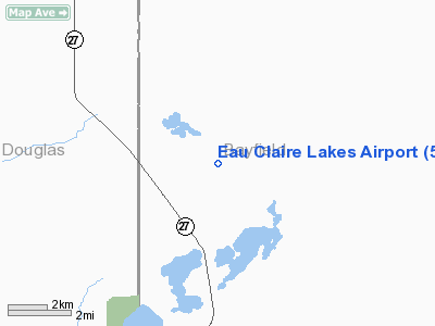
Location & QuickFacts
| FAA Information Effective: | 2008-09-25 |
| Airport Identifier: | 5G4 |
| Airport Status: | Operational |
| Longitude/Latitude: | 091-29-53.6850W/46-20-55.8000N
-91.498246/46.348833 (Estimated) |
| Elevation: | 1214 ft / 370.03 m (Surveyed) |
| Land: | 53 acres |
| From nearest city: | 10 nautical miles W of Drummond, WI |
| Location: | Bayfield County, WI |
| Magnetic Variation: | 01E (1985) |
Owner & Manager
| Ownership: | Privately owned |
| Owner: | J. Friermood |
| Address: | Hcr 61 Box 5506
Barnes, WI 54873 |
| Phone number: | 715-795-2248 |
| Manager: | J. Friermood |
| Address: | Hcr 61 Box 5506
Barnes, WI 54873 |
| Phone number: | 715-795-2248 |
Airport Operations and Facilities
| Airport Use: | Open to public |
| Wind indicator: | Yes |
| Segmented Circle: | No |
| Control Tower: | No |
| Landing fee charge: | No |
| Sectional chart: | Green Bay |
| Region: | AGL - Great Lakes |
| Boundary ARTCC: | ZMP - Minneapolis |
| Tie-in FSS: | GRB - Green Bay |
| FSS on Airport: | No |
| FSS Toll Free: | 1-800-WX-BRIEF |
| NOTAMs Facility: | GRB (NOTAM-d service avaliable) |
Airport Communications
Airport Services
| Airframe Repair: | NONE |
| Power Plant Repair: | NONE |
| Bottled Oxygen: | NONE |
| Bulk Oxygen: | NONE |
Runway Information
Runway 18/36
| Dimension: | 2290 x 70 ft / 698.0 x 21.3 m |
| Surface: | TURF, Fair Condition |
| |
Runway 18 |
Runway 36 |
| Traffic Pattern: | Left | Left |
| Runway End Identifier: | No | No |
| Centerline Lights: | No | No |
| Touchdown Lights: | No | No |
| Obstruction: | 50 ft trees, 250.0 ft from runway, 100 ft left of centerline, 5:1 slope to clear | 4 ft fence, 65 ft right of centerline |
|
Radio Navigation Aids
| ID |
Type |
Name |
Ch |
Freq |
Var |
Dist |
| OLG | NDB | Solon Springs | | 388.00 | 01E | 13.2 nm |
| SLY | NDB | Seeley | | 344.00 | 01E | 15.0 nm |
| ENY | NDB | Kennedy | | 254.00 | 02E | 27.1 nm |
| SUW | NDB | Bong | | 260.00 | 01E | 32.4 nm |
| SSQ | NDB | Shell Lake | | 212.00 | 01E | 41.3 nm |
| TWM | NDB | Two Harbors | | 243.00 | 01E | 43.5 nm |
| DL | NDB | Pykla | | 379.00 | 02E | 46.3 nm |
| COQ | NDB | Cloquet | | 335.00 | 03E | 46.5 nm |
| BXR | NDB | Big Doctor | | 203.00 | 02E | 48.1 nm |
| LKI | TACAN | Lakeside | 011X | | 05E | 41.2 nm |
| HYR | VOR/DME | Hayward | 081X | 113.40 | 03E | 19.9 nm |
| ASX | VOR/DME | Ashland | 039X | 110.20 | 02E | 26.9 nm |
| RZN | VOR/DME | Siren | 031X | 109.40 | 02E | 48.4 nm |
| DLH | VORTAC | Duluth | 073X | 112.60 | 05E | 39.9 nm |
Remarks
- ARPT CLSD TO WHEELED ACFT NOV 15 THRU MAR 31.
- -10'DEPRESSION 40-400'FM RWY 36 THR 125'L.
- REFLECTORS EA SIDE RWY 18/36.
- 62 FT ANT 150 FT R & 340 FT FM THLD RY 36.
- RY 18/36 HAS 130 FT STWY S END & 140 FT STWY N END.
Images and information placed above are from
http://www.airport-data.com/airport/5G4/
We thank them for the data!
| General Info
|
| Country |
United States
|
| State |
WISCONSIN
|
| FAA ID |
5G4
|
| Latitude |
46-20-55.800N
|
| Longitude |
091-29-53.685W
|
| Elevation |
1214 feet
|
| Near City |
DRUMMOND
|
We don't guarantee the information is fresh and accurate. The data may
be wrong or outdated.
For more up-to-date information please refer to other sources.
|
|


