 |
|
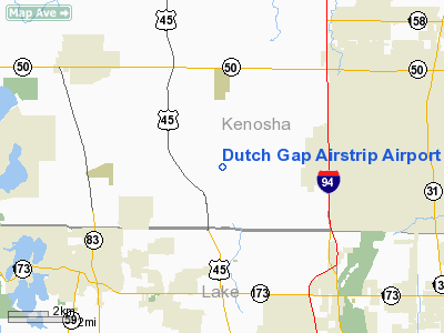
Dutch Gap Airstrip Airport |
Location & QuickFacts
| FAA Information Effective: | 2008-09-25 |
| Airport Identifier: | 04WI |
| Airport Status: | Operational |
| Longitude/Latitude: | 088-01-00.2930W/42-31-24.0690N
-88.016748/42.523352 (Estimated) |
| Elevation: | 760 ft / 231.65 m (Estimated) |
| Land: | 0 acres |
| From nearest city: | 3 nautical miles SE of Bristol, WI |
| Location: | Kenosha County, WI |
| Magnetic Variation: | 01W (1985) |
Owner & Manager
| Ownership: | Privately owned |
| Owner: | Gary Ziegler |
| Address: | 17206 Winfield Rd
Bristol, WI 53104 |
| Phone number: | 414-857-6801 |
| Manager: | Gary Ziegler |
| Address: | 17206 Winfield Road
Bristol, WI 53104 |
| Phone number: | 414-857-6801 |
Airport Operations and Facilities
| Airport Use: | Private |
| Wind indicator: | Yes |
| Segmented Circle: | No |
| Control Tower: | No |
| Sectional chart: | Green Bay |
| Region: | AGL - Great Lakes |
| Boundary ARTCC: | ZAU - Chicago |
| Tie-in FSS: | GRB - Green Bay |
| FSS on Airport: | No |
| FSS Toll Free: | 1-800-WX-BRIEF |
Runway Information
Runway 09/27
| Dimension: | 1800 x 100 ft / 548.6 x 30.5 m |
| Surface: | TURF, |
| |
Runway 09 |
Runway 27 |
| Traffic Pattern: | Left | Left |
|
Radio Navigation Aids
| ID |
Type |
Name |
Ch |
Freq |
Var |
Dist |
| RA | NDB | Paser | | 206.00 | 00E | 10.9 nm |
| GM | NDB | Teels | | 242.00 | 02W | 23.2 nm |
| LVV | NDB | Lake Lawn | | 404.00 | 00W | 27.6 nm |
| UES | NDB | Waukesha | | 359.00 | 01W | 32.8 nm |
| BL | NDB | Yanks | | 260.00 | 02W | 32.8 nm |
| ME | NDB | Deana | | 350.00 | 00E | 33.4 nm |
| JVL | NDB | Janesville | | 375.00 | 03E | 45.7 nm |
| DKB | NDB | Dekalb | | 209.00 | 02W | 46.9 nm |
| HK | NDB | Ermin | | 332.00 | 01W | 49.0 nm |
| MX | NDB | Kedzi | | 248.00 | 01W | 49.2 nm |
| ENW | VOR/DME | Kenosha | 029X | 109.20 | 02W | 5.9 nm |
| BUU | VOR/DME | Burbun | 092X | 114.50 | 01W | 16.1 nm |
| HRK | VOR/DME | Horlick | 124X | 117.70 | 02W | 16.9 nm |
| OBK | VOR/DME | Northbrook | 077X | 113.00 | 02W | 18.4 nm |
| ORD | VOR/DME | Chicago O'hare | 086X | 113.90 | 02E | 32.6 nm |
| LJT | VOR/DME | Timmerman | 072X | 112.50 | 02W | 35.3 nm |
| DPA | VOR/DME | Dupage | 021X | 108.40 | 02E | 40.8 nm |
| JVL | VOR/DME | Janesville | 090X | 114.30 | 03E | 48.3 nm |
| BAE | VORTAC | Badger | 111X | 116.40 | 02E | 37.6 nm |
| MKE | VOT | Milwaukee | | 109.00 | | 26.1 nm |
| ORD | VOT | Chicago O'hare Intl | | 112.00 | | 32.9 nm |
| MDW | VOT | Chicago Midway | | 111.00 | | 45.9 nm |
Remarks
- DUE TO LACK OF SUFFICIENT AVAILABLE AIRSPACE TO ESTABLISH AIRPORT TRAFFIC PATTERN AIRSPACE AT DUTCH GAP WHICH WOULD NOT CONFLICT WITH THE AIRPORT TRAFFIC PATTERN AND TRAFFIC PATTERN OPERATIONS AT WINFIELD AIRPORT.
Images and information placed above are from
http://www.airport-data.com/airport/04WI/
We thank them for the data!
| General Info
|
| Country |
United States
|
| State |
WISCONSIN
|
| FAA ID |
04WI
|
| Latitude |
42-31-24.069N
|
| Longitude |
088-01-00.293W
|
| Elevation |
760 feet
|
| Near City |
BRISTOL
|
We don't guarantee the information is fresh and accurate. The data may
be wrong or outdated.
For more up-to-date information please refer to other sources.
|
|


