 |
|
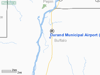
Location & QuickFacts
| FAA Information Effective: | 2008-09-25 |
| Airport Identifier: | WI25 |
| Airport Status: | Operational |
| Longitude/Latitude: | 092-00-50.6090W/44-32-19.8810N
-92.014058/44.538856 (Estimated) |
| Elevation: | 780 ft / 237.74 m (Estimated) |
| Land: | 60 acres |
| From nearest city: | 6 nautical miles SW of Durand, WI |
| Location: | Buffalo County, WI |
| Magnetic Variation: | 02E (1985) |
Owner & Manager
| Ownership: | Privately owned
CITY OF DURAND, LESSEE. |
| Owner: | Gordon D. Gifford |
| Address: | Route 3
Durand, WI 54736 |
| Phone number: | 715-672-4242 |
| Manager: | Thomas J Rutherford |
| Address: | Rte 2, Box 186
Arkansaw, WI 54721 |
| Phone number: | 715-672-5050
CALL 608-285-5768 AFTER HRS. |
Airport Operations and Facilities
| Airport Use: | Private |
| Wind indicator: | Yes |
| Segmented Circle: | No |
| Control Tower: | No |
| Lighting Schedule: | DUSK-DAWN |
| Beacon Color: | Clear-Green (lighted land airport) |
| Landing fee charge: | No |
| Sectional chart: | Green Bay |
| Region: | AGL - Great Lakes |
| Boundary ARTCC: | ZMP - Minneapolis |
| Tie-in FSS: | GRB - Green Bay |
| FSS on Airport: | No |
| FSS Toll Free: | 1-800-WX-BRIEF |
Airport Communications
Airport Services
| Fuel available: | 100LL
FOR FUEL CALL 715-285-5768. |
Runway Information
Runway 18/36
| Dimension: | 2790 x 50 ft / 850.4 x 15.2 m
LGTD 2400'; 390'N END NOT LGTD. |
| Surface: | ASPH, Fair Condition |
| Edge Lights: | Low |
| |
Runway 18 |
Runway 36 |
| Traffic Pattern: | Left | Left |
| Markings: | None, | None, |
| Displaced threshold: | 390.00 ft
THR DSPLCD NGTS ONLY RATIO 41:1, RATIO OVER ACCESS ROAD 24:1. | 0.00 ft |
| Obstruction: | 42 ft trees, 1360.0 ft from runway, 32:1 slope to clear
ACCESS ROAD AT RWY 18THR IS PART OF DSPLCD THR. | , 50:1 slope to clear |
|
Radio Navigation Aids
| ID |
Type |
Name |
Ch |
Freq |
Var |
Dist |
| RNH | NDB | New Richmond | | 257.00 | 02E | 42.7 nm |
| PPI | NDB | Hopey | | 400.00 | 03E | 44.5 nm |
| AHH | NDB | Ameron | | 278.00 | 01E | 47.2 nm |
| MS | NDB | Narco | | 266.00 | 02E | 49.2 nm |
| ONA | VOR/DME | Winona | 051X | 111.40 | 01E | 30.8 nm |
| EAU | VORTAC | Eau Claire | 076X | 112.90 | 04E | 31.4 nm |
| ODI | VORTAC | Nodine | 126X | 117.90 | 01E | 44.4 nm |
Remarks
- RWY 18/36 HAS A 1100'TURF STWY ON S END 80'WIDE.
- +45'PLINE 235'W OF RWY 18/36.
- ULTRALIGHT ACTVTY ON & IN VCNTY OF ARPT.
Images and information placed above are from
http://www.airport-data.com/airport/WI25/
We thank them for the data!
| General Info
|
| Country |
United States
|
| State |
WISCONSIN
|
| FAA ID |
WI25
|
| Latitude |
44-32-19.881N
|
| Longitude |
092-00-50.609W
|
| Elevation |
780 feet
|
| Near City |
DURAND
|
We don't guarantee the information is fresh and accurate. The data may
be wrong or outdated.
For more up-to-date information please refer to other sources.
|
|


