|
|
Door County Cherryland Airport |
| Door County Cherryland Airport |
 |
| IATA: SUE – ICAO: KSUE |
| Summary |
| Airport type |
Public |
| Operator |
Door County |
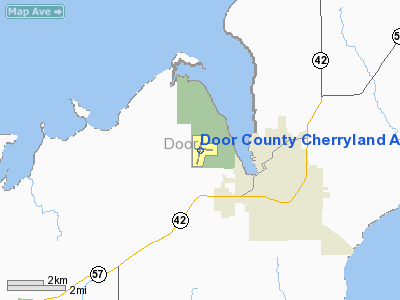
| Location |
2 miles (3.2 km) W |
| Elevation AMSL |
220.7 ft / m |
| Coordinates |
44°50′37″N 87°25′17″W / 44.84361°N 87.42139°W / 44.84361; -87.42139Coordinates: 44°50′37″N 87°25′17″W / 44.84361°N 87.42139°W / 44.84361; -87.42139 |
| Runways |
| Direction |
Length |
Surface |
| ft |
m |
| 2/20 |
4,600 |
1,402 |
Asphalt |
| 10/28 |
3,200 |
975 |
Asphalt |
Sign  | |
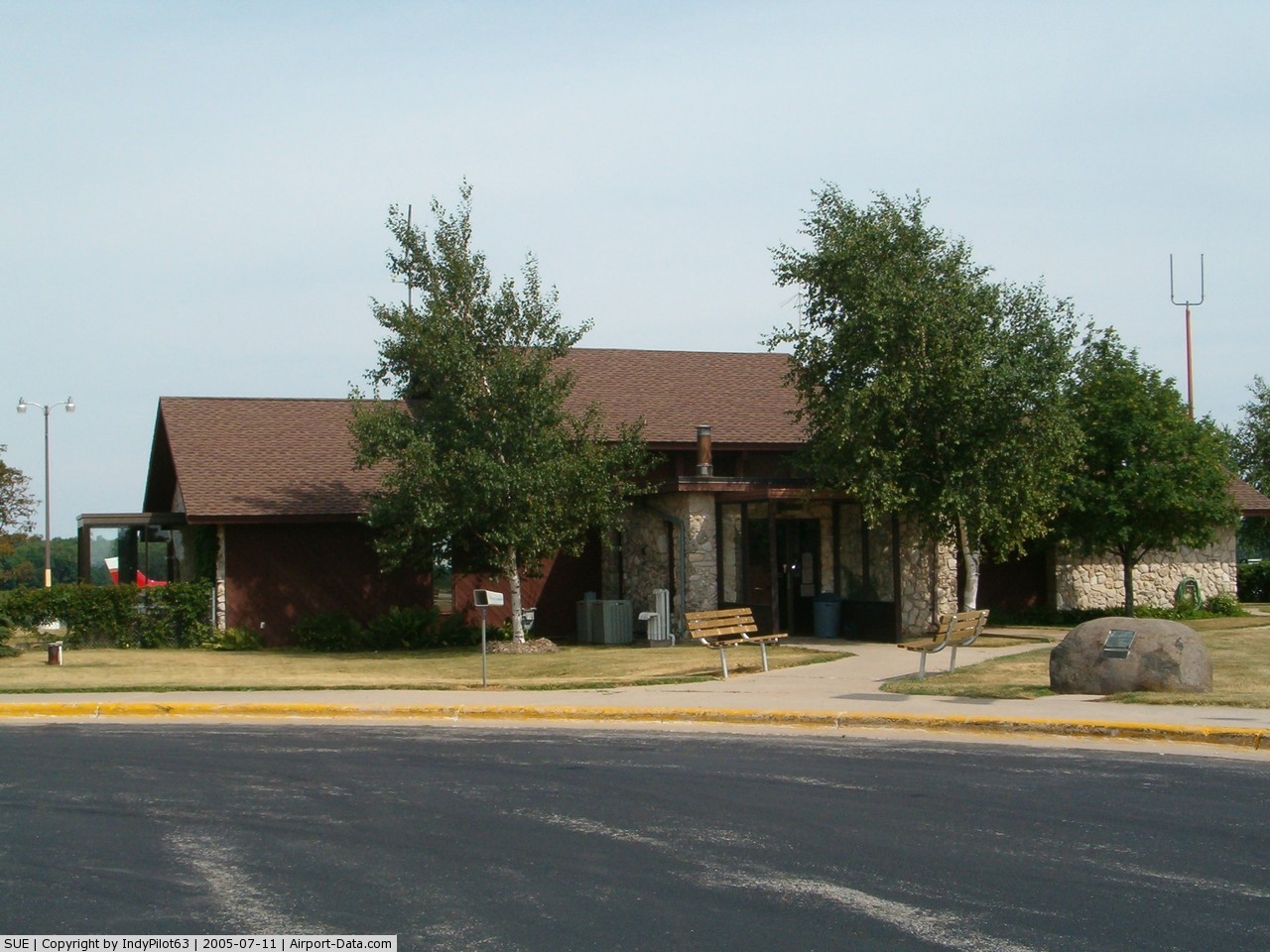
Terminal |
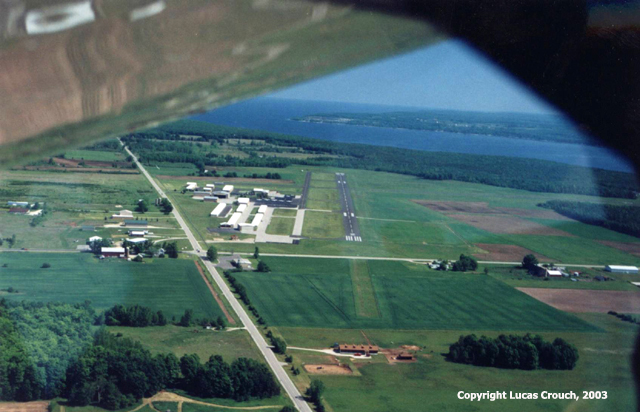
Door County Cherryland Airport (IATA: SUE, ICAO: KSUE) is a public airport located in Sturgeon Bay, Wisconsin, 2 miles west of the city. It has two runways and is used for corporate and general aviation. Facilities
Door County Cherryland Airport has one FBO: MaxAir Incorporated. The airport has two runways:
- Runway 2/20: 4,600 x 75 ft. (1,402 x 23 m.), Surface: Asphalt.
- Runway 10/28: 3,200 x 75 ft. (975 x 23 m.), Surface: Asphalt.
Airfield Information
Instrument Approach Procedures :
Local frequences are as follows: Organizations
- Door County Cherryland Airport is also home to the Door County Civil Air Patrol Senior Squadron (WI-197).
- EAA Chapter 630 Peninsula Flyers, is based at the airfield.
The above content comes from Wikipedia and is published under free licenses – click here to read more.
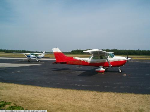 |
(Click on the photo to enlarge) |
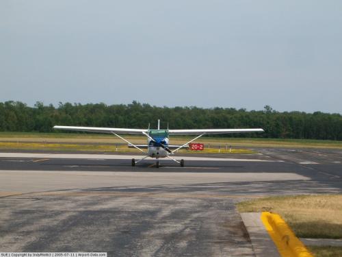 |
(Click on the photo to enlarge) |
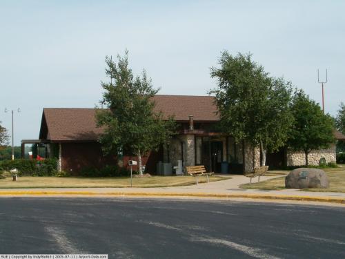 |
(Click on the photo to enlarge) |
Location & QuickFacts
| FAA Information Effective: | 2008-09-25 |
| Airport Identifier: | SUE |
| Airport Status: | Operational |
| Longitude/Latitude: | 087-25-17.6000W/44-50-37.2000N
-87.421556/44.843667 (Estimated) |
| Elevation: | 725 ft / 220.98 m (Surveyed) |
| Land: | 406 acres |
| From nearest city: | 2 nautical miles W of Sturgeon Bay, WI |
| Location: | Door County, WI |
| Magnetic Variation: | 03W (1995) |
Owner & Manager
| Ownership: | Publicly owned |
| Owner: | Door County |
| Address: | Courthouse
Sturgeon Bay, WI 54235 |
| Phone number: | 920-743-5511 |
| Manager: | Keith R. Kasbohm |
| Address: | 3418 Park Dr Door Co Arpt
Sturgeon Bay, WI 54235 |
| Phone number: | 920-743-3636 |
Airport Operations and Facilities
| Airport Use: | Open to public |
| Wind indicator: | Yes |
| Segmented Circle: | No |
| Control Tower: | No |
| Lighting Schedule: | DUSK-DAWN
ACTVT MIRL RYS 02/20 & 10/28; PAPI RYS 02; 20; 10 & 28; REIL RYS 02; 20; 10 & 28; LDIN RY 02 - CTAF. |
| Beacon Color: | Clear-Green (lighted land airport) |
| Landing fee charge: | No |
| Sectional chart: | Green Bay |
| Region: | AGL - Great Lakes |
| Boundary ARTCC: | ZMP - Minneapolis |
| Tie-in FSS: | GRB - Green Bay |
| FSS on Airport: | No |
| FSS Toll Free: | 1-800-WX-BRIEF |
| NOTAMs Facility: | SUE (NOTAM-d service avaliable) |
| Federal Agreements: | NGY |
Airport Communications
| CTAF: | 122.700 |
| Unicom: | 122.700 |
Airport Services
| Fuel available: | 100LLA
AFTER HRS FUELING AVBL, CTC 920-743-6952. |
| Airframe Repair: | MAJOR |
| Power Plant Repair: | MAJOR |
Runway Information
Runway 02/20
| Dimension: | 4600 x 75 ft / 1402.1 x 22.9 m |
| Surface: | ASPH, Good Condition |
| Weight Limit: | Single wheel: 16000 lbs.
Dual wheel: 22000 lbs. |
| Edge Lights: | Medium |
| |
Runway 02 |
Runway 20 |
| Longitude: | 087-25-29.1054W | 087-25-14.8425W |
| Latitude: | 44-50-12.9312N | 44-50-57.1994N |
| Elevation: | 722.00 ft | 704.00 ft |
| Alignment: | 13 | 127 |
| ILS Type: | SDF
| |
| Traffic Pattern: | Left | Left |
| Markings: | Non-precision instrument, Good Condition | Non-precision instrument, Good Condition |
| Crossing Height: | 32.00 ft | 46.00 ft |
| VASI: | 4-light PAPI on left side | 4-light PAPI on left side |
| Visual Glide Angle: | 3.00° | 3.00° |
| Approach lights: | LDIN | |
| Runway End Identifier: | Yes | Yes |
| Centerline Lights: | No | No |
| Touchdown Lights: | No | No |
| Obstruction: | 10 ft road, 400.0 ft from runway, 290 ft right of centerline, 20:1 slope to clear | 36 ft trees, 1100.0 ft from runway, 200 ft left of centerline, 25:1 slope to clear |
|
Runway 10/28
| Dimension: | 3199 x 75 ft / 975.1 x 22.9 m |
| Surface: | ASPH, Good Condition |
| Weight Limit: | Single wheel: 16000 lbs.
Dual wheel: 22000 lbs. |
| Edge Lights: | Medium |
| |
Runway 10 |
Runway 28 |
| Longitude: | 087-25-33.3558W | 087-24-49.0148W |
| Latitude: | 44-50-41.0747N | 44-50-39.3856N |
| Elevation: | 719.00 ft | 715.00 ft |
| Alignment: | 93 | 127 |
| Traffic Pattern: | Left | Left |
| Markings: | Non-precision instrument, Good Condition | Non-precision instrument, Good Condition |
| Crossing Height: | 31.00 ft | 37.00 ft |
| VASI: | 4-light PAPI on left side | 4-light PAPI on left side |
| Visual Glide Angle: | 3.00° | 3.00° |
| Runway End Identifier: | Yes | Yes |
| Centerline Lights: | No | No |
| Touchdown Lights: | No | No |
| Obstruction: | 8 ft road, 400.0 ft from runway, 25:1 slope to clear | 32 ft trees, 850.0 ft from runway, 250 ft left of centerline, 20:1 slope to clear |
|
Radio Navigation Aids
| ID |
Type |
Name |
Ch |
Freq |
Var |
Dist |
| SUE | NDB | Sturgeon Bay | | 414.00 | 03W | 0.4 nm |
| OCQ | NDB | Oconto | | 388.00 | 03W | 21.0 nm |
| SG | NDB | Depre | | 332.00 | 02W | 40.5 nm |
| MNM | VOR/DME | Menominee | 033X | 109.60 | 00E | 22.4 nm |
| MTW | VOR/DME | Manitowoc | 047X | 111.00 | 02W | 44.4 nm |
| GRB | VORTAC | Green Bay | 102X | 115.50 | 01E | 37.3 nm |
Remarks
- BE ALERT: NO LINE OF SIGHT RY 02 TO 20.
- GROUP OF FIVE TWRS APRXLY 4 NM NE-TALLEST TWR IS 1309 FT MSL/489 FT AGL.
- DEER, TURKEYS & SEAGULLS OCNL ON ARPT.
- ULTRALIGHT ACTIVITY ON & INVOF ARPT.
Images and information placed above are from
http://www.airport-data.com/airport/SUE/
We thank them for the data!
| General Info
|
| Country |
United States
|
| State |
WISCONSIN
|
| FAA ID |
SUE
|
| Latitude |
44-50-37.184N
|
| Longitude |
087-25-17.548W
|
| Elevation |
724 feet
|
| Near City |
STURGEON BAY
|
We don't guarantee the information is fresh and accurate. The data may
be wrong or outdated.
For more up-to-date information please refer to other sources.
|
|