 |
|
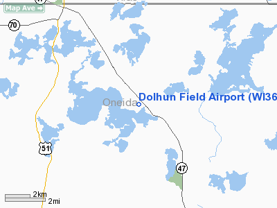
Location & QuickFacts
| FAA Information Effective: | 2008-09-25 |
| Airport Identifier: | WI36 |
| Airport Status: | Operational |
| Longitude/Latitude: | 089-37-12.5160W/45-49-35.8320N
-89.620143/45.826620 (Estimated) |
| Elevation: | 1625 ft / 495.30 m (Estimated) |
| Land: | 32 acres |
| From nearest city: | 2 nautical miles NW of Lake Tomahawk, WI |
| Location: | Oneida County, WI |
| Magnetic Variation: | 01W (1995) |
Owner & Manager
| Ownership: | Privately owned |
| Owner: | Dolhun Field Airpark Owners Assn Ua |
| Address: | 7436 Retreat Drive
Lake Tomahawk, WI 54539 |
| Phone number: | 800-552-2766 |
| Manager: | John L. Geitz |
| Address: | 7436 Retreat Drive
Lake Tomahawk, WI 54539 |
| Phone number: | 800-552-2766 |
Airport Operations and Facilities
| Airport Use: | Private |
| Wind indicator: | Yes |
| Segmented Circle: | No |
| Control Tower: | No |
| Sectional chart: | Green Bay |
| Region: | AGL - Great Lakes |
| Boundary ARTCC: | ZMP - Minneapolis |
| Tie-in FSS: | GRB - Green Bay |
| FSS Toll Free: | 1-800-WX-BRIEF |
Airport Communications
Runway Information
Runway 18/36
| Dimension: | 2700 x 75 ft / 823.0 x 22.9 m |
| Surface: | ASPH, |
| |
Runway 18 |
Runway 36 |
| Traffic Pattern: | Left | Left |
| Markings: | Basic, | , |
| Displaced threshold: | 120.00 ft | 280.00 ft |
| Obstruction: | 10 ft road, 240.0 ft from runway | 30 ft tree, 670.0 ft from runway |
|
Radio Navigation Aids
| ID |
Type |
Name |
Ch |
Freq |
Var |
Dist |
| DO | NDB | Dougy | | 236.00 | 01W | 4.6 nm |
| ARV | NDB | Arbor Vitae | | 221.00 | 01W | 7.5 nm |
| EGV | NDB | Eagle River | | 341.00 | 02W | 16.2 nm |
| BDJ | NDB | Boulder Junction | | 206.00 | 02E | 18.5 nm |
| MHA | NDB | Manitowish | | 364.00 | 01W | 20.9 nm |
| LNL | NDB | Land O Lakes | | 396.00 | 02W | 25.9 nm |
| RXW | NDB | Watersmeet | | 407.00 | 01E | 31.2 nm |
| PBH | NDB | Phillips | | 263.00 | 00E | 34.0 nm |
| PKF | NDB | Park Falls | | 371.00 | 01W | 34.6 nm |
| RRL | NDB | Merrill | | 257.00 | 01W | 37.9 nm |
| AIG | NDB | Antigo | | 347.00 | 02W | 45.5 nm |
| RHI | VORTAC | Rhinelander | 029X | 109.20 | 02E | 13.4 nm |
| IWD | VORTAC | Ironwood | 025X | 108.80 | 01E | 47.3 nm |
Remarks
- ALL AIRCRAFT MONITOR 122.7 DUE TO PROXIMITY TO LAKELAND AIRPORT/NOBLE F. LEE MEMORIAL FIELD.
- PRVDD CLEAR 20:1 APCH SLOPE, CLEAR OBSTACLE FREE ZONE & CLEAR RY SAFETY AREA.
Images and information placed above are from
http://www.airport-data.com/airport/WI36/
We thank them for the data!
| General Info
|
| Country |
United States
|
| State |
WISCONSIN
|
| FAA ID |
WI36
|
| Latitude |
45-49-35.832N
|
| Longitude |
089-37-12.516W
|
| Elevation |
1640 feet
|
| Near City |
LAKE TOMAHAWK
|
We don't guarantee the information is fresh and accurate. The data may
be wrong or outdated.
For more up-to-date information please refer to other sources.
|
|


